Category:Tsushima, Nagasaki
Jump to navigation
Jump to search

city in Nagasaki Prefecture, Japan | |||||
| Upload media | |||||
| Instance of | |||||
|---|---|---|---|---|---|
| Located in protected area | |||||
| Location | Nagasaki Prefecture, Japan | ||||
| Located in or next to body of water | |||||
| Legislative body |
| ||||
| Head of government |
| ||||
| Legal form |
| ||||
| Inception |
| ||||
| Highest point |
| ||||
| Population |
| ||||
| Area |
| ||||
| Replaces |
| ||||
| Different from | |||||
| official website | |||||
 | |||||
Subcategories
This category has the following 8 subcategories, out of 8 total.
B
E
G
H
M
T
W
Pages in category "Tsushima, Nagasaki"
This category contains only the following page.
Media in category "Tsushima, Nagasaki"
The following 33 files are in this category, out of 33 total.
-
Flag of Tsushima, Nagasaki.png 900 × 600; 26 KB
-
A Beehive often seen in Tsushima.jpg 275 × 363; 85 KB
-
Agami End of Nagasaki Prefectural Route 192.jpg 1,280 × 720; 207 KB
-
Ayumodoshi Natural Park.jpg 1,280 × 720; 243 KB
-
Big Ginkgo Tree in Kin, Tsushima.jpg 836 × 944; 431 KB
-
Busan as seen from Korea Observatory in Tsushima.jpg 3,648 × 2,736; 4.14 MB
-
Busan as seen from Korea Observatory in Tsushima2.jpg 3,648 × 2,736; 8.21 MB
-
Emblem of Tsushima, Nagasaki.svg 500 × 445; 5 KB
-
Former Agami End of Nagasaki Prefectural Route 192.jpg 1,280 × 720; 203 KB
-
HitakatsuFerryTerminal 20120901.jpg 4,928 × 3,264; 7.32 MB
-
IzuharaFuruiKabe.jpg 1,331 × 1,025; 993 KB
-
Komoda End of Nagasaki Prefectural Route 44.jpg 1,280 × 720; 142 KB
-
Koura TsushimaKotsu 20120901.jpg 4,928 × 3,264; 6.87 MB
-
Mt Ariake Mt Nariai Mt Shimizu with Explanation.jpg 1,280 × 720; 267 KB
-
Mt Ariake Mt Nariai Mt Shimizu.jpg 1,280 × 720; 259 KB
-
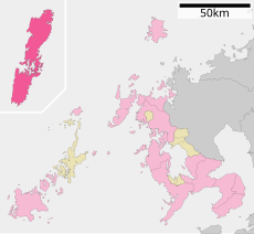
Population distribution of Tsushima, Nagasaki, Japan.svg 512 × 256; 22 KB
-
Project Blue Book report - 1952-09-6383597-TsuShima-Japan.pdf 3,029 × 2,120, 12 pages; 1.51 MB
-
Project Blue Book report - 1952-09-6384202-TsuShima-Japan.pdf 3,070 × 2,143, 4 pages; 820 KB
-
Sakanotaiyaki.jpg 1,080 × 672; 177 KB
-
Sasuse End of Nagasaki Prefectural Route 192.jpg 1,280 × 720; 211 KB
-
Site of Nagasaki Prefectural Tsushima Izuhara Hospital.jpg 751 × 391; 76 KB
-
Site of Taishu Mine.jpg 816 × 471; 215 KB
-
Site of Toho Zinc Inc Taishu Mine Enginnering School.jpg 1,280 × 720; 379 KB
-
Strait of Ofunakoshi.jpg 637 × 374; 115 KB
-
Toyoko-inn TsushimaHitakatsu.jpg 2,880 × 2,160; 1.82 MB
-
Tsushima city Izuhara district Aerial photograph.2016.jpg 5,600 × 4,200; 8.06 MB
-
Tsushima nagasaki chapter.JPG 363 × 324; 19 KB
-
TsusimaBukeyashiki.JPG 1,544 × 1,024; 775 KB
-
View from shimizuyama.jpg 640 × 480; 172 KB
-
お手洗い キラリ 掃除を行いました。 対馬市 (28406150928).jpg 3,840 × 2,160; 3.31 MB
-
ツシマウラボシシジミ雌成虫.jpg 3,768 × 2,511; 5.29 MB
-
東横イン対馬比田勝看板.jpg 2,160 × 2,880; 2.43 MB


