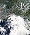
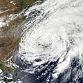
Category:Tropical Storm Lee (2011)
Jump to navigation
Jump to search
Atlantic tropical storm in 2011 | |||||
| Upload media | |||||
| Instance of |
| ||||
|---|---|---|---|---|---|
| Part of | |||||
| Location | Atlantic Ocean, international waters | ||||
| Start time |
| ||||
| End time |
| ||||
| Part of the series |
| ||||
| |||||
Media in category "Tropical Storm Lee (2011)"
The following 49 files are in this category, out of 49 total.
-
13L 2011 5day.gif 895 × 716; 26 KB
-
13L 2011-09-01 2015Z.jpg 1,920 × 1,080; 1.89 MB
-
13L northern portion.jpg 1,300 × 1,500; 939 KB
-
A Wild Weekend in the Tropical Atlantic (6130185913).jpg 3,000 × 2,222; 2.95 MB
-
Brevard, North Carolina in the Remnants of Tropical Storm Lee.jpg 1,597 × 865; 143 KB
-
Catawissa flooding.jpg 3,888 × 2,592; 1.51 MB
-
Cohoes Falls after passage of ex-Lee (6128429090).jpg 704 × 480; 25 KB
-
Ex-Lee and Katia Sept 6 2011 1545Z.jpg 1,920 × 1,080; 2.4 MB
-
Flood 3 008.JPG 3,648 × 2,736; 2.54 MB
-
Flood Walls on Market Street in Wilkes-Barre.jpg 4,288 × 2,848; 1.89 MB
-
Flooded farmland after Tropical Storm Lee, Campbell Hall, NY.jpg 4,288 × 3,216; 5.73 MB
-
Lee 2011 rainfall.gif 1,401 × 1,385; 69 KB
-
Lee 2011 track.png 2,700 × 1,669; 4.59 MB
-
Lee Sept 3 2011 1850Z.jpg 5,710 × 7,411; 5.37 MB
-
Lee Sept 4 2011 1935Z.jpg 6,672 × 6,672; 7.99 MB
-
Lee's Remnants Continue to Drench the Eastern U.S. (6125204556).jpg 3,600 × 3,000; 1.48 MB
-
Lee's Remnants Continue to Plague the Eastern U.S. (6121680978).jpg 2,400 × 2,000; 835 KB
-
LVRR Loyalsock Creek Bridge Damage 2.jpg 3,648 × 2,736; 4 MB
-
LVRR Loyalsock Creek Bridge Damage 3.jpg 7,255 × 1,985; 5.86 MB
-
LVRR Loyalsock Creek Bridge Damage.jpg 2,077 × 1,558; 1.96 MB
-
Mississippi Missouri confluence point.jpg 7,728 × 2,120; 2.56 MB
-
NAM predicted rainfall from Lee.jpg 1,920 × 1,080; 709 KB
-
NASA Sees 4 Tropical Cyclones in the Atlantic Today (labeled).jpg 2,700 × 2,141; 1.92 MB
-
NASA Sees 4 Tropical Cyclones in the Atlantic Today.jpg 2,700 × 2,141; 1.9 MB
-
NY 103 Irene Construction FEMA.jpg 4,256 × 2,832; 4.7 MB
-
NY 103 South FEMA.jpg 3,000 × 2,011; 3.09 MB
-
NY 416 flooded at Neelytown Road after Tropical Storm Lee, Montgomery, NY.jpg 3,788 × 2,732; 5.76 MB
-
Owego Flooding from Tropical Storm Lee in 2011.jpg 7,500 × 5,000; 17.89 MB
-
Pennsylvania 973 Bridge 1.jpg 3,648 × 2,736; 2.15 MB
-
Pennsylvania 973 Bridge 2.jpg 3,648 × 2,736; 2.07 MB
-
Pennsylvania 973 Bridge 3.jpg 3,648 × 2,736; 1.51 MB
-
Sediment Clouds the Chesapeake Bay after Tropical Storm Lee (2011).jpg 1,159 × 1,487; 381 KB
-
Sonestown Covered Bridge flood 1.jpg 3,648 × 2,736; 3.25 MB
-
Sonestown Covered Bridge flood 2.jpg 4,709 × 2,486; 6.57 MB
-
Sonestown Covered Bridge flood 3.jpg 2,736 × 3,648; 2.1 MB
-
Sonestown Covered Bridge flood 8.jpg 2,657 × 1,993; 3.63 MB
-
Tropical Storm Lee (6106665283).jpg 720 × 720; 206 KB
-
Tropical storm lee 09-09-2011 001 (6635590691).jpg 4,320 × 3,240; 6.69 MB
-
Tropical storm lee 09-09-2011 005 (6635591705).jpg 4,320 × 3,240; 5.71 MB
-
Tropical storm lee 09-09-2011 007 (6635592655).jpg 4,320 × 3,240; 5.74 MB
-
Tropical Storm Lee 090311 2145 UTC.jpg 1,964 × 1,902; 527 KB
-
Tropical Storm Lee 2011.ogv 34 s, 1,280 × 720; 62.98 MB
-
Tropical Storm Lee high res (6106665421).jpg 7,280 × 5,916; 5.21 MB
-
Tropical Storm Lee on 2nd Sept 2011.JPG 8,200 × 8,200; 9.58 MB
-
Tropical Storm Lee Sept 3 2011 1440Z.jpg 1,948 × 1,948; 2.55 MB
-
Tropical Storm Lee to Newfoundland.ogv 15 s, 640 × 425; 3.53 MB
-
Wallis Run Road damage.jpg 3,648 × 2,736; 1.96 MB


