Category:Trewern (community)
Jump to navigation
Jump to search
Media in category "Trewern (community)"
The following 51 files are in this category, out of 51 total.
-
-
 Bank Farm Caravan site Middletown - geograph.org.uk - 1712979.jpg 640 × 480; 88 KB
-
 Barn at Nellie Andrews Green - geograph.org.uk - 1712985.jpg 640 × 480; 79 KB
-
 Cae Post recycling depot at Trewern - geograph.org.uk - 1566676.jpg 640 × 480; 73 KB
-
 Criggion Lane in Trewern - geograph.org.uk - 1566671.jpg 640 × 480; 90 KB
-
 Crossroads at Old Mills - geograph.org.uk - 1566679.jpg 640 × 480; 88 KB
-
 Cwmbychan - geograph.org.uk - 581039.jpg 640 × 480; 86 KB
-
 Entrance drive to Llwyn Melyn - geograph.org.uk - 1712963.jpg 640 × 480; 53 KB
-
 Entrance to Pentre Gwyn in Trewern - geograph.org.uk - 1566673.jpg 640 × 480; 72 KB
-
 Falling Leaf - geograph.org.uk - 1060810.jpg 640 × 457; 167 KB
-
 Fields Near Rhos-goch - geograph.org.uk - 819551.jpg 640 × 480; 144 KB
-
 Fields next to railway bridge - geograph.org.uk - 1712968.jpg 640 × 480; 74 KB
-
 First House after road junction - geograph.org.uk - 1566661.jpg 640 × 480; 94 KB
-
 Gorse on the sides of Cwm Dingle - geograph.org.uk - 838024.jpg 640 × 480; 90 KB
-

-
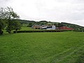
 Hillside farm - geograph.org.uk - 1321335.jpg 640 × 426; 93 KB
-
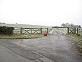
 Kennels and Dog grooming centre - geograph.org.uk - 1566664.jpg 640 × 480; 68 KB
-
 Lane at Hope - geograph.org.uk - 1512308.jpg 640 × 480; 95 KB
-
 Long Mountain Road Junction - geograph.org.uk - 1321322.jpg 640 × 426; 63 KB
-
 Low bridge near Middle Heldre - geograph.org.uk - 1712993.jpg 640 × 480; 113 KB
-
 Manure pile, Stone House Farm - geograph.org.uk - 838102.jpg 640 × 480; 84 KB
-
 Moel y Golfa and Middletown Hill - geograph.org.uk - 640356.jpg 640 × 378; 45 KB
-
 Offa's Dyke Business Park - geograph.org.uk - 1512304.jpg 640 × 480; 54 KB
-

-
 Part of Cwmdingle Plantation - geograph.org.uk - 827734.jpg 640 × 480; 65 KB
-
 Pastures below Cwmdingle Plantation - geograph.org.uk - 827732.jpg 640 × 480; 82 KB
-
 Railway at Buttington - geograph.org.uk - 829757.jpg 640 × 480; 88 KB
-
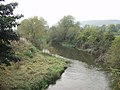
 River Severn North of Buttington - geograph.org.uk - 829783.jpg 640 × 480; 51 KB
-
 Road to Buttington - geograph.org.uk - 1439227.jpg 640 × 480; 67 KB
-
 Road To Hope - geograph.org.uk - 1439225.jpg 640 × 480; 61 KB
-
 Rodney's Pillar from Middletown Hill - geograph.org.uk - 1467554.jpg 640 × 480; 46 KB
-
 Romany Monument atop Moel y Golfa - geograph.org.uk - 881056.jpg 640 × 457; 102 KB
-
 Stone bridge below Stone House Farm - geograph.org.uk - 838120.jpg 640 × 480; 101 KB
-
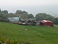
 Stone House Farm - geograph.org.uk - 827739.jpg 640 × 480; 79 KB
-
 The Beech Woods - geograph.org.uk - 1027405.jpg 640 × 425; 151 KB
-
 The fort on Middletown Hill - geograph.org.uk - 1718326.jpg 800 × 541; 88 KB
-

-

-

-
 Tree Tops on Fire - geograph.org.uk - 1047760.jpg 640 × 457; 109 KB
-
 Trewern Farm from Offa's Dyke.jpg 4,000 × 3,000; 1.75 MB
-
 Twisted Firs - geograph.org.uk - 1047782.jpg 640 × 425; 140 KB
-
 Upper Heldre Farm - geograph.org.uk - 1712987.jpg 640 × 480; 88 KB
-
 Valley view - geograph.org.uk - 1321331.jpg 640 × 426; 69 KB
-

-

-
 View towards the Severn Valley - geograph.org.uk - 827737.jpg 640 × 480; 89 KB
-
 Wales Powys Community Trewern map.svg 512 × 723; 1.15 MB
-
 Weak bridge ahead - geograph.org.uk - 1712972.jpg 640 × 480; 108 KB
-
 White Horses in The Mist - geograph.org.uk - 877906.jpg 640 × 457; 118 KB
-
 Yes, But it Has A Great View^ - geograph.org.uk - 1075588.jpg 640 × 457; 143 KB
_from_Maginnis_Bridge_-_geograph.org.uk_-_582593.jpg)


