Category:Treflys, Powys
Jump to navigation
Jump to search
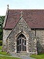
community in the county of Powys, Wales (UK) .jpg) Church i Beulah, Treflys | |||||
| Upload media | |||||
| Pronunciation audio | |||||
|---|---|---|---|---|---|
| Instance of | |||||
| Location | Powys, Wales | ||||
| Population |
| ||||
 | |||||
Subcategories
This category has the following 3 subcategories, out of 3 total.
Media in category "Treflys, Powys"
The following 200 files are in this category, out of 450 total.
(previous page) (next page)-
 A badly neglected cemetery - geograph.org.uk - 1048380.jpg 640 × 480; 141 KB
-
 A beautiful spot - geograph.org.uk - 2492548.jpg 800 × 600; 391 KB
-
 A483 towards Llanwrtyd Wells - geograph.org.uk - 1048951.jpg 640 × 480; 53 KB
-
 Across Cwm Cnyffiad, Powys - geograph.org.uk - 2930903.jpg 1,024 × 753; 545 KB
-
 Adeilad anghysbell - Remote building - geograph.org.uk - 5549948.jpg 640 × 480; 140 KB
-
 Afon Cammarch - upstream from the bridge - geograph.org.uk - 2422689.jpg 640 × 480; 148 KB
-
 Afon Cammarch footbridge near Abergwesyn, Powys - geograph.org.uk - 6241596.jpg 1,440 × 960; 1.64 MB
-
 Afon Cammarch footbridge near Abergwesyn, Powys - geograph.org.uk - 6241606.jpg 1,280 × 960; 1.66 MB
-
 Afon Cammarch near Abergwesyn in Powys - geograph.org.uk - 6241791.jpg 1,280 × 960; 1.51 MB
-
 Afon Cammarch near Abergwesyn in Powys - geograph.org.uk - 6241796.jpg 960 × 1,280; 1.7 MB
-
 Afon Cammarch near Abergwesyn in Powys - geograph.org.uk - 6241814.jpg 960 × 1,280; 1.75 MB
-

-
 Afon Cnyffiad in the Trallwm Forest near Abergwesyn - geograph.org.uk - 6244401.jpg 960 × 1,280; 1.99 MB
-
 Afon Cnyffiad near Abergwesyn in Powys - geograph.org.uk - 6244463.jpg 960 × 1,280; 1.98 MB
-

-
 At the footbridge - geograph.org.uk - 4758025.jpg 640 × 480; 60 KB
-
 Autumn colours in Irfon Valley - geograph.org.uk - 3149454.jpg 800 × 566; 199 KB
-
 B4358 approaching Beulah, Powys - geograph.org.uk - 2932289.jpg 1,024 × 753; 524 KB
-
 Back on the flat in the valley - geograph.org.uk - 4249277.jpg 857 × 1,142; 467 KB
-
 Back to Llangammarch Wells - geograph.org.uk - 1062142.jpg 640 × 428; 177 KB
-
 Back to the A483 - geograph.org.uk - 1062158.jpg 640 × 428; 198 KB
-

-
 Banc Paderau - geograph.org.uk - 5496580.jpg 640 × 480; 97 KB
-
 Below Garn Wen - geograph.org.uk - 1065561.jpg 640 × 427; 190 KB
-
 Bends on the A483 - geograph.org.uk - 4894304.jpg 6,000 × 4,000; 6.74 MB
-
 Beside the Nant Gellifelen - geograph.org.uk - 4249282.jpg 1,142 × 857; 436 KB
-
 Beulah, village pump - geograph.org.uk - 2610585.jpg 1,024 × 768; 242 KB
-
 Bog at Bryn Rhudd - geograph.org.uk - 2111190.jpg 2,000 × 1,308; 2.06 MB
-
 Brick side of the chapel - geograph.org.uk - 6110462.jpg 1,024 × 768; 139 KB
-
 Bridge 333 - geograph.org.uk - 1062108.jpg 640 × 428; 243 KB
-
 Bridleway and farm land near Abergwesyn in Powys - geograph.org.uk - 6241906.jpg 1,440 × 960; 1.22 MB
-

-

-

-
 Bridleway and rough pasture near Abergwesyn in Powys - geograph.org.uk - 6241904.jpg 1,600 × 900; 1.32 MB
-
 Bridleway below Esgair Eithaf in Powys - geograph.org.uk - 6241921.jpg 1,440 × 960; 1.38 MB
-
 Bridleway below Esgair Eithaf in Powys - geograph.org.uk - 6241970.jpg 1,440 × 1,080; 1.54 MB
-
-
 Bridleway by Afon Cnyffiad near Aberwesyn in Powys - geograph.org.uk - 6244391.jpg 1,280 × 960; 1.68 MB
-
 Bridleway by Trallwm Forest Cottages near Abergwesyn - geograph.org.uk - 6244382.jpg 1,440 × 960; 1.97 MB
-
 Bridleway in Coed Trallwm near Abergwesyn, Powys - geograph.org.uk - 6237817.jpg 1,280 × 960; 1.76 MB
-
 Bridleway in Coed Trallwm near Abergwesyn, Powys - geograph.org.uk - 6237821.jpg 1,280 × 1,280; 2.23 MB
-
 Bridleway in Coed Trallwm near Abergwesyn, Powys - geograph.org.uk - 6237824.jpg 960 × 1,280; 1.83 MB
-
 Bridleway north-east of Abergwesyn in Powys - geograph.org.uk - 6242846.jpg 1,440 × 1,080; 2.14 MB
-
 Bridleway north-east of Abergwesyn in Powys - geograph.org.uk - 6242847.jpg 960 × 1,280; 2.04 MB
-
 Bridleway on Cefn Garw in Powys - geograph.org.uk - 6241828.jpg 1,280 × 960; 1.22 MB
-
 Bridleway to Abergwesyn in Powys - geograph.org.uk - 6241601.jpg 1,280 × 960; 1.63 MB
-
 Bridleway to Abergwesyn in Powys - geograph.org.uk - 6242062.jpg 1,280 × 960; 1.43 MB
-
 Bridleway to Abergwesyn in Powys - geograph.org.uk - 6242802.jpg 960 × 1,280; 1.3 MB
-
 Bridleway to Abergwesyn in Powys - geograph.org.uk - 6242833.jpg 960 × 1,280; 1.63 MB
-
 Bridleway to Carnau and Cwm Elan in Powys - geograph.org.uk - 6242918.jpg 960 × 1,280; 1.92 MB
-
 Bridleway to Carnau in Powys - geograph.org.uk - 6242055.jpg 1,440 × 960; 1.43 MB
-
 Bridleway to Carnau in Powys - geograph.org.uk - 6242796.jpg 1,440 × 960; 1.53 MB
-
 Bridleway to Carnau in Powys - geograph.org.uk - 6242825.jpg 1,440 × 960; 1.46 MB
-
 Bridleway to Carnau, Powys - geograph.org.uk - 6240949.jpg 960 × 1,280; 1.72 MB
-
 Bridleway, hill pasture and woodland near Abergwesyn - geograph.org.uk - 6241930.jpg 1,280 × 960; 1.33 MB
-
 Bridleway, Nant yr Hwch - geograph.org.uk - 748751.jpg 640 × 480; 109 KB
-
 Bryn Glas and distant Fforest Fawr - geograph.org.uk - 801451.jpg 640 × 480; 65 KB
-
 Bryn Glas, Bryn Mawr and Fforest Fawr - geograph.org.uk - 801463.jpg 640 × 480; 56 KB
-
 Bryn Rhudd - geograph.org.uk - 4725991.jpg 1,200 × 1,600; 602 KB
-
 Cairn On Carnau - geograph.org.uk - 4725983.jpg 1,600 × 1,200; 471 KB
-
 Cairn on Carnau looking south - geograph.org.uk - 2329832.jpg 640 × 480; 77 KB
-
 Cairn on Esgair Fraith - geograph.org.uk - 1063228.jpg 640 × 427; 181 KB
-
 Camarch cataract - geograph.org.uk - 2510723.jpg 800 × 600; 408 KB
-
 Camarch Melyn confluence - geograph.org.uk - 2510714.jpg 800 × 600; 396 KB
-
 Carnau - geograph.org.uk - 4484656.jpg 640 × 480; 55 KB
-
 Carnau from the north east approach - geograph.org.uk - 2329801.jpg 640 × 480; 84 KB
-
 Cars on the road to Beulah, Powys - geograph.org.uk - 2080294.jpg 640 × 489; 156 KB
-
 Cat and kits in a farm entrance. - geograph.org.uk - 2510497.jpg 800 × 600; 398 KB
-
 Cefn Garw - geograph.org.uk - 1066350.jpg 640 × 427; 166 KB
-
 Cefn Garw - geograph.org.uk - 1066354.jpg 640 × 427; 164 KB
-
 Cemetery corner - geograph.org.uk - 6110454.jpg 1,024 × 768; 213 KB
-
 Chapel and bluebells - geograph.org.uk - 2422687.jpg 640 × 456; 137 KB
-
 Chapel cemetery - geograph.org.uk - 6110452.jpg 1,024 × 768; 175 KB
-
 Chapel near Abergwesyn, Powys - geograph.org.uk - 1851858.jpg 1,200 × 1,600; 1.94 MB
-
 Chapel near Abergwesyn, Powys - geograph.org.uk - 1851859.jpg 1,600 × 1,190; 2.22 MB
-
 Chapel on the other side - geograph.org.uk - 6110443.jpg 1,024 × 768; 106 KB
-

-
-
 Church of the Lamb Of God at Beulah, Powys - geograph.org.uk - 5359711.jpg 1,687 × 1,127; 1.04 MB
-
 Church of the Lamb of God near Beulah in Powys - geograph.org.uk - 6216295.jpg 1,440 × 960; 1.55 MB
-

-

-
 Clearfell and hill pasture near Abergwesyn, Powys - geograph.org.uk - 6240691.jpg 1,600 × 900; 1.51 MB
-

-

-
 Clearfell in the Trallwm Forest near Abergwesyn - geograph.org.uk - 6243739.jpg 960 × 1,280; 1.64 MB
-
 Clearfell north-east of Abergwesyn in Powys - geograph.org.uk - 6239344.jpg 1,440 × 960; 1.67 MB
-
 Clearfelled forest north-east of Abergwesyn in Powys - geograph.org.uk - 6237866.jpg 1,600 × 900; 1.54 MB
-
 Cnyffiad and Lloft-y-bardd - geograph.org.uk - 749614.jpg 640 × 480; 81 KB
-
 Cnyffiad, near Beulah, Powys - geograph.org.uk - 2923431.jpg 600 × 800; 387 KB
-
 Cnyffiad, near Beulah, Powys - geograph.org.uk - 2923435.jpg 1,024 × 768; 642 KB
-
 Cnyffiad, near Beulah, Powys - geograph.org.uk - 2923483.jpg 600 × 800; 488 KB
-
 Coed Caeper-corn from the south - geograph.org.uk - 1048975.jpg 640 × 480; 56 KB
-
 Coed Graig-goch - geograph.org.uk - 988351.jpg 640 × 480; 102 KB
-
 Coed Lloft-y-bardd, graveyard - geograph.org.uk - 2610660.jpg 1,024 × 725; 210 KB
-
 Coed Lloft-y-bardd, sheep grazing - geograph.org.uk - 2610628.jpg 1,024 × 768; 228 KB
-

-

-
 Coed Trallwm, Cefn Garw - geograph.org.uk - 2510737.jpg 800 × 600; 405 KB
-

-
 Cwm Annell - geograph.org.uk - 5496651.jpg 640 × 480; 94 KB
-
 Cwm Cnyffiad - geograph.org.uk - 2510516.jpg 800 × 600; 372 KB
-
 Cwm Cnyffiad near Abergwesyn, Powys - geograph.org.uk - 1851863.jpg 800 × 518; 279 KB
-
 Cwm Cnyffiad near Abergwesyn, Powys - geograph.org.uk - 1851864.jpg 640 × 640; 169 KB
-
 Cwm Cnyffiad, Powys - geograph.org.uk - 1506086.jpg 640 × 452; 137 KB
-
 Cwm Gwesyn - geograph.org.uk - 4484620.jpg 640 × 480; 104 KB
-
 Cwm Gwesyn - geograph.org.uk - 4484723.jpg 640 × 480; 103 KB
-
 Cwm Gwesyn with Whinchat - geograph.org.uk - 2497085.jpg 1,811 × 1,359; 2.12 MB
-

-
 Cwm-bryn farm - geograph.org.uk - 1048971.jpg 640 × 480; 105 KB
-
 Cyclists in the mist - geograph.org.uk - 4247977.jpg 1,102 × 1,469; 421 KB
-

-
 Cynffiad - geograph.org.uk - 988359.jpg 640 × 480; 143 KB
-
 Dead-end road near Beulah - geograph.org.uk - 3498084.jpg 640 × 480; 550 KB
-
 Downhill in the Nant-y-Cerdin area - geograph.org.uk - 1048579.jpg 640 × 480; 45 KB
-
 Drygarn Fawr - geograph.org.uk - 4484629.jpg 640 × 480; 101 KB
-
 Drygarn Fawr - geograph.org.uk - 4726755.jpg 1,600 × 1,200; 626 KB
-
 Drygarn Fawr - geograph.org.uk - 5917919.jpg 1,024 × 768; 151 KB
-
 Drygarn Fawr cairns - geograph.org.uk - 2329907.jpg 640 × 480; 53 KB
-
 East along Cwm Cammarch - geograph.org.uk - 1065601.jpg 640 × 427; 203 KB
-
 Eastern Cairn, Drygarn Fawr - geograph.org.uk - 4725998.jpg 1,600 × 1,200; 426 KB
-
 Eglwys Oen Duw near Beulah, Powys - geograph.org.uk - 5324801.jpg 640 × 480; 89 KB
-
 Entrance to Tynewydd Farm - geograph.org.uk - 1062150.jpg 640 × 428; 164 KB
-
 Entrance to Tysegur Farm - geograph.org.uk - 1044691.jpg 640 × 428; 317 KB
-
 Esgair Eithaf - geograph.org.uk - 4484691.jpg 640 × 517; 104 KB
-

-
 Esgair Fraith - geograph.org.uk - 1066368.jpg 640 × 427; 149 KB
-
 Esgair yr Wyn - geograph.org.uk - 1066364.jpg 640 × 427; 186 KB
-
 Esgair yr Wyn - geograph.org.uk - 4484673.jpg 640 × 480; 106 KB
-
 Farm and forest road near Trallwm in Powys - geograph.org.uk - 6244458.jpg 960 × 1,280; 1.46 MB
-
 Farm in Cwm Cnyffiad, Powys - geograph.org.uk - 2930906.jpg 800 × 571; 240 KB
-
 Farm on the Cnyffiad - geograph.org.uk - 2932414.jpg 640 × 480; 94 KB
-

-
 Farm road in Cwm Nant Eithaf in Powys - geograph.org.uk - 6243747.jpg 960 × 1,280; 1.22 MB
-
 Farm road near Trallwm in Powys - geograph.org.uk - 6243753.jpg 1,440 × 960; 2.15 MB
-
 Farm road north-east of Abergwesyn in Powys - geograph.org.uk - 6243562.jpg 1,600 × 900; 1.44 MB
-
 Farm road north-east of Abergwesyn in Powys - geograph.org.uk - 6243565.jpg 1,440 × 1,080; 2.17 MB
-

-
 Farm track and sheep pens near Abergwesyn in Powys - geograph.org.uk - 6242048.jpg 1,440 × 960; 1.39 MB
-
 Farm track near Abergwesyn in Powys - geograph.org.uk - 6242934.jpg 960 × 1,280; 1.3 MB
-
 Farmland and forest near Abergwesyn, Powys - geograph.org.uk - 6243573.jpg 1,440 × 960; 1.53 MB
-

-
 Farmland and forest north-east of Abergwesyn in Powys - geograph.org.uk - 6242858.jpg 1,024 × 1,024; 1.1 MB
-
 Farmland below Pen y Garn-goch - geograph.org.uk - 4894336.jpg 6,000 × 4,000; 3.91 MB
-
 Farmland in Cwm Cnyffiad, Powys - geograph.org.uk - 3689335.jpg 1,024 × 768; 529 KB
-
 Farmland in Cwm Cnyffiad, Powys - geograph.org.uk - 3689371.jpg 1,024 × 748; 455 KB
-
 Farmland in Cwm Cnyffiad, Powys - geograph.org.uk - 3689793.jpg 1,024 × 750; 492 KB
-
 Farmland in Cwm Nant Eithaf in Powys - geograph.org.uk - 6243744.jpg 1,440 × 960; 1.62 MB
-
 Farmland near Beulah, Powys - geograph.org.uk - 2339465.jpg 800 × 542; 255 KB
-
 Farmland near Llwynpiod - geograph.org.uk - 6403148.jpg 2,048 × 1,536; 1.66 MB
-
 Farmland, and forest near Abergwesyn, Powys - geograph.org.uk - 6242930.jpg 1,440 × 960; 1.35 MB
-
 Field and woodland between Llwynpiod and Llwynon - geograph.org.uk - 6403145.jpg 3,536 × 2,372; 1,004 KB
-
 Field near Prysiau Fawr - geograph.org.uk - 1062126.jpg 640 × 428; 157 KB
-
 Fields and roadside trees by the A483 - geograph.org.uk - 5741515.jpg 3,264 × 2,448; 3.63 MB
-
 Five-way junction at Cefn Glancamddwr - geograph.org.uk - 157549.jpg 640 × 480; 126 KB
-
 Footbridge across the Afon Cammarch in Powys - geograph.org.uk - 6240937.jpg 960 × 1,280; 1.57 MB
-
 Footbridge by Eglwys Oen Duw near Beulah, Powys - geograph.org.uk - 6216303.jpg 1,280 × 960; 1.95 MB
-

-
 Forest bridleway north-east of Abergwesyn in Powys - geograph.org.uk - 6211570.jpg 1,440 × 1,080; 2.37 MB
-

-
 Forest bridleway north-east of Abergwesyn in Powys - geograph.org.uk - 6211591.jpg 1,280 × 960; 1.84 MB
-
 Forest bridleway north-east of Abergwesyn in Powys - geograph.org.uk - 6237753.jpg 960 × 1,280; 1.93 MB
-
 Forest bridleway north-east of Abergwesyn in Powys - geograph.org.uk - 6237802.jpg 960 × 1,280; 1.92 MB
-
 Forest bridleway north-east of Abergwesyn in Powys - geograph.org.uk - 6237812.jpg 1,280 × 960; 1.78 MB
-
 Forest bridleway north-east of Abergwesyn in Powys - geograph.org.uk - 6240887.jpg 1,280 × 960; 1.69 MB
-
 Forest bridleway north-east of Abergwesyn in Powys - geograph.org.uk - 6240918.jpg 1,280 × 960; 1.74 MB
-
 Forest bridleway on Cefn Garw in Powys - geograph.org.uk - 6241832.jpg 960 × 1,280; 1.29 MB
-
 Forestry and hill pasture near Abergwesyn in Powys - geograph.org.uk - 6239858.jpg 1,440 × 1,080; 1.8 MB
-
 Forestry clear fell near Abergwesyn in Powys - geograph.org.uk - 6211601.jpg 1,600 × 900; 1.38 MB
-
 Forestry clear fell near Abergwesyn in Powys - geograph.org.uk - 6212241.jpg 1,440 × 960; 1.59 MB
-
 Forestry clear fell near Abergwesyn in Powys - geograph.org.uk - 6237872.jpg 1,600 × 900; 1.44 MB
-
 Forestry road and bridleway near Abergwesyn in Powys - geograph.org.uk - 6212244.jpg 960 × 1,280; 1.56 MB
-
 Forestry road and bridleway on Cefn Garw, Powys - geograph.org.uk - 6240876.jpg 1,440 × 960; 1.46 MB
-

-
 Forestry road in Coed Trallwm near Abergwesyn, Powys - geograph.org.uk - 6238943.jpg 1,440 × 960; 1.27 MB
-
 Forestry road in Coed Trallwm near Abergwesyn, Powys - geograph.org.uk - 6238944.jpg 1,440 × 960; 1.55 MB
-
 Forestry road in Coed Trallwm near Aberwesyn, Powys - geograph.org.uk - 6239363.jpg 1,600 × 900; 1.67 MB
-
 Forestry road in Coed Trallwm near Aberwesyn, Powys - geograph.org.uk - 6239841.jpg 1,600 × 900; 1.62 MB
-
 Forestry road in the Trallwm Forest, Powys - geograph.org.uk - 6239180.jpg 1,600 × 900; 1.39 MB
-
 Forestry road junction on Cefn Garw, Powys - geograph.org.uk - 6240719.jpg 1,600 × 900; 1.44 MB
-
 Forestry road north-east of Abergwesyn in Powys - geograph.org.uk - 6212248.jpg 1,600 × 900; 1.15 MB
-
 Forestry road north-east of Abergwesyn in Powys - geograph.org.uk - 6238077.jpg 1,280 × 960; 1.47 MB
-
 Forestry road north-east of Abergwesyn in Powys - geograph.org.uk - 6240866.jpg 960 × 1,280; 1.31 MB
-

-
 Forestry road on Cefn Garw in Powys - geograph.org.uk - 6240698.jpg 1,440 × 960; 1.39 MB
-
 Forestry road on Cefn Garw in Powys - geograph.org.uk - 6240744.jpg 1,440 × 960; 1.3 MB
-
 Forestry road on Cefn Garw in Powys - geograph.org.uk - 6240756.jpg 1,440 × 960; 1.62 MB
-
 Forestry road on Cefn Garw in Powys - geograph.org.uk - 6240763.jpg 1,280 × 960; 1.37 MB
-
 Forestry road on Cefn Garw in Powys - geograph.org.uk - 6240845.jpg 1,280 × 960; 1.38 MB
-
 Forestry track - geograph.org.uk - 2932369.jpg 640 × 480; 74 KB
-
 Frogspawn - geograph.org.uk - 1221603.jpg 640 × 426; 65 KB
-
 From the south west - geograph.org.uk - 6111295.jpg 1,024 × 768; 102 KB
-
 Garn Wen - geograph.org.uk - 1217023.jpg 640 × 426; 57 KB
-
 Garn Wen - geograph.org.uk - 5527396.jpg 640 × 480; 81 KB
-
 Garth House and Wood - geograph.org.uk - 1044990.jpg 640 × 427; 307 KB
-
 Gate into forestry area at Esgair Gul - geograph.org.uk - 2932358.jpg 640 × 480; 109 KB
-
 Gate into the forestry - geograph.org.uk - 4758007.jpg 640 × 480; 74 KB
-
 Gate posts above Llwyn Madoc - geograph.org.uk - 1224954.jpg 640 × 426; 88 KB
-
 Gated track - geograph.org.uk - 2932395.jpg 640 × 480; 70 KB


_near_Beulah_in_Powys_-_geograph.org.uk_-_6216300.jpg)
_near_Beulah_in_Powys_-_geograph.org.uk_-_6216301.jpg)


