Category:Travel maps of Wales
Jump to navigation
Jump to search
Media in category "Travel maps of Wales"
The following 21 files are in this category, out of 21 total.
-
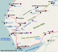
Bro Dysynni Map.svg 598 × 531; 262 KB
-
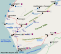
BroDysynni.png 1,195 × 1,063; 323 KB
-
Ceredigon map.png 1,143 × 956; 32 KB
-
Conwy map.png 844 × 978; 29 KB
-
Denbighshire map.png 664 × 1,053; 21 KB
-
Flintshire map.png 1,086 × 1,165; 25 KB
-
Glamorgan map.png 1,027 × 639; 24 KB
-
Gwynedd map.png 1,122 × 1,008; 29 KB
-
Mid Wales map.png 1,140 × 1,190; 33 KB
-
Monmouthshire map.png 581 × 717; 18 KB
-
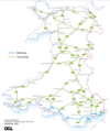
Motorway & Trunk Road Network in Wales.png 651 × 777; 290 KB
-
North Wales map.png 1,324 × 950; 40 KB
-
North Wales Wikivoyage map.png 1,324 × 950; 54 KB
-
Pembrokeshire map.png 1,142 × 1,125; 38 KB
-
Powys map.png 593 × 1,190; 25 KB
-
SnowdoniaMap.jpg 932 × 720; 324 KB
-
South Wales map.png 1,168 × 550; 24 KB
-
Trunk Road Network in Wales 2015.png 438 × 588; 159 KB
-
Tywyn Map.png 685 × 660; 112 KB
-
Wales map.png 876 × 1,091; 31 KB
-
Wrexham map.png 1,024 × 642; 19 KB


