Category:Travel maps of New Zealand
Jump to navigation
Jump to search
Countries of Oceania: Australia · Fiji · Federated States of Micronesia · Kiribati · Marshall Islands · Nauru · New Zealand · Papua New Guinea · Samoa
Other areas: American Samoa · Cocos (Keeling) Islands · Cook Islands · French Polynesia · Guam · Hawaii · New Caledonia · Niue · Norfolk Island · Northern Mariana Islands · Pitcairn Islands · Tokelau · Wallis and Futuna – Partly: Indonesia
Other areas: American Samoa · Cocos (Keeling) Islands · Cook Islands · French Polynesia · Guam · Hawaii · New Caledonia · Niue · Norfolk Island · Northern Mariana Islands · Pitcairn Islands · Tokelau · Wallis and Futuna – Partly: Indonesia
Subcategories
This category has the following 4 subcategories, out of 4 total.
Media in category "Travel maps of New Zealand"
The following 17 files are in this category, out of 17 total.
-
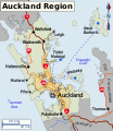
Auckland Region map EN.png 2,100 × 2,424; 1.12 MB
-
Auckland Region WV map.svg 681 × 786; 5.04 MB
-
Auckland WV districts map EN.png 1,600 × 1,966; 914 KB
-
Auckland WV districts map-W.svg 683 × 840; 2.55 MB
-
Kiwi Regional Airlines destinations.svg 1,311 × 1,616; 73 KB
-
New Zealand regions map (cs).png 1,265 × 1,642; 459 KB
-
NewZealandAirportsMap.png 502 × 494; 38 KB
-
North is proposed regions2.png 1,349 × 2,044; 511 KB
-
NZ north island regions.png 1,349 × 2,044; 703 KB
-
Nz north island.png 1,349 × 2,044; 473 KB
-
NZ regions (fr).png 1,349 × 1,752; 509 KB
-
NZ regions map (ru).png 1,349 × 1,752; 470 KB
-
NZ regions.png 1,500 × 1,948; 1.1 MB
-
NZ regions.svg 1,349 × 1,752; 881 KB
-
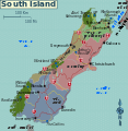
Nz south island map2.png 1,500 × 1,554; 1.29 MB
-
South island map.png 1,500 × 1,537; 642 KB
-
South island regions.svg 1,123 × 1,150; 1.03 MB


