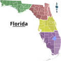
Category:Travel maps of Florida
Jump to navigation
Jump to search
States of the United States: Alabama · Alaska · Arizona · Arkansas · California · Colorado · Delaware · Florida · Georgia · Hawaii · Idaho · Illinois · Indiana · Iowa · Kansas · Kentucky · Louisiana · Maine · Maryland · Massachusetts · Michigan · Minnesota · Mississippi · Missouri · Montana · Nebraska · Nevada · New Hampshire · New Jersey · New Mexico · New York · North Carolina · North Dakota · Ohio · Oklahoma · Oregon · Pennsylvania · Rhode Island · South Carolina · South Dakota · Tennessee · Texas · Utah · Virginia · Washington · Wisconsin · Wyoming – Washington, D.C.
American Samoa · Guam · Northern Mariana Islands · Puerto Rico
American Samoa · Guam · Northern Mariana Islands · Puerto Rico
Subcategories
This category has the following 3 subcategories, out of 3 total.
T
- Travel maps of Miami (6 F)
Media in category "Travel maps of Florida"
The following 15 files are in this category, out of 15 total.
-
East Central Florida Static Map.png 2,672 × 3,024; 585 KB
-
Florida Panhandle Static Map SVG version.svg 2,020 × 1,594; 525 KB
-
Florida Panhandle Static Map.png 2,655 × 2,096; 685 KB
-
Florida Proposed New Map.svg 4,429 × 3,614; 698 KB
-
Florida Static Map.png 6,043 × 4,645; 3.46 MB
-
Lake Alfred Wikivoyage Map.png 3,808 × 3,052; 1.63 MB
-
Lake Alfred Wikivoyage Map.svg 2,243 × 1,803; 1.5 MB
-
Map of Florida Regions with Cities (ru).png 2,028 × 1,973; 465 KB
-
Map of Florida Regions with Cities.svg 7,342 × 7,321; 1.51 MB
-
Map of Florida Regions.png 2,203 × 2,196; 435 KB
-
Map of Florida Regions.svg 7,342 × 7,321; 702 KB
-
Map-USA-Pensacola-Downtown.png 1,337 × 729; 184 KB
-
Map-USA-Pensacola.png 819 × 793; 323 KB
-
Orlando printable tourist attractions map.jpg 2,105 × 1,488; 1.47 MB
-
SAL Florida 1936.jpg 1,200 × 1,800; 570 KB


