Category:Travel maps of Africa
Jump to navigation
Jump to search
Subcategories
This category has the following 44 subcategories, out of 44 total.
Media in category "Travel maps of Africa"
The following 73 files are in this category, out of 73 total.
-
Africa raid 1933 Malakal map.jpg 938 × 1,200; 162 KB
-
Africa raid 1934 Banciulescu map.jpg 938 × 1,200; 162 KB
-
Africa raid 1935 Banciulescu map.jpg 938 × 1,200; 166 KB
-
Africa raid 1935 Burnaia map.jpg 938 × 1,200; 162 KB
-
Africa raid 1935 Cape Town map.jpg 938 × 1,200; 167 KB
-
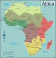
Africa regions (cs).svg 1,273 × 1,324; 62 KB
-
Africa Visa Openness in 2016.svg 1,000 × 1,000; 186 KB
-
Africacolour.PNG 287 × 336; 9 KB
-
Afrika Karte.jpg 800 × 328; 166 KB
-
Blondin Diop Map.png 11,200 × 6,800; 3.16 MB
-
Borobudur ship expedition route.jpg 1,440 × 810; 184 KB
-
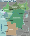
Central Africa regions map (cs).png 1,697 × 1,970; 654 KB
-
Central Africa regions map (fr).png 1,823 × 2,098; 691 KB
-
Central Africa regions map (ru).png 1,667 × 1,987; 526 KB
-
Central Africa regions map.png 1,810 × 2,101; 678 KB
-
Central Africa regions map.svg 940 × 477; 3.31 MB
-
Destinos Iberia africa.gif 540 × 540; 14 KB
-
East Africa regions map (cs).png 1,406 × 2,288; 796 KB
-
East Africa regions map (fr).png 1,500 × 2,440; 732 KB
-
East Africa regions map (ru).png 1,500 × 2,440; 735 KB
-
East Africa regions map.png 1,998 × 2,148; 502 KB
-
East Africa regions map.svg 73 × 119; 3.55 MB
-
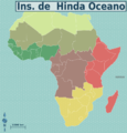
East African islands.png 1,249 × 1,749; 182 KB
-
Fourth trip to Africa by Viktor Pinchuk.jpg 991 × 1,030; 553 KB
-
Map-Africa-Regions (eo 1).png 991 × 1,030; 231 KB
-
Map-Africa-Regions (eo 2).png 991 × 1,030; 232 KB
-
Map-Africa-Regions (eo 3).png 991 × 1,030; 237 KB
-
Map-Africa-Regions (eo 4).png 991 × 1,030; 234 KB
-
Map-Africa-Regions (eo 5).png 991 × 1,030; 220 KB
-
Map-Africa-Regions (eo 6).png 991 × 1,030; 226 KB
-
Map-Africa-Regions (eo 7).png 991 × 1,030; 220 KB
-
Map-Africa-Regions (eo).png 991 × 1,030; 291 KB
-
Map-Africa-Regions (fr).png 990 × 1,030; 356 KB
-
Map-Africa-Regions (nl).png 990 × 1,030; 354 KB
-
Map-Africa-Regions (pt).png 1,000 × 1,039; 410 KB
-
Map-Africa-Regions (ru).png 3,254 × 3,383; 1.43 MB
-
Map-Africa-Regions (zh-hans)-非洲地图.png 1,019 × 1,059; 339 KB
-
Map-Africa-Regions.png 991 × 1,030; 2.93 MB
-
Map-Africa-Regions.svg 1,273 × 1,324; 1.8 MB
-
Map-Africa-Southern Africa-Regions.png 974 × 831; 264 KB
-
Map-Africa-Southern Africa-Regions.svg 744 × 1,052; 1.65 MB
-
Map-Southern Africa-ru.png 1,313 × 823; 148 KB
-
North Africa regions map (cs).png 1,877 × 769; 350 KB
-
North Africa regions map (fr).png 2,002 × 821; 317 KB
-
North Africa regions map (ru).png 2,038 × 932; 376 KB
-
North Africa regions map ka.svg 2,000 × 819; 87 KB
-
North Africa regions map uk.png 2,000 × 826; 250 KB
-
North Africa regions map uk.svg 2,000 × 819; 83 KB
-
North Africa regions map.png 2,000 × 819; 312 KB
-
North Africa regions map.svg 940 × 477; 4.07 MB
-
Omar Blondin Diop Carte.jpg 4,200 × 2,550; 2.18 MB
-
OmarBlondinDiop Déplacements.jpg 11,200 × 6,800; 7.59 MB
-
OmarBlondinDiop Trajectoire.jpg 11,200 × 6,800; 7.58 MB
-
Risks-in-Africa December-25-2012.svg 1,000 × 1,000; 322 KB
-
Saharan Africa regions map (cs).png 1,875 × 1,077; 561 KB
-
Saharan Africa regions map (fr).png 3,448 × 1,981; 1,006 KB
-
Saharan Africa regions map (ru).png 3,008 × 1,731; 756 KB
-
Saharan Africa regions map.png 2,000 × 1,149; 528 KB
-
Saharan Africa regions map.svg 137 × 79; 2.25 MB
-
Second trip to Africa by Viktor Pinchuk.jpg 3,049 × 2,131; 3.5 MB
-
Southern Africa new map (fr).png 2,000 × 1,204; 574 KB
-
Southern Africa new map (ru).png 2,000 × 1,204; 569 KB
-
Southern Africa new map ka.svg 2,001 × 1,204; 107 KB
-
Southern Africa new map uk.png 2,001 × 1,205; 411 KB
-
Southern Africa new map uk.svg 2,001 × 1,204; 101 KB
-
Southern Africa new map.png 2,000 × 1,204; 771 KB
-
Southern Africa new map.svg 918 × 553; 1.48 MB
-
Southern Africa regions map (cs).png 1,875 × 1,128; 656 KB
-
West Africa regions map (cs).png 1,403 × 688; 394 KB


