Category:Transport maps of Normandie
Jump to navigation
Jump to search
Administrative regions and territorial collectivity of Metropolitan France (‡ since start of 2016):
Corsica · Normandy‡
Former administrative regions of Metropolitan France (until end of 2015):
Rhône-Alpes
Overseas departments and regions: Réunion
Corsica · Normandy‡
Former administrative regions of Metropolitan France (until end of 2015):
Rhône-Alpes
Overseas departments and regions: Réunion
Subcategories
This category has the following 4 subcategories, out of 4 total.
P
T
Media in category "Transport maps of Normandie"
The following 24 files are in this category, out of 24 total.
-
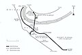
 Caen-Rennes rouge.png 971 × 1,007; 107 KB
-
 Caen-Rennes.png 971 × 1,007; 99 KB
-
 Caen1bis.svg 913 × 623; 80 KB
-
 CaenRoutes.JPG 821 × 558; 51 KB
-
 CaenRoutes.svg 913 × 623; 413 KB
-
 Chemin de Fer de la Suisse Normande.png 600 × 1,500; 23 KB
-
 Chemin de fer de Normandie.svg 985 × 1,387; 317 KB
-
 Chemin de fer en normandie.svg 3,752 × 2,896; 442 KB
-
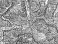
 Chemins de fer en Seine-Inférieure et dans l'Eure.jpg 1,061 × 1,317; 200 KB
-
 Elbeuf Plan du Tramway.jpg 931 × 627; 150 KB
-
 La Normandie Jules Janin illustration 107.jpg 3,409 × 2,067; 1.81 MB
-
 LGV Normandie Projet1.png 4,500 × 2,755; 1.17 MB
-
 Lig. Mant-Caen.png 1,653 × 345; 66 KB
-
 Ligne Falaise - Berjou.svg 2,377 × 846; 170 KB
-
 Ligne sainte Gauburge.jpg 975 × 787; 659 KB
-
 Lignes du Chemin de fer de Normandie.jpg 1,000 × 1,306; 137 KB
-
 Noeud ferroviaire de Gisors.png 1,226 × 920; 2.12 MB
-
 Noeud ferroviaire de Vernon.png 1,227 × 920; 1.85 MB
-
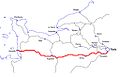 Paris-Granville01.jpg 1,023 × 653; 37 KB
-
 Plan reseau argentan.svg 435 × 890; 95 KB
-
 Plan-reseau-Manche.gif 1,358 × 2,372; 851 KB
-
 Réseau des tramways du Havre.jpg 1,024 × 710; 120 KB
-
 Réseau ferré de Manche.svg 400 × 550; 43 KB
-
 Tramway de Eu.jpg 1,132 × 643; 322 KB


