Category:Transport maps of Guatemala
Jump to navigation
Jump to search
Countries of North America: Belize · Canada · Costa Rica · Cuba · Dominican Republic · Guatemala · Jamaica · Mexico · Panama · United States of America‡
Other territories: Puerto Rico
‡: partly located in North America
Other territories: Puerto Rico
‡: partly located in North America
Media in category "Transport maps of Guatemala"
The following 11 files are in this category, out of 11 total.
-
AILA Domestic Destinations - Guatemala.gif 540 × 540; 18 KB
-
BRT Líneas GT.png 1,200 × 1,500; 268 KB
-
Guatemala Transportation Map 2020.jpg 5,400 × 7,200; 12.32 MB
-
Guatemala Transportation.jpg 2,009 × 2,409; 1.52 MB
-
Guatemalan international air routes in the Americas.gif 540 × 540; 26 KB
-
Map of Tag Airlines Routes.gif 540 × 540; 20 KB
-
Mapa de Rutas Aéreas desde el Aeropuerto Internacional la Aurora.gif 540 × 540; 21 KB
-
Mapa de Vuelos Internos en Guatemala.gif 540 × 540; 27 KB
-
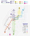
Rutas Transmetro.png 538 × 821; 194 KB
-
Tag Airlines' ATR Flight Route From France to Guatemala.gif 720 × 360; 17 KB
-
Transmetro Guatemala Public Map March 2020.jpg 3,490 × 4,096; 785 KB


