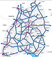
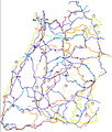
Category:Transport maps of Baden-Württemberg
Jump to navigation
Jump to search
Federal states of Germany:
Urban districts (cities): Freiburg · Heidelberg · Heilbronn · Karlsruhe · Mannheim · Stuttgart · Ulm
Subcategories
This category has the following 11 subcategories, out of 11 total.
H
K
S
U
Media in category "Transport maps of Baden-Württemberg"
The following 15 files are in this category, out of 15 total.
-
0-RadNETZ.jpg 800 × 885; 531 KB
-
1 Radwege-Netz.jpg 556 × 686; 173 KB
-
2-Radwege-Routen.jpg 633 × 762; 236 KB
-
3-NetzRouten.jpg 620 × 758; 322 KB
-
3-NetzRouten2.jpg 610 × 741; 304 KB
-
B1 RadNetz.jpg 808 × 948; 296 KB
-
B2 Radrouten.jpg 804 × 947; 332 KB
-
B2 Radrouten2.jpg 799 × 946; 348 KB
-
B2 Radrouten3.jpg 803 × 949; 351 KB
-
B3 RadNetz Routen.jpg 807 × 949; 466 KB
-
B3 RadNetz Routen2.jpg 806 × 946; 476 KB
-
B3 RadNetz Routen3.jpg 802 × 940; 481 KB
-
Exit Rheinfelden Süd, map OSM 2022.png 438 × 661; 136 KB
-
RadNETZ BW Karte 2024 Alltag+Freizeit.png 1,748 × 1,896; 2.27 MB
-
Stadt Karlsruhe - Radnetz 2023.png 2,338 × 1,653; 2.82 MB


