Category:Tramlink trams in red and white livery
Jump to navigation
Jump to search
Media in category "Tramlink trams in red and white livery"
The following 171 files are in this category, out of 171 total.
-
 Croydon Tramlink Addiscombe Road.jpg 2,400 × 1,600; 1.51 MB
-
 Sandilands tram stop (2000k).jpg 1,731 × 1,181; 462 KB
-
 Sandilands tram stop (2000c).jpg 1,731 × 1,189; 434 KB
-
 West Croydon station (2000c).jpg 1,723 × 1,189; 260 KB
-
 Morden Road stop (2001a).jpg 1,170 × 1,740; 397 KB
-
 Morden Road stop (2001c).jpg 1,736 × 1,181; 419 KB
-
 2543-Dundonald Road.jpg 640 × 438; 59 KB
-
 Sandilands tram stop (2000a).jpg 1,731 × 1,177; 361 KB
-
 Sandilands tram stop (2000d).jpg 1,731 × 1,189; 427 KB
-
 West Croydon station (2000n).jpg 1,723 × 1,189; 436 KB
-
 Addington Village bus and tram station.jpg 640 × 432; 120 KB
-
 Addington Village Tram Stop - geograph.org.uk - 1188324.jpg 3,648 × 2,056; 3.81 MB
-
 Addiscombe tram stop 1.jpg 640 × 480; 121 KB
-
 Alongside Coombe Road - geograph.org.uk - 825539.jpg 640 × 414; 118 KB
-
 Approaching Coombe Lane - geograph.org.uk - 825586.jpg 640 × 413; 126 KB
-
 Approaching East Croydon tram stop - geograph.org.uk - 853156.jpg 640 × 399; 91 KB
-
 Approaching Sandilands - geograph.org.uk - 852812.jpg 640 × 405; 97 KB
-
 Arena tram junction.jpg 640 × 480; 84 KB
-
 Arena tram stop - geograph.org.uk - 881330.jpg 640 × 480; 97 KB
-
 Around the Loop (1) - geograph.org.uk - 813854.jpg 640 × 409; 88 KB
-
 Around the Loop (2) - geograph.org.uk - 813862.jpg 640 × 390; 90 KB
-
 Around the Loop (3) - geograph.org.uk - 813869.jpg 640 × 407; 81 KB
-
 Around the Loop (4) - geograph.org.uk - 813873.jpg 640 × 407; 67 KB
-
 Around the Loop (5) - geograph.org.uk - 813884.jpg 640 × 407; 68 KB
-
 Around the Loop (6) - geograph.org.uk - 813893.jpg 640 × 408; 83 KB
-
 Beckenham Junction tramstop look to buffers with tram 2550.JPG 1,600 × 1,200; 406 KB
-
 Belgrave Walk tram stop - geograph.org.uk - 1055133.jpg 640 × 480; 97 KB
-
 Birkbeck station on the Croydon TramLink.jpg 950 × 728; 198 KB
-
 Changing Times (1) - geograph.org.uk - 1241374.jpg 640 × 360; 69 KB
-
 Church Street, Croydon - geograph.org.uk - 853988.jpg 640 × 464; 97 KB
-
 Church Street, Croydon - geograph.org.uk - 853990.jpg 640 × 456; 103 KB
-
 Church Street, Croydon, Surrey - geograph.org.uk - 40105.jpg 640 × 480; 119 KB
-
 Climbing through the woods - geograph.org.uk - 823566.jpg 640 × 397; 118 KB
-
 Coombe Lane tram stop - geograph.org.uk - 823572.jpg 640 × 409; 119 KB
-
 Coombe Lane tram stop - geograph.org.uk - 825552.jpg 640 × 415; 127 KB
-
 Coombe Lane tram stop - geograph.org.uk - 825560.jpg 640 × 415; 112 KB
-
 Coombe Lane tram stop - geograph.org.uk - 825572.jpg 640 × 413; 120 KB
-
 Coupled cars at Therapia Lane - geograph.org.uk - 813300.jpg 640 × 404; 87 KB
-
 Crossing Gravel Hill - geograph.org.uk - 825612.jpg 640 × 403; 85 KB
-
 Crossing Lloyd Park Avenue - geograph.org.uk - 825513.jpg 640 × 412; 109 KB
-
 Croydon tram.jpg 700 × 525; 135 KB
-
 Croydon Tramlink 2000.jpg 1,451 × 1,232; 234 KB
-
 Croydon Tramlink 2000.png 1,455 × 1,234; 3.56 MB
-
 Croydon, Addington Hills - geograph.org.uk - 1671740.jpg 1,797 × 1,165; 2.62 MB
-
 Croydon, Church Street - geograph.org.uk - 1671689.jpg 640 × 429; 115 KB
-
 Croydon, Church Street tram stop - geograph.org.uk - 1671695.jpg 1,840 × 1,232; 2.28 MB
-
 Croydon, Coombe Lane tram stop - geograph.org.uk - 1671731.jpg 1,840 × 1,232; 2.77 MB
-
 Croydon, Coombe Lane tram stop - geograph.org.uk - 1671736.jpg 1,705 × 1,143; 2.47 MB
-
 Croydon, near Reeves Corner - geograph.org.uk - 1671707.jpg 1,771 × 1,140; 1.98 MB
-
 Croydon, Top of Addington Hills - geograph.org.uk - 1671720.jpg 1,764 × 1,149; 2.12 MB
-
 Dundonald Road tramstop, Wimbledon - geograph.org.uk - 608368.jpg 640 × 480; 79 KB
-
 East Croydon station tram stop - geograph.org.uk - 853137.jpg 640 × 402; 72 KB
-
 East Croydon station tram stop - geograph.org.uk - 853149.jpg 640 × 391; 75 KB
-
 East Croydon Station tram stop - geograph.org.uk - 853160.jpg 640 × 400; 91 KB
-
 East Croydon station tram stop - geograph.org.uk - 853165.jpg 640 × 401; 87 KB
-
 East Croydon Tram Stop - geograph.org.uk - 1160437.jpg 3,648 × 2,056; 3.3 MB
-
 East Croydon tram stop - geograph.org.uk - 873696.jpg 640 × 480; 81 KB
-
 East Croydon tram stop - geograph.org.uk - 937939.jpg 640 × 480; 74 KB
-
 East Croydon Tramlink 2008.JPG 1,944 × 2,592; 1.06 MB
-
 Elmers End station - geograph.org.uk - 825335.jpg 640 × 411; 85 KB
-
 Elmers End stn Tramlink look north2.JPG 1,600 × 1,200; 331 KB
-
 Elmers End tram terminus - geograph.org.uk - 825326.jpg 640 × 411; 87 KB
-
 Gb-tramlink-croydoncentre-01.jpg 1,600 × 1,200; 877 KB
-
 Gb-tramlink-croydoncentre-02.jpg 1,600 × 1,200; 849 KB
-
 Gb-tramlink-croydoncentre-03.jpg 1,600 × 1,200; 966 KB
-
 Gb-tramlink-croydoncentre-04.jpg 1,600 × 1,200; 868 KB
-
 Gb-tramlink-croydoncentre-05.jpg 1,600 × 1,200; 847 KB
-
 Gb-tramlink-croydoncentre-06.jpg 1,200 × 1,600; 864 KB
-
 Gb-tramlink-croydoncentre-10.jpg 1,600 × 1,200; 866 KB
-
 Gb-tramlink-croydoncentre-11.jpg 1,600 × 1,200; 869 KB
-
 George Street (East), Croydon - geograph.org.uk - 722809.jpg 640 × 634; 82 KB
-
 George Street (west) - geograph.org.uk - 722822.jpg 640 × 544; 77 KB
-
 George Street (West), Croydon - geograph.org.uk - 829855.jpg 640 × 410; 82 KB
-
 George Street East, Croydon - geograph.org.uk - 823399.jpg 640 × 409; 95 KB
-
 Gravel Hill tram stop - geograph.org.uk - 825631.jpg 640 × 406; 95 KB
-
 Gravel Hill tram stop - geograph.org.uk - 825646.jpg 640 × 413; 104 KB
-
 Just testing - geograph.org.uk - 813091.jpg 640 × 400; 107 KB
-
 Lebanon Road tram stop - geograph.org.uk - 825362.jpg 640 × 430; 109 KB
-
 Lebanon Road tram stop - geograph.org.uk - 825392.jpg 640 × 413; 101 KB
-
 Lloyd Park tram stop - geograph.org.uk - 825503.jpg 640 × 412; 115 KB
-
 Lloyd Park tram stop - geograph.org.uk - 825530.jpg 640 × 414; 99 KB
-
 Lloyd Park tram stop, Croydon - geograph.org.uk - 823587.jpg 640 × 409; 116 KB
-
 Mitcham, Tramlink - geograph.org.uk - 415494.jpg 640 × 480; 141 KB
-
 New Addington tram terminus - geograph.org.uk - 823538.jpg 640 × 408; 104 KB
-
 New Addington tramstop look south.JPG 1,600 × 1,200; 360 KB
-
 Opening Day - geograph.org.uk - 823522.jpg 640 × 411; 108 KB
-
 Outside East Croydon station - geograph.org.uk - 823478.jpg 640 × 405; 88 KB
-
 Round the bend into Wellesley Road - geograph.org.uk - 722842.jpg 640 × 542; 87 KB
-
 Sandilands tram stop (2000j).jpg 1,731 × 1,181; 426 KB
-
 Sandilands Tram Stop - geograph.org.uk - 692931.jpg 640 × 480; 55 KB
-
 Sandilands tram stop - geograph.org.uk - 825489.jpg 640 × 414; 97 KB
-
 Sandilands tram stop - geograph.org.uk - 852711.jpg 640 × 412; 92 KB
-
 Sandilands tram stop - geograph.org.uk - 852732.jpg 640 × 414; 101 KB
-
 Sandilands tram stop - geograph.org.uk - 852780.jpg 640 × 454; 101 KB
-
 Sandilands tram stop - geograph.org.uk - 852792.jpg 640 × 419; 95 KB
-
 Sandilands tram stop - geograph.org.uk - 852796.jpg 640 × 415; 97 KB
-

-
 Simply Red - geograph.org.uk - 1677646.jpg 3,648 × 2,056; 3.68 MB
-
 South Lodge at Addington Palace, CRo - geograph.org.uk - 55149.jpg 640 × 516; 84 KB
-
 Tamworth Road, Croydon - geograph.org.uk - 725869.jpg 640 × 480; 76 KB
-
 The first car - geograph.org.uk - 821779.jpg 640 × 410; 103 KB
-
 Tram 2532 at East Croydon.jpg 3,648 × 2,736; 3.98 MB
-
 Tram 2544 at Church Street.jpg 3,648 × 2,736; 4.24 MB
-
 Tram 2550 at Church Street 1.jpg 3,648 × 2,736; 4.58 MB
-
 Tram 2550 at Church Street 2.jpg 3,648 × 2,736; 4.2 MB
-
 Tram 2550 on Church Street - geograph.org.uk - 929377.jpg 640 × 480; 94 KB
-

-
 Tram 2553 at East Croydon 1.jpg 3,648 × 2,736; 4.57 MB
-
 Tram 2553 at East Croydon 2.jpg 3,648 × 2,736; 3.86 MB
-
 Tram 2553 at East Croydon station - geograph.org.uk - 1020168.jpg 640 × 480; 78 KB
-
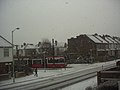 Tram and snow - geograph.org.uk - 22974.jpg 640 × 480; 73 KB
-
 Tram Approaching Mitcham Junction Stop - geograph.org.uk - 1188197.jpg 3,648 × 2,056; 3.47 MB
-
 Tram Approaching Therapia Lane Stop - geograph.org.uk - 1188181.jpg 3,072 × 1,728; 2.08 MB
-
 Tram Approaching Waddon Marsh Stop - geograph.org.uk - 1188171.jpg 3,072 × 1,728; 2.13 MB
-
 Tram at Addington Village - geograph.org.uk - 988255.jpg 640 × 480; 83 KB
-
 Tram at Addiscombe (geograph 4628021).jpg 1,024 × 768; 122 KB
-
 Tram at Beckenham Junction station - geograph.org.uk - 937883.jpg 640 × 480; 74 KB
-
 Tram at Dundonald Road - geograph.org.uk - 1188376.jpg 640 × 360; 66 KB
-
 Tram at East Croydon Station - geograph.org.uk - 587492.jpg 640 × 427; 92 KB
-
 Tram at East Croydon Station - geograph.org.uk - 873694.jpg 640 × 480; 89 KB
-
 Tram at Lloyd Park Tram Stop - geograph.org.uk - 1159259.jpg 3,648 × 2,056; 3.69 MB
-
 Tram at Merton Park station (geograph 2234124).jpg 1,600 × 1,200; 622 KB
-
 Tram at Reeves Corner, Croydon - geograph.org.uk - 1185983.jpg 3,072 × 1,728; 2.11 MB
-
 Tram at Wandle Park Tram Stop - geograph.org.uk - 683526.jpg 640 × 480; 90 KB
-
 Tram at West Croydon - geograph.org.uk - 1209586.jpg 640 × 480; 86 KB
-
 Tram at Woodside - geograph.org.uk - 1188243.jpg 3,072 × 1,728; 1.88 MB
-
 Tram crossing at Gravel Hill - geograph.org.uk - 692969.jpg 640 × 480; 80 KB
-
 Tram in South Norwood Country Park - geograph.org.uk - 1188215.jpg 3,072 × 1,728; 2.15 MB
-
 Tram in Tamworth Road Croydon - geograph.org.uk - 650583.jpg 640 × 480; 67 KB
-
 Tram Lines Near Arena Stop - geograph.org.uk - 1188230.jpg 3,072 × 1,728; 1.93 MB
-
 Tram Near Phipps Bridge - geograph.org.uk - 1188209.jpg 3,648 × 2,056; 3.63 MB
-
 Tram on test in Church Street - geograph.org.uk - 1637153.jpg 640 × 508; 73 KB
-
 Tram on test, East Croydon - geograph.org.uk - 1637151.jpg 640 × 553; 90 KB
-

-
 Tram on test, Tamworth Road, Croydon - geograph.org.uk - 1637155.jpg 640 × 527; 74 KB
-
 Tram on test, Tamworth Road, Croydon - geograph.org.uk - 1637156.jpg 640 × 558; 73 KB
-

-
 Tram on trial in George Street - geograph.org.uk - 1660801.jpg 640 × 408; 93 KB
-
 Tram on trial near Wandle Park - geograph.org.uk - 813044.jpg 640 × 411; 85 KB
-
 Tram on trial, George Street - geograph.org.uk - 1660875.jpg 407 × 640; 103 KB
-
 Tram on trial, West Croydon - geograph.org.uk - 1637152.jpg 640 × 573; 74 KB
-
 Tram route 2.jpg 2,304 × 1,728; 1.34 MB
-
 Tram to Elmers End - geograph.org.uk - 1106371.jpg 640 × 480; 107 KB
-
 Tramlink East Croydon.jpg 640 × 401; 63 KB
-
 Tramlink Route 2 at Beckenham Junction.jpg 640 × 480; 85 KB
-
 Tramlink station at Ampere Way - geograph.org.uk - 24226.jpg 640 × 480; 91 KB
-
 Tramlink stop at Lloyd Park, Croydon - geograph.org.uk - 32919.jpg 640 × 481; 113 KB
-

-
 Tramlink Wimbledon 01.jpg 1,600 × 1,200; 844 KB
-
 Tramlink Wimbledon 02.jpg 1,200 × 1,600; 857 KB
-
 Tramlink-Beckenham Jn.jpg 1,600 × 1,200; 856 KB
-
 Tramlink-Tram2536-01.jpg 1,600 × 1,200; 835 KB
-
 Tramlink-Tram2536-02.jpg 1,600 × 1,200; 852 KB
-
 Tramlink-Tram2536-03.jpg 1,600 × 1,200; 898 KB
-
 Tramlink-Tram2536-04.jpg 1,600 × 1,200; 814 KB
-
 Tramlink-Tram2536-05.jpg 1,600 × 1,200; 890 KB
-
 Tramlink-Tram2536-06.jpg 1,200 × 1,600; 885 KB
-
 Tramlink-Tram2536-07.jpg 1,600 × 1,200; 871 KB
-
 Trams, first day at New Addington - geograph.org.uk - 1660895.jpg 640 × 400; 91 KB
-
 Waddon Marsh tram stop - geograph.org.uk - 216797.jpg 640 × 480; 119 KB
-
 Wellesley Road, Croydon - geograph.org.uk - 722826.jpg 640 × 567; 81 KB
-
 Wellesley Road, Croydon - geograph.org.uk - 722834.jpg 640 × 508; 75 KB
-
 Wellesley Road, Croydon - geograph.org.uk - 823416.jpg 640 × 410; 96 KB
-
 Wimbledon station - geograph.org.uk - 647728.jpg 640 × 419; 83 KB
-
 Wimbledon station - geograph.org.uk - 825301.jpg 640 × 416; 89 KB
-
 Wimbledon station Tramlink platform 10 look south.JPG 1,600 × 1,200; 498 KB
-
 Wimbledon station Tramlink platform 10 look south2.JPG 1,600 × 1,200; 498 KB
-
 Wimbledon Tramlink station - geograph.org.uk - 719106.jpg 640 × 480; 86 KB
-
 Winter Landscape on Gravel Hill - geograph.org.uk - 1159987.jpg 640 × 360; 55 KB
-
 Woodside 2008 01.JPG 2,592 × 1,944; 1.59 MB
-
 Woodside 2008 02.JPG 2,592 × 1,944; 1.45 MB

.jpg)
.jpg)
.jpg)
.jpg)
.jpg)

.jpg)
.jpg)
.jpg)


_-_geograph.org.uk_-_813854.jpg)
_-_geograph.org.uk_-_813862.jpg)
_-_geograph.org.uk_-_813869.jpg)
_-_geograph.org.uk_-_813873.jpg)
_-_geograph.org.uk_-_813884.jpg)
_-_geograph.org.uk_-_813893.jpg)


_-_geograph.org.uk_-_1241374.jpg)


,_Croydon_-_geograph.org.uk_-_722809.jpg)
_-_geograph.org.uk_-_722822.jpg)
,_Croydon_-_geograph.org.uk_-_829855.jpg)


.jpg)


.jpg)


.jpg)


._-_geograph.org.uk_-_1660811.jpg)


.jpg)


