Category:Tram maps of Lille
Jump to navigation
Jump to search
Media in category "Tram maps of Lille"
The following 21 files are in this category, out of 21 total.
-
Plan du tramway de Lille 1876-12-17 1.jpg 2,557 × 2,497; 1.38 MB
-
Plan du tramway de Lille 1876-12-17 2.jpg 1,803 × 1,992; 765 KB
-
Plan de Lille 1930.jpg 8,996 × 7,174; 11.33 MB
-
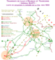
Carte situ ELRT, v. 1930.png 1,416 × 1,546; 315 KB
-
Metro tram Lille.svg 1,440 × 1,420; 1.39 MB
-
Metro-UndStraßenbahnGleisplanLille2014.png 9,280 × 7,514; 2 MB
-
Plan des lignes de tramway et de métro de Lille.svg 2,279 × 601; 986 KB
-
Plan Metro Tramway Lille.png 2,124 × 543; 175 KB
-
Plan tramway Lille 1909.svg 819 × 865; 530 KB
-
Plan tramway Lille 1912.svg 819 × 865; 531 KB
-
Plan tramway Lille 1926.svg 819 × 865; 531 KB
-
Plan tramway Lille 1983.svg 819 × 865; 532 KB
-
Plan tramway Lille 1994.svg 819 × 865; 534 KB
-
Plan tramway Lille fin année 1876.svg 2,740 × 2,400; 3.81 MB
-
Plan tramway Roubaix 1909.svg 1,020 × 1,221; 675 KB
-
Plan tramway Roubaix 1954.svg 1,020 × 1,221; 677 KB
-
Plan tramway Roubaix 1994.svg 1,020 × 1,221; 677 KB
-
Plan tramway Tourcoing 1926.svg 520 × 980; 549 KB
-
Plan tramway Tourcoing 1982.svg 520 × 980; 549 KB
-
Plan tramway Tourcoing 1994.svg 520 × 980; 551 KB
-
Projet de tramway de Lille Métropole (juin 2019).svg 963 × 1,087; 3.65 MB


