Category:Tram maps of Kassel
Jump to navigation
Jump to search
Media in category "Tram maps of Kassel"
The following 9 files are in this category, out of 9 total.
-
Entwicklung des Straßenbahn-Streckennetzes im Stadtzentrum von Kassel.jpg 3,454 × 2,440; 1.3 MB
-
HerkulesbahnNetz.png 448 × 864; 19 KB
-
Kassel Strassenbahn Netzplan Stand 03-2020.jpg 3,000 × 3,000; 2.31 MB
-
Kassel Strassenbahn.png 3,000 × 3,000; 1.04 MB
-
Kassel Verpflechtung Test.png 1,600 × 1,000; 83 KB
-
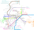
KasselTramPlan.png 1,100 × 978; 54 KB
-
KasselTramPlan.svg 1,103 × 982; 318 KB
-
Koenigsplatz Kassel map 1877.jpg 1,754 × 1,554; 2.22 MB
-
Stadt-undStraßenbahnGleisplanKassel2013.png 13,000 × 8,065; 2.14 MB


