Category:Tram maps of Dresden
Jump to navigation
Jump to search
Media in category "Tram maps of Dresden"
The following 24 files are in this category, out of 24 total.
-
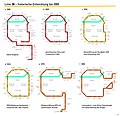
26er Ring - historischer Überblick.gif 1,323 × 1,512; 166 KB
-
Basiskarte Dresden.pdf 3,654 × 2,947; 7.85 MB
-
Dresden Hauptbahnhof tram network.png 699 × 519; 58 KB
-
Dresden streetcar system topographic.png 1,001 × 822; 142 KB
-
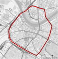
Dresden-26er Ring.png 2,000 × 2,021; 2.85 MB
-
Dresden-straßenbahnnetz.png 350 × 287; 57 KB
-
Dresdner Vorortbahn map de.svg 2,811 × 2,753; 66.31 MB
-
Dresdner Vorortsbahn de map.png 2,999 × 2,937; 18.82 MB
-
Light-rail system Dresden.png 3,385 × 2,990; 511 KB
-
Linie26.jpg 3,071 × 2,961; 587 KB
-
Liniennetzplan Straßenbahn Dresden 2012 schematisch.png 4,465 × 3,158; 877 KB
-
Liniennetzplan Straßenbahn Dresden 2012 schematisch.svg 1,489 × 1,053; 2.33 MB
-
Linienplan Straßenbahn Dresden Februar2007.png 3,724 × 2,272; 506 KB
-
Linienplan Straßenbahn Dresden Mai2007.png 3,724 × 2,272; 505 KB
-
Linienplan Straßenbahn Dresden November2006.png 3,624 × 2,272; 214 KB
-
Lößnitzbahn map de.jpg 6,989 × 4,758; 29.89 MB
-
Osmtram-footage2.svg 601 × 463; 635 KB
-
StraßenbahnGleisplanDresden2012.png 12,000 × 11,882; 4.04 MB
-
Streckennetzplan Straßenbahn Dresden 1990.svg 3,403 × 2,689; 930 KB
-
Streckennetzplan Straßenbahn Dresden 2012.svg 3,226 × 2,688; 909 KB
-
Tram line network Dresden.png 3,624 × 2,272; 214 KB
-
Übersichtsplan der Dresdner Strassenbahnen 1885.jpg 3,165 × 3,921; 2.03 MB
-
Übersichtsplan der Dresdner Strassenbahnen 1887.jpg 3,129 × 3,862; 1.95 MB
-
Übersichtsplan der Dresdner Strassenbahnen 1888.jpg 3,129 × 3,862; 2.06 MB


