Category:Tram maps of Belarus
Jump to navigation
Jump to search
Media in category "Tram maps of Belarus"
The following 15 files are in this category, out of 15 total.
-
Map of tram system in Mazyr (pl).svg 2,204 × 1,806; 171 KB
-
Map of tram system in Mazyr.svg 2,204 × 1,806; 160 KB
-
Map of tram system in Navapolatsk (pl).svg 1,115 × 931; 107 KB
-
Map of tram system in Navapolatsk.svg 1,115 × 931; 100 KB
-
Map of tram system in Vitebsk (pl).svg 1,897 × 1,569; 174 KB
-
Map of tram system in Vitebsk.svg 1,897 × 1,569; 161 KB
-
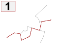
Tram line 1, Vitebsk.svg 1,897 × 1,569; 11 KB
-
Tram line 2, Vitebsk.svg 1,897 × 1,569; 11 KB
-
Tram line 3, Vitebsk.svg 1,897 × 1,569; 10 KB
-
Tram line 5, Vitebsk.svg 1,897 × 1,569; 9 KB
-
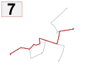
Tram line 7, Vitebsk.svg 1,897 × 1,569; 11 KB
-
Tram map of Mazyr (in rus).png 1,490 × 2,133; 2.05 MB
-
Tram map of Navapolack (no stations).png 1,400 × 994; 1.34 MB
-
Tram map of Navapolack.png 1,282 × 994; 1.22 MB
-
Tram map of Viciebsk.png 1,835 × 1,573; 3.54 MB


