Category:Trallong
Jump to navigation
Jump to search
village and community in Powys, Wales, UK  Golygfa i gyfeiriad Trallong o Abercamlais | |||||
| Upload media | |||||
| Instance of | |||||
|---|---|---|---|---|---|
| Location | Powys, Wales | ||||
| Located in or next to body of water | |||||
| Population |
| ||||
| Area |
| ||||
 | |||||
Subcategories
This category has the following 5 subcategories, out of 5 total.
A
- Abercamlais (1 F)
B
- Bettws Penpont Church (12 F)
P
- Penpont Manor House (2 F)
S
- Soar, Powys (4 F)
- St David’s Church, Trallong (7 F)
Media in category "Trallong"
The following 198 files are in this category, out of 198 total.
-

-
 A view from the north of Tyn Y Cwm - geograph.org.uk - 2514710.jpg 3,648 × 2,736; 2.22 MB
-
 Aber-bran Bridge - geograph.org.uk - 5805341.jpg 3,625 × 2,175; 2.89 MB
-
 Aber-bran Bridge Plaque - geograph.org.uk - 4500729.jpg 480 × 640; 98 KB
-
 Aberbran Fawr - geograph.org.uk - 4532777.jpg 1,920 × 887; 392 KB
-
 Aberbran Fawr - geograph.org.uk - 4597709.jpg 5,715 × 3,800; 2.76 MB
-
 Aberbran Fawr pick your own - geograph.org.uk - 4597725.jpg 5,721 × 3,569; 3.17 MB
-
 Aberbran Valley - geograph.org.uk - 5068386.jpg 3,648 × 5,472; 6.54 MB
-
 Abernant in Llanfihangel Nant Bran - geograph.org.uk - 3051802.jpg 3,648 × 2,736; 3.44 MB
-
 Barn at Blaencamlais - geograph.org.uk - 6686145.jpg 3,816 × 2,862; 4.58 MB
-
 Barn at Cwm Camlais - uchaf - geograph.org.uk - 4249446.jpg 3,872 × 2,592; 4.03 MB
-
 Barn at Llwynyneuadd Farm - geograph.org.uk - 3953848.jpg 640 × 480; 52 KB
-
 Battle End House - geograph.org.uk - 5065891.jpg 1,799 × 1,226; 1.69 MB
-
 Bettws Penpont Church - geograph.org.uk - 6317360.jpg 1,600 × 1,200; 442 KB
-
 Blaencamlais Farm - geograph.org.uk - 6686140.jpg 2,048 × 1,536; 1.66 MB
-
 Blaenegnant-isaf - geograph.org.uk - 1174016.jpg 640 × 427; 195 KB
-
 Blaenegnant-isaf - geograph.org.uk - 1179869.jpg 640 × 426; 199 KB
-
 Blaenegnant-isaf - geograph.org.uk - 1179873.jpg 640 × 428; 183 KB
-
 Blaenegnant-uchaf - geograph.org.uk - 1179858.jpg 640 × 425; 194 KB
-
 Bracken bale - geograph.org.uk - 4252329.jpg 3,872 × 2,592; 3.38 MB
-
 Bracken bales and telegraph poles - geograph.org.uk - 4250997.jpg 3,872 × 2,592; 4.08 MB
-
 Bracken in bales, Brecon in background - geograph.org.uk - 4250029.jpg 3,872 × 2,592; 3.75 MB
-
 Bridge over Nant Bran, Aberbran - geograph.org.uk - 5522324.jpg 1,280 × 851; 615 KB
-
 Bridge over River Usk - geograph.org.uk - 1451996.jpg 640 × 480; 121 KB
-
 Bridge over the River Usk at Penpont - geograph.org.uk - 5805335.jpg 3,479 × 2,319; 2.7 MB
-
 Bridge over the River Usk, Trallong - geograph.org.uk - 3453978.jpg 1,024 × 680; 216 KB
-
 Bridleway to Maen Richard - geograph.org.uk - 2513396.jpg 3,648 × 2,736; 3.65 MB
-
 Capel Bethel - Bethel Chapel - geograph.org.uk - 5414152.jpg 640 × 480; 84 KB
-
 Capel Sardis Chapel - geograph.org.uk - 2327907.jpg 690 × 518; 210 KB
-

-
 Cefn Bola Maen - geograph.org.uk - 3064158.jpg 690 × 518; 185 KB
-
 Cefn Bola-maen - geograph.org.uk - 5413098.jpg 640 × 480; 82 KB
-
 Chapel at Ty wrth-y- ffynnon - geograph.org.uk - 3453926.jpg 1,024 × 680; 293 KB
-
 Cil-fyndd - geograph.org.uk - 2513432.jpg 3,648 × 2,736; 3.09 MB
-
 Clos Coed - geograph.org.uk - 5064627.jpg 3,264 × 2,448; 2.37 MB
-
 Clouds over the Brecon Beacons - geograph.org.uk - 6686187.jpg 2,048 × 1,536; 323 KB
-
 Collapsing Tree - geograph.org.uk - 5065087.jpg 3,264 × 2,448; 2.07 MB
-
 Cottage in Aberbran - geograph.org.uk - 2514338.jpg 640 × 480; 73 KB
-
 Country road east of Pentre'r-Felin - geograph.org.uk - 3459589.jpg 1,024 × 680; 245 KB
-
 Cribyn, Pen y Fan and Corn Du - geograph.org.uk - 5066132.jpg 5,472 × 3,648; 6 MB
-
 Cwm Camlais - geograph.org.uk - 3925478.jpg 640 × 480; 133 KB
-
 Cwm Camlais waterfall - geograph.org.uk - 4249444.jpg 3,872 × 2,592; 4.3 MB
-
 Cwm-Camlais-ucharf - geograph.org.uk - 3925476.jpg 640 × 480; 72 KB
-
 Cwmffrengig - geograph.org.uk - 1179907.jpg 640 × 426; 198 KB
-
 Derelict cottage north west of Llanfihangel Nant Bran - geograph.org.uk - 3072034.jpg 3,648 × 2,736; 3.04 MB
-
 Drive to Troed y rhiw - geograph.org.uk - 2513422.jpg 3,648 × 2,736; 4.53 MB
-

-
 Entering Llanfihangel Nant Bran from the north west - geograph.org.uk - 3072069.jpg 3,648 × 2,736; 3.97 MB
-

-
 Farm buildings near Blaen Camlais - geograph.org.uk - 4248759.jpg 3,872 × 2,592; 2.87 MB
-
 Farm gate and bridleway - geograph.org.uk - 4249440.jpg 3,872 × 2,592; 4.86 MB
-
 Farm gate and windswept tree - geograph.org.uk - 4250002.jpg 3,872 × 2,592; 4.62 MB
-
 Farm Sign - geograph.org.uk - 5068361.jpg 3,264 × 2,448; 2.49 MB
-
 Farm track up to Cammant - geograph.org.uk - 798977.jpg 640 × 480; 87 KB
-
 Farmland in the Cilieni valley - geograph.org.uk - 3459577.jpg 1,024 × 680; 258 KB
-
 Farmland near Pentre'r-Felin - geograph.org.uk - 3459584.jpg 1,024 × 680; 203 KB
-
 Farmyard at Llwynyneuadd Farm - geograph.org.uk - 3953858.jpg 640 × 480; 77 KB
-
 Ffarm y Rhome - Rhome Farm - geograph.org.uk - 5414121.jpg 640 × 480; 107 KB
-
 Ffermdy Tir Cyd Farmhouse - geograph.org.uk - 2301965.jpg 690 × 518; 140 KB
-
 Field below Rhiwrfran Farm - geograph.org.uk - 799013.jpg 640 × 480; 69 KB
-
 Field gate access to bridleway over common land - geograph.org.uk - 2513412.jpg 3,648 × 2,736; 3.27 MB
-

-
 Footbridge in Cwm Camlais - geograph.org.uk - 2877101.jpg 640 × 480; 130 KB
-
 Footpath by Ty'n y cwm - geograph.org.uk - 798917.jpg 640 × 480; 103 KB
-

-
 Footpath down to Nant Bran - geograph.org.uk - 799003.jpg 640 × 480; 136 KB
-
 Former drove road - geograph.org.uk - 1178419.jpg 640 × 428; 193 KB
-
 Former ford at Felincamlais - geograph.org.uk - 4249434.jpg 3,872 × 2,592; 4.79 MB
-
 Former railway bridge parapet - geograph.org.uk - 3453995.jpg 680 × 1,024; 243 KB
-
 Gathering clouds - geograph.org.uk - 6691779.jpg 4,032 × 2,406; 1.74 MB
-

-
 Graveyard at Betws Penpont Church - geograph.org.uk - 3797050.jpg 1,500 × 1,125; 2.23 MB
-
 Iron Age Earthworks - geograph.org.uk - 5065099.jpg 2,448 × 3,264; 3.51 MB
-
 Junction on the Llanfihangel Nant Bran Road - geograph.org.uk - 3067276.jpg 2,853 × 2,211; 1.52 MB
-
 Llyn Dwr - geograph.org.uk - 5413101.jpg 640 × 480; 89 KB
-
 Llyn Dwr lake - geograph.org.uk - 945490.jpg 640 × 480; 51 KB
-
 Looking towards the Brecon Beacons - geograph.org.uk - 1013531.jpg 640 × 480; 70 KB
-
 Lower Penrheol - geograph.org.uk - 6686904.jpg 4,032 × 3,024; 3.64 MB
-
 Milestone - Bracon 6 - geograph.org.uk - 5270636.jpg 481 × 640; 137 KB
-
 Milestone - Brecon 5 - geograph.org.uk - 5312212.jpg 640 × 433; 114 KB
-
 Minor road across Trallong Common - geograph.org.uk - 3953874.jpg 640 × 480; 59 KB
-
 Minor road at Blaen Camlais - geograph.org.uk - 4248775.jpg 3,872 × 2,592; 3.41 MB
-
 Minor road descending from Mynydd Illtud Common - geograph.org.uk - 4037869.jpg 3,648 × 2,736; 2.27 MB
-

-
 Moorland road to Brecon - geograph.org.uk - 2977728.jpg 640 × 430; 51 KB
-
 Mynwent Capel Sardis Burial Ground - geograph.org.uk - 2327890.jpg 690 × 518; 194 KB
-
 Mynydd Illtyd - geograph.org.uk - 6686156.jpg 3,024 × 4,032; 3.3 MB
-
 Nant Bran at Maerdy - geograph.org.uk - 1179897.jpg 426 × 640; 206 KB
-
 Nant Bran, Aberbran - geograph.org.uk - 5522379.jpg 1,280 × 851; 644 KB
-
 Neuadd Cwmcamlais - geograph.org.uk - 4249437.jpg 3,872 × 2,592; 4.44 MB
-
 New Dry Stone Walling - geograph.org.uk - 3924538.jpg 640 × 480; 95 KB
-
 Old barn above Cwm Camlais - geograph.org.uk - 2877131.jpg 640 × 480; 72 KB
-

-
 Old Earthworks - geograph.org.uk - 842645.jpg 640 × 427; 207 KB
-

-

-
 Old sunken way going uphill - geograph.org.uk - 2877141.jpg 640 × 480; 90 KB
-
 Old sunken way uphill - geograph.org.uk - 2877115.jpg 640 × 480; 144 KB
-
 Old windmill at Twyn y Gaer - geograph.org.uk - 4249985.jpg 3,872 × 2,592; 3.91 MB
-
 Ordnance Survey Cut Mark - geograph.org.uk - 4955103.jpg 640 × 529; 143 KB
-
 Ordnance Survey Cut Mark - geograph.org.uk - 5195446.jpg 640 × 343; 91 KB
-
 Ordnance Survey Cut Mark - geograph.org.uk - 5195447.jpg 640 × 339; 54 KB
-
 Ordnance Survey Cut Mark - geograph.org.uk - 5259936.jpg 416 × 640; 89 KB
-
 Ordnance Survey Cut Mark - geograph.org.uk - 5259940.jpg 640 × 372; 103 KB
-
 Ordnance Survey Flush Bracket (920) - geograph.org.uk - 4004755.jpg 480 × 640; 126 KB
-
 Ordnance Survey Pivot - geograph.org.uk - 5195445.jpg 640 × 405; 106 KB
-
 Ordnance Survey Rivet - geograph.org.uk - 5312191.jpg 640 × 355; 70 KB
-
 Over the churchyard wall (geograph 6904366).jpg 2,048 × 1,536; 1.35 MB
-
 Overlooking Nant Bran - geograph.org.uk - 1179919.jpg 640 × 426; 178 KB
-
 Packhorse Bridge - geograph.org.uk - 5068352.jpg 3,264 × 2,448; 2.89 MB
-
 Part of Mynydd Illtud Common - geograph.org.uk - 2877152.jpg 640 × 480; 63 KB
-
 Path to gate at south of this Tir Gofal access land - geograph.org.uk - 2514698.jpg 3,648 × 2,736; 2.75 MB
-
 Pathside picnic table - geograph.org.uk - 2877126.jpg 640 × 480; 150 KB
-
 Pen y Fan - geograph.org.uk - 5065917.jpg 3,738 × 2,529; 7.26 MB
-
 Pen y Fan - geograph.org.uk - 5068411.jpg 3,648 × 5,472; 7.05 MB
-
 Pen y Fan and Corn Du from Trallong - geograph.org.uk - 1828185.jpg 1,200 × 900; 320 KB
-
 Penpont Farm - geograph.org.uk - 5070341.jpg 3,062 × 2,297; 1.64 MB
-
 Pond formed in boggy area - geograph.org.uk - 945496.jpg 640 × 480; 65 KB
-
 Pond, Mynydd Illtud - geograph.org.uk - 3924534.jpg 640 × 480; 66 KB
-
 Pool on Mynydd Illtyd - geograph.org.uk - 6686170.jpg 4,032 × 3,024; 2.42 MB
-

-
 Recent barn conversion at Ffinnant-uchaf - geograph.org.uk - 3073830.jpg 3,648 × 2,736; 3.05 MB
-
 Residence in Llanfihangel Nant Bran - geograph.org.uk - 3072082.jpg 3,648 × 2,736; 2.61 MB
-
 Rhome - geograph.org.uk - 1013446.jpg 640 × 480; 167 KB
-

-
 River Nant Bran - geograph.org.uk - 1446938.jpg 640 × 480; 145 KB
-
 River Usk - upstream - geograph.org.uk - 918049.jpg 640 × 480; 131 KB
-
 River Usk at Penpont - geograph.org.uk - 5805326.jpg 3,569 × 2,379; 3.96 MB
-
 Road across Trallong Common - geograph.org.uk - 3459554.jpg 1,024 × 680; 186 KB
-
 Road and rail bridge, Trallong - geograph.org.uk - 4481929.jpg 5,799 × 3,679; 4.02 MB
-
 Road and rail crossing, Trallong - geograph.org.uk - 4481930.jpg 5,799 × 3,679; 5.03 MB
-
 Road bridge over Cwm Llythin - geograph.org.uk - 3071988.jpg 3,648 × 2,736; 4.61 MB
-
 Road bridge over Nant Bran - geograph.org.uk - 3072061.jpg 3,648 × 2,736; 3.61 MB
-
 Road crossing Nant Bran - geograph.org.uk - 1179915.jpg 640 × 426; 178 KB
-
 Road junction at Cwm Camlais - uchaf - geograph.org.uk - 4249449.jpg 3,872 × 2,592; 3.32 MB
-
 Road junction on Trallong Common - geograph.org.uk - 3459539.jpg 1,024 × 680; 174 KB
-
 Road junction on Trallong Common - geograph.org.uk - 3953870.jpg 640 × 480; 52 KB
-
 Road Junction On Trallong Common - geograph.org.uk - 486649.jpg 640 × 493; 101 KB
-
 Road south eastwards from Llanfihangel Nant Bran - geograph.org.uk - 3072089.jpg 3,648 × 2,736; 3.38 MB
-
 Road to Brecon across Mynydd Illtyd Common - geograph.org.uk - 4252464.jpg 3,872 × 2,592; 4.66 MB
-
 Road to Bryn y Fedwen Farm - geograph.org.uk - 3459561.jpg 680 × 1,024; 218 KB
-
 Road to Maes-llwydiart-isaf - geograph.org.uk - 3459575.jpg 1,024 × 680; 228 KB
-
 Road to Pontsenni from Llanfihangel Nant Bran - geograph.org.uk - 3072077.jpg 3,648 × 2,736; 3.44 MB
-
 Road to the A40 - geograph.org.uk - 3459548.jpg 1,024 × 680; 217 KB
-
 Road to Tyn y Cwm - geograph.org.uk - 3065722.jpg 3,648 × 2,736; 2.69 MB
-
 Rough grazing above Nant Cecil - geograph.org.uk - 1173818.jpg 640 × 427; 183 KB
-
 Ruined Windmill - geograph.org.uk - 5065076.jpg 3,264 × 2,448; 1.35 MB
-
 Sarn Helen - geograph.org.uk - 6686151.jpg 3,024 × 4,032; 3 MB
-
 Scarlet Elf Cup Fungus - geograph.org.uk - 3925484.jpg 640 × 480; 151 KB
-
 Sheep and Parc Mawr - geograph.org.uk - 3459567.jpg 1,024 × 680; 191 KB
-
 Sheep country - geograph.org.uk - 3459580.jpg 1,024 × 680; 241 KB
-
 Sheep near Trallong - geograph.org.uk - 3453943.jpg 1,024 × 680; 199 KB
-
 Shop at Aberbran Fawr P Y O - geograph.org.uk - 2514336.jpg 3,648 × 2,736; 1.6 MB
-
 Slopes of Gwryd - geograph.org.uk - 1179882.jpg 640 × 427; 201 KB
-
 Small wood near Rhome - geograph.org.uk - 1013454.jpg 640 × 480; 239 KB
-
 Standing stone - geograph.org.uk - 945494.jpg 640 × 480; 80 KB
-
 Stile and Footpath Sign - geograph.org.uk - 5068346.jpg 3,264 × 2,448; 3.24 MB
-
 Stile to Epynt - geograph.org.uk - 1013516.jpg 640 × 480; 109 KB
-
 Stone walled sunken way - geograph.org.uk - 2877147.jpg 640 × 480; 123 KB
-
 Sunken Lane - geograph.org.uk - 1451803.jpg 640 × 480; 134 KB
-
 The A40 heading for Brecon - geograph.org.uk - 5900085.jpg 2,592 × 1,944; 1.15 MB
-

-
 The Camlais - geograph.org.uk - 1223926.jpg 426 × 640; 121 KB
-
 The Lonesome Hawthorn - geograph.org.uk - 841847.jpg 640 × 427; 167 KB
-
 The road to Pentre r-felin - geograph.org.uk - 1013432.jpg 640 × 480; 114 KB
-
 The track to Penbryn - geograph.org.uk - 812882.jpg 640 × 427; 164 KB
-
 The Usk valley - geograph.org.uk - 3453334.jpg 1,024 × 680; 171 KB
-
 The Usk valley - geograph.org.uk - 3459570.jpg 1,024 × 680; 215 KB
-
 The Usk valley, Trallong - geograph.org.uk - 3453934.jpg 1,024 × 680; 188 KB
-
 The Valley of Cwm Erchan - geograph.org.uk - 1453212.jpg 640 × 480; 62 KB
-
 Tir Gofal at Soar - geograph.org.uk - 1451929.jpg 640 × 480; 98 KB
-
 Tir Gofal near Tyn y Cwm - geograph.org.uk - 1332301.jpg 640 × 480; 134 KB
-
 Towards an observation post - geograph.org.uk - 1178364.jpg 640 × 426; 179 KB
-
 Towards Blaendyryn - geograph.org.uk - 1179933.jpg 640 × 426; 192 KB
-
 Towards Gwryd - geograph.org.uk - 1179871.jpg 640 × 427; 201 KB
-
 Towards Nant Bran - geograph.org.uk - 1176352.jpg 640 × 426; 174 KB
-
 Towards Nant Bran - geograph.org.uk - 1176359.jpg 640 × 427; 181 KB
-
 Traditional road sign, Brecon County - geograph.org.uk - 3454013.jpg 680 × 1,024; 161 KB
-
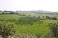
 Trallong From Abercamlais - geograph.org.uk - 486769.jpg 640 × 480; 104 KB
-
 Trallong girder bridge.jpg 3,660 × 4,170; 2.9 MB
-
 Treeline alongside Nant Bran - geograph.org.uk - 3071983.jpg 3,648 × 2,736; 3.97 MB
-
 Triangulation Pillar (S5532) - geograph.org.uk - 3802213.jpg 640 × 480; 100 KB
-
 Trig Point - geograph.org.uk - 5065625.jpg 2,448 × 3,264; 1.93 MB
-
 Trig point at Twyn y Gaer - geograph.org.uk - 4251006.jpg 3,872 × 2,592; 2.6 MB
-
 Twyn y gaer - geograph.org.uk - 812878.jpg 640 × 427; 193 KB
-
 Ty wrth-y- ffynnon - geograph.org.uk - 812898.jpg 640 × 427; 240 KB
-
 Unclassified road at Soar - geograph.org.uk - 1446960.jpg 640 × 480; 124 KB
-
 Upland stream - geograph.org.uk - 1452036.jpg 640 × 480; 131 KB
-
 Usk valley at Penpont - geograph.org.uk - 4532761.jpg 4,000 × 1,810; 1.01 MB
-
 Valleyside path and old tree trunk - geograph.org.uk - 2877108.jpg 640 × 480; 138 KB
-
 View to Blaencamlais motte - geograph.org.uk - 2873952.jpg 640 × 480; 77 KB
-
 View towards Blaencamlais motte - geograph.org.uk - 2875655.jpg 640 × 480; 91 KB
-
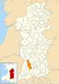 Wales Powys Community Trallong map.svg 512 × 723; 1.15 MB
-
 Wall above Blaenegnant-uchaf - geograph.org.uk - 1179855.jpg 640 × 426; 180 KB
-
 Waymarked route in Tir Gofal access land - geograph.org.uk - 2514363.jpg 3,648 × 2,736; 3.87 MB
-
 Wind blown rowan on Allt Lom - geograph.org.uk - 760574.jpg 640 × 480; 97 KB
-
 Woodland near Rhome - geograph.org.uk - 1013482.jpg 640 × 480; 216 KB
-
 Zig-zag hedges and dairy pasture - geograph.org.uk - 520372.jpg 640 × 361; 75 KB


_-_geograph.org.uk_-_4004755.jpg)


.jpg)


_-_geograph.org.uk_-_3802213.jpg)


