Category:Traditional Chinese maps of Japan
Jump to navigation
Jump to search
Media in category "Traditional Chinese maps of Japan"
The following 12 files are in this category, out of 12 total.
-
Chugoku Region Administration Map TC.png 600 × 600; 43 KB
-
Eight regions of Japan (zh-hant).svg 1,397 × 1,593; 473 KB
-
JAB (zh-hant).png 1,341 × 870; 484 KB
-
Japan map hiroshima nagasaki-hant.png 508 × 600; 58 KB
-
JapanGE20014 (zh-hant).svg 659 × 1,232; 93 KB
-
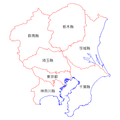
Kanto Region Administration Map TC.png 600 × 600; 42 KB
-
Kinki Region Administration Map TC.png 600 × 600; 45 KB
-
Map of Honshu-Shikoku Bridge Project (zh-hant).svg 1,170 × 966; 302 KB
-
Ordinance designed Cities (zh-hant).svg 595 × 842; 1.59 MB
-
Regions and Prefectures of Japan (zh-hant).svg 2,480 × 3,175; 258 KB
-
Shikoku Region Administration Map TC.png 600 × 600; 43 KB
-
Tohoku Region Administration Map TC.png 600 × 600; 34 KB


