Category:Town line signs in Massachusetts
Jump to navigation
Jump to search
Media in category "Town line signs in Massachusetts"
The following 158 files are in this category, out of 158 total.
-
Alford-State Line.JPG 1,600 × 1,200; 346 KB
-
Ashuwillticook Rail Trail entering Adams, Adams MA.jpg 4,032 × 3,024; 6.98 MB
-
Ashuwillticook Rail Trail entering Cheshire, Cheshire MA.jpg 4,032 × 3,024; 7.28 MB
-
Ashuwillticook Rail Trail, Lanesborough and Cheshire MA.jpg 2,592 × 1,728; 1.21 MB
-
Attleboro town line sign (Massachusetts).jpg 2,250 × 3,000; 2.42 MB
-
Beach Road entering Oak Bluffs MA.jpg 3,264 × 2,176; 894 KB
-
Blackstone River Bikeway entering Worcester MA.jpg 4,032 × 3,024; 6.34 MB
-
Blackstone River Greenway entering Millville, Millville MA.jpg 4,032 × 3,024; 6.11 MB
-
Blackstone River Greenway entering Uxbridge, Uxbridge MA.jpg 4,032 × 3,024; 7.1 MB
-
Border to Boston Trail entering Wenham MA.jpg 4,032 × 3,024; 6.71 MB
-
Brewster Massachusetts town sign.jpg 3,000 × 2,000; 1.92 MB
-
Brodie Mountain Road entering Hancock MA.jpg 2,592 × 1,728; 1,015 KB
-
Clarksburg Road Sign.jpg 800 × 600; 79 KB
-
Concord town line sign (Massachusetts).jpg 3,000 × 3,000; 2.1 MB
-
CT Route 83 northbound entering Springfield MA.jpg 1,732 × 2,592; 1 MB
-
CT8nMA8nRoad-SandisfieldMassachusettsStateLine (33021017816).jpg 2,400 × 1,600; 2.07 MB
-
D, Rabbit Run Rail Bed, Petersham MA.jpg 4,032 × 3,024; 6.02 MB
-
Dalton Road Sign.JPG 800 × 800; 126 KB
-
Dennis Sign.JPG 2,280 × 2,280; 368 KB
-
Dennis town sign (Massachusetts).jpg 2,000 × 3,000; 1.64 MB
-
Dighton Massachusetts town line sign.jpg 3,000 × 3,000; 2.14 MB
-
East Brookfield welcome sign in front of Podunk Cemetery.jpg 5,152 × 2,898; 3.6 MB
-
Eastbound MA Route 57 entering Sandisfield MA.jpg 2,592 × 1,728; 1.15 MB
-
Eastham Massachusetts town sign.jpg 3,000 × 3,000; 2.09 MB
-
Entering Avon, MA.jpg 2,046 × 1,365; 496 KB
-
Entering Burlington, MA.jpg 2,178 × 3,264; 1.77 MB
-
Entering Dunstable, MA.jpg 1,296 × 1,944; 660 KB
-
Entering Groton eastbound on MA Route 225, MA.jpg 2,572 × 1,716; 1.18 MB
-
Entering Groveland Eastbound on MA Route 113, MA.jpg 2,046 × 1,365; 635 KB
-
Entering Holden eastbound on MA Route 122A, MA.jpg 2,592 × 1,728; 988 KB
-
Entering Hopkinton MA.jpg 2,046 × 1,365; 612 KB
-
Entering Millis, MA.jpg 2,046 × 1,365; 674 KB
-
Entering Milton northbound on MA Route 138, MA.jpg 2,816 × 2,112; 2.06 MB
-
Entering Prescott MA.jpg 3,072 × 2,304; 2.29 MB
-
Entering Randolph eastbound on MA Route 139, MA.jpg 2,816 × 2,112; 1.78 MB
-
Entering Swansea sign.jpg 3,000 × 3,000; 3.15 MB
-
Entering Tyringham southbound on Main Road, Tyringham MA.jpg 3,264 × 2,176; 1.86 MB
-
Entering Wellesley westbound on MA Route 16, MA.jpg 3,260 × 2,170; 1.73 MB
-
Fall River town line sign, Massachusetts.jpg 3,000 × 2,685; 3.33 MB
-
Freetown town sign (Massachusetts).jpg 3,000 × 3,000; 3.26 MB
-
George Washington Boulevard entering Hull MA.jpg 2,046 × 1,365; 645 KB
-
Harwich Massachusetts town sign.jpg 3,000 × 2,000; 2.43 MB
-
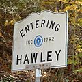
Hawley Road Sign.jpg 1,100 × 1,100; 223 KB
-
Lagoon Pond Drawbridge entering Tisbury MA.jpg 2,178 × 3,264; 1.02 MB
-
Lexington Road entering Concord MA.jpg 2,592 × 1,944; 2.35 MB
-
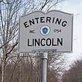
Lincoln town line sign (Massachusetts).jpg 3,000 × 3,000; 2.81 MB
-
Location sign - DPLA - 850ce4b998532065be7b630d96a42a20.jpg 800 × 538; 72 KB
-
Loudville Rd, Loudville MA.jpg 1,705 × 2,560; 1.24 MB
-
MA Route 10 northbound entering Southampton MA.jpg 2,048 × 1,536; 931 KB
-
MA Route 101 southbound entering Gardner MA.jpg 2,592 × 1,728; 725 KB
-
MA Route 102 westbound entering Stockbridge MA.jpg 3,264 × 2,176; 2.05 MB
-
MA Route 105 southbound entering Marion MA.jpg 2,272 × 1,704; 1.68 MB
-
MA Route 106 westbound entering Mansfield, MA.jpg 2,592 × 1,728; 864 KB
-
MA Route 109 eastbound entering Medway MA.jpg 3,264 × 2,176; 1.6 MB
-
MA Route 112 northbound entering Colrain, MA.jpg 2,592 × 1,944; 2.04 MB
-
MA Route 116 crossing the Sunderland Bridge, Deerfield MA.jpg 3,264 × 2,176; 1.67 MB
-
MA Route 116 entering Cheshire MA.jpg 2,592 × 1,728; 1.02 MB
-
MA Route 116 entering Conway MA.jpg 3,264 × 2,176; 1.35 MB
-
MA Route 116 westbound entering Savoy MA.jpg 2,592 × 1,728; 1.1 MB
-
MA Route 117 eastbound entering Bolton MA.jpg 3,264 × 2,176; 2.12 MB
-
MA Route 122 northbound entering Grafton MA.jpg 2,046 × 1,365; 544 KB
-
MA Route 122 southbound entering Blackstone MA.jpg 2,031 × 1,353; 502 KB
-
MA Route 122 southbound entering Oakham MA.jpg 3,264 × 2,448; 2.19 MB
-
MA Route 127 southbound entering Manchester MA.jpg 2,048 × 1,536; 1.34 MB
-
MA Route 127A entering Rockport MA.jpg 2,272 × 1,704; 1.73 MB
-
MA Route 13 northbound entering Townsend MA.jpg 4,032 × 3,024; 5.56 MB
-
MA Route 130 northbound entering Mashpee MA.jpg 2,592 × 1,944; 1.28 MB
-
MA Route 133 eastbound entering Essex MA.jpg 2,592 × 1,728; 565 KB
-
MA Route 135 eastbound entering Westborough, MA.jpg 1,364 × 2,048; 704 KB
-
MA Route 139 entering Hanover MA.jpg 1,364 × 2,048; 862 KB
-
MA Route 139 entering Holbrook MA.jpg 2,592 × 1,728; 645 KB
-
MA Route 14 eastbound entering Pembroke MA.jpg 2,592 × 1,728; 1,008 KB
-
MA Route 140 southbound entering Upton MA.jpg 2,046 × 1,365; 895 KB
-
MA Route 142 northbound entering Gill MA.jpg 3,072 × 2,304; 1.51 MB
-
MA Route 146A entering Uxbridge MA.jpg 5,472 × 3,648; 5.35 MB
-
MA Route 151 westbound entering Falmouth MA.jpg 1,728 × 2,592; 994 KB
-
MA Route 16 eastbound entering Sherborn, MA.jpg 2,046 × 1,365; 920 KB
-
MA Route 16 westbound entering Hopedale MA.jpg 3,216 × 2,148; 1.46 MB
-
MA Route 177 entering Fall River MA.jpg 5,472 × 3,648; 5.71 MB
-
MA Route 18 southbound entering Bridgewater, MA.jpg 3,260 × 2,175; 1.73 MB
-
MA Route 181 southbound entering Palmer, Bondsville MA.jpg 2,592 × 1,728; 1.01 MB
-
MA Route 183 Eastbound entering Lenox MA.jpg 2,592 × 1,728; 1.06 MB
-
MA Route 187 North entering Westfield MA.jpg 4,032 × 3,024; 6.59 MB
-
MA Route 1A southbound entering Walpole, MA.jpg 2,178 × 3,264; 1.38 MB
-
MA Route 21 northbound entering Ludlow, MA.jpg 2,592 × 1,728; 959 KB
-
MA Route 228 northbound entering Hingham MA.jpg 2,592 × 1,728; 633 KB
-
MA Route 23 westbound entering Otis MA.jpg 2,592 × 1,728; 1.13 MB
-
MA Route 27 southbound entering Medfield MA.jpg 2,592 × 1,728; 969 KB
-
MA Route 31 northbound entering Spencer, MA.jpg 2,592 × 1,728; 1.02 MB
-
MA Route 31 westbound entering Paxton, MA.jpg 2,592 × 1,728; 1.21 MB
-
MA Route 36 southbound entering Halifax MA.jpg 2,592 × 1,728; 948 KB
-
MA Route 38 northbound entering Dracut, MA.jpg 3,264 × 2,176; 1.32 MB
-
MA Route 4 northbound entering Billerica MA.jpg 1,725 × 2,590; 1.25 MB
-
MA Route 41 southbound entering Richmond MA.jpg 2,592 × 1,728; 570 KB
-
MA Route 56 northbound entering Rutland MA.jpg 2,592 × 1,728; 1.23 MB
-
MA Route 58 northbound entering Hanson MA.jpg 2,592 × 1,728; 677 KB
-
MA Route 62 westbound entering Hubbardston MA.jpg 2,592 × 1,728; 1.29 MB
-
MA Route 67 northbound entering New Braintree MA.jpg 2,046 × 1,365; 651 KB
-
MA Route 67 northbound entering North Brookfield, MA.jpg 2,046 × 1,365; 800 KB
-
MA Route 68 southbound entering Gardner MA.jpg 3,158 × 2,301; 1.57 MB
-
MA Route 6A eastbound entering Yarmouth MA.jpg 3,264 × 2,176; 1.37 MB
-
MA Route 6A entering Bourne, Sagamore MA.jpg 2,592 × 1,728; 748 KB
-
MA Route 6A westbound entering Sandwich MA.jpg 3,264 × 2,176; 1.25 MB
-
MA Route 70 southbound entering Boylston, MA.jpg 2,046 × 1,365; 636 KB
-
MA Route 8A northbound entering Heath MA.jpg 1,730 × 2,590; 1.54 MB
-
MA Route 8A northbound entering Savoy MA.jpg 2,592 × 1,728; 700 KB
-
MA Route 9 eastbound entering Goshen MA.jpg 2,592 × 1,728; 900 KB
-
MA Route 9 eastbound entering Windsor MA.jpg 1,732 × 2,592; 923 KB
-
MA Route 9 entering Leicester, MA.jpg 3,260 × 2,175; 1.33 MB
-
MA Route 9 westbound entering Brookfield MA.jpg 2,592 × 1,728; 823 KB
-
MA Route 98 entering Uxbridge MA.jpg 5,472 × 3,648; 6.49 MB
-
MA57eRoad-EnteringTollandSign (32936039361).jpg 2,400 × 1,600; 2.25 MB
-
Main Road entering Montgomery MA.jpg 2,592 × 1,728; 1.24 MB
-
N S, Rabbit Run Rail Bed, New Salem MA.jpg 4,032 × 3,024; 6.06 MB
-
New England Interstate Route 8 entering Washington MA.jpg 2,592 × 1,728; 1.03 MB
-
New England Route 32 northbound entering Athol MA.jpg 2,592 × 1,728; 819 KB
-
New Marlborough - 57 S.JPG 800 × 1,000; 94 KB
-
North Central Pathway entering Winchendon MA.jpg 4,032 × 3,024; 7.5 MB
-
North end of MA Route 35 entering Danvers, MA.jpg 2,178 × 3,264; 2.49 MB
-
Northbound MA Route 3A entering Tyngsborough MA.jpg 2,046 × 1,365; 649 KB
-
Peru - 143 E.JPG 1,000 × 1,000; 188 KB
-
Provincetown Massachusetts town sign.jpg 2,000 × 3,000; 1.1 MB
-
Raynham Town Line.jpg 2,002 × 3,000; 2.53 MB
-
Raynham, Massachusetts town line Welcome sign.jpg 3,000 × 2,002; 2.52 MB
-
Reading line.jpg 2,828 × 3,334; 1.66 MB
-
Rehoboth town line sign (Massachusetts).jpg 2,250 × 3,000; 1.82 MB
-
Route 6A entering Provincetown MA.jpg 3,260 × 2,175; 1.48 MB
-
Route 71 westbound entering Egremont MA.jpg 2,592 × 1,944; 1.2 MB
-
Rowe - Heath Town Line, Rowe MA.jpg 1,725 × 2,590; 1.65 MB
-
Sandwich (Massachusetts) Town Sign.jpg 2,250 × 3,000; 2.09 MB
-
Scituate ma entering sign.jpg 2,816 × 2,112; 1.36 MB
-
Southern New England Trunkline Trail entering Bellingham, Bellingham MA.jpg 4,032 × 3,024; 5.8 MB
-
Southern New England Trunkline Trail entering Franklin, Franklin MA.jpg 4,032 × 3,024; 5.69 MB
-
State Road entering Chilmark MA.jpg 2,272 × 1,704; 1.19 MB
-
Swansea-Rehoboth town line.jpg 3,000 × 2,250; 3.92 MB
-
Taunton Town Line sign.jpg 2,002 × 3,000; 2.58 MB
-
Town line.JPG 1,250 × 2,067; 934 KB
-
Truro Massachusetts town sign.jpg 3,000 × 3,000; 1.87 MB
-
US Route 20 eastbound entering Russell MA.jpg 2,592 × 1,728; 1,005 KB
-
US Route 20 southbound entering Lee MA.jpg 3,264 × 2,176; 1.46 MB
-
US Route 20 westbound entering Becket MA.jpg 2,592 × 1,728; 1.03 MB
-
US Route 20 westbound entering Sturbridge MA.jpg 2,592 × 1,728; 1.04 MB
-
US Route 6 eastbound entering Truro MA.jpg 3,260 × 2,175; 1.31 MB
-
US Route 6 southbound entering Eastham MA.jpg 2,592 × 1,728; 1.1 MB
-
US Route 6 westbound entering New Bedford, MA.jpg 2,568 × 1,712; 576 KB
-
US Route 7 southbound entering New Ashford MA.jpg 3,264 × 2,176; 1.71 MB
-
VT 142 at the state line.jpg 2,048 × 1,536; 826 KB
-
Walpole Norfolk Town Line on Clark St, MA.jpg 2,046 × 1,365; 596 KB
-
Warwick-State Line.JPG 1,600 × 1,200; 435 KB
-
Welcome to East Brookfield sign.jpg 3,690 × 3,690; 2.25 MB
-
Welcome to Somerset, Massachusetts (cropped).jpg 2,800 × 400; 636 KB
-
Welcome to Somerset, Massachusetts.jpg 3,000 × 2,002; 2.58 MB
-
Wellfleet Massachusetts town sign.jpg 3,000 × 3,000; 2.36 MB
-
West Tisbury Chilmark Town Line, MA.jpg 3,216 × 2,144; 1.78 MB
-
Westbound on State Road entering Aquinnah MA.jpg 3,264 × 2,176; 1.22 MB
-
Whately Road Sign.JPG 1,600 × 1,200; 653 KB
-
Windsor Welcome Sign.jpg 1,200 × 800; 239 KB
-
Yarmouth town sign (Massachusetts).jpg 2,000 × 3,000; 2.19 MB


