Category:Totsukawa, Nara
Jump to navigation
Jump to search
village in Yoshino district, Nara prefecture, Japan | |||||
| Upload media | |||||
| Instance of | |||||
|---|---|---|---|---|---|
| Location | Yoshino district, Nara Prefecture, Japan | ||||
| Located in or next to body of water |
| ||||
| Legal form |
| ||||
| Inception |
| ||||
| Significant event |
| ||||
| Population |
| ||||
| Area |
| ||||
| Replaces |
| ||||
| official website | |||||
 | |||||

日本語: 奈良県十津川村に関するカテゴリ
Subcategories
This category has the following 7 subcategories, out of 7 total.
+
Media in category "Totsukawa, Nara"
The following 18 files are in this category, out of 18 total.
-
Hatenashi houses banner.jpg 5,040 × 720; 619 KB
-
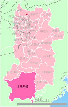
Nara-totsukawa-village.svg 347 × 548; 20 KB
-
Population distribution of Totsukawa, Nara, Japan.svg 512 × 256; 22 KB
-
R168 in Totsukawa01.jpg 1,024 × 768; 287 KB
-
Totsugawa keibu lib.jpg 800 × 533; 155 KB
-
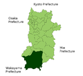
Totsukawa in Nara Prefecture.png 981 × 901; 34 KB
-
Totsukawa montage.JPG 388 × 468; 117 KB
-
Totsukawa Montage.jpg 1,024 × 1,350; 774 KB
-
Totsukawa-jinkou.gif 576 × 305; 21 KB
-
Totsukawa-vill.png 166 × 187; 2 KB
-
Totugawa warabiwo.jpg 533 × 800; 110 KB
-
ミツバツツジ咲く登山道(伯母子岳).jpg 5,472 × 3,648; 7.38 MB
-
伯母子岳から南西の眺め.jpg 8,192 × 1,856; 3.45 MB
-
伯母子岳山頂にて.jpg 5,472 × 3,648; 6.33 MB
-
口千丈山山頂.jpg 5,472 × 3,648; 9.4 MB
-
星の軌跡十津川・上湯にてImg042.jpg 1,280 × 832; 339 KB
-
杉の大木 - panoramio.jpg 2,016 × 3,024; 1.44 MB
-
林道奥千丈線の登山口.jpg 5,472 × 3,648; 9.06 MB


