Category:Toseland
Jump to navigation
Jump to search
village in Cambridgeshire, England, United Kingdom  | |||||
| Upload media | |||||
| Instance of | |||||
|---|---|---|---|---|---|
| Location | Huntingdonshire, Cambridgeshire, East of England, England | ||||
| Population |
| ||||
 | |||||
Subcategories
This category has the following 2 subcategories, out of 2 total.
H
- Toseland Hall (5 F)
M
Media in category "Toseland"
The following 75 files are in this category, out of 75 total.
-
 Adams Lane footpath to London Lane ^ B1043 High Street - geograph.org.uk - 3786748.jpg 2,304 × 3,072; 937 KB
-
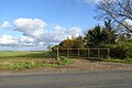
 Barn near Lodge Farm - geograph.org.uk - 4511357.jpg 640 × 480; 75 KB
-

-
 Bridleway to Toseland Wood - geograph.org.uk - 3786877.jpg 3,072 × 2,304; 1.52 MB
-
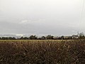
 Cornfields off Toseland Road - geograph.org.uk - 3787065.jpg 3,072 × 2,304; 1,021 KB
-
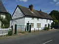
 Cottage and barn, Toseland - geograph.org.uk - 2667267.jpg 1,600 × 1,200; 781 KB
-
 Cottage, Toseland - geograph.org.uk - 2667274.jpg 1,600 × 1,200; 769 KB
-
 Cottages in Toseland High Street - geograph.org.uk - 3876139.jpg 640 × 480; 83 KB
-
 Cottages, Toseland - geograph.org.uk - 4511354.jpg 640 × 480; 78 KB
-
 Crop field near Toseland - geograph.org.uk - 4529973.jpg 640 × 480; 83 KB
-
 Earthworks by Toseland Wood - geograph.org.uk - 2667228.jpg 1,600 × 1,200; 1,005 KB
-
 Electricity pylons ^ electricity wires - geograph.org.uk - 3786657.jpg 3,072 × 2,012; 711 KB
-
 Entering Toseland - geograph.org.uk - 4530654.jpg 640 × 480; 75 KB
-
 Entering Toseland on High Street - geograph.org.uk - 3786665.jpg 3,072 × 2,216; 914 KB
-
 Entering Toseland on Toseland Road - geograph.org.uk - 3787478.jpg 3,072 × 2,304; 855 KB
-

-
 Farm track, Yelling - geograph.org.uk - 4511349.jpg 640 × 480; 83 KB
-
 Farmland south of Graveley - geograph.org.uk - 2832450.jpg 2,592 × 1,944; 1.85 MB
-
 Field edge and footpath - geograph.org.uk - 3088821.jpg 1,600 × 1,200; 833 KB
-
 Footpath away from Toseland - geograph.org.uk - 2667169.jpg 1,600 × 1,200; 986 KB
-
 Footpath from Toseland - geograph.org.uk - 3088758.jpg 1,600 × 1,200; 1,016 KB
-
 Footpath from Toseland - geograph.org.uk - 3088764.jpg 1,600 × 1,200; 929 KB
-
 Footpath off Toseland Road - geograph.org.uk - 3787483.jpg 3,072 × 2,304; 918 KB
-
 Footpath past Toseland Hall - geograph.org.uk - 2667250.jpg 1,600 × 1,200; 800 KB
-
 Footpath past wheat field - geograph.org.uk - 3088775.jpg 1,600 × 1,200; 1,008 KB
-
 Footpath to Great Paxton - geograph.org.uk - 2667245.jpg 1,600 × 1,200; 765 KB
-
 Footpath to St Neots - geograph.org.uk - 4530671.jpg 640 × 480; 109 KB
-
 Footpath to Toseland - geograph.org.uk - 3094337.jpg 1,600 × 1,200; 679 KB
-
 Footpath to Toseland Wood - geograph.org.uk - 2667195.jpg 1,600 × 1,200; 953 KB
-
 Footpath towards Toseland Wood - geograph.org.uk - 2667239.jpg 1,600 × 1,200; 837 KB
-
 Former Methodist chapel, Toseland - geograph.org.uk - 4530656.jpg 640 × 480; 92 KB
-
-
 Geest Auto Truck - geograph.org.uk - 967068.jpg 480 × 640; 110 KB
-
 Green Farm ^ Wind Turbines - geograph.org.uk - 3786753.jpg 3,072 × 2,304; 1.04 MB
-
 Green Farm, Toseland - geograph.org.uk - 2667262.jpg 1,600 × 1,200; 648 KB
-
 High Street Toseland - geograph.org.uk - 1656620.jpg 640 × 480; 93 KB
-
 High Street ^ Toseland Postbox - geograph.org.uk - 3786726.jpg 3,072 × 2,304; 1.58 MB
-
 High Street ^ Toseland Postbox - geograph.org.uk - 3786729.jpg 3,072 × 2,304; 1.49 MB
-
 High Street, Toseland - geograph.org.uk - 3786721.jpg 3,072 × 2,304; 934 KB
-
 High Street, Toseland - geograph.org.uk - 3786762.jpg 3,072 × 2,304; 1.03 MB
-
 High Street, Toseland - geograph.org.uk - 3786765.jpg 3,072 × 2,304; 1.09 MB
-
 High Street, Toseland - geograph.org.uk - 3787486.jpg 3,072 × 2,242; 680 KB
-
 High Street, Toseland - geograph.org.uk - 4530659.jpg 640 × 480; 79 KB
-

-
 Large Block Of Rock - geograph.org.uk - 967079.jpg 640 × 480; 106 KB
-
 Large wheat field - geograph.org.uk - 3088808.jpg 1,600 × 1,200; 1.08 MB
-
 Large wheat field - geograph.org.uk - 3088814.jpg 1,600 × 1,200; 948 KB
-
 Leaving Toseland - geograph.org.uk - 4530661.jpg 640 × 480; 75 KB
-
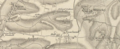 Map of Toseland in 1835.PNG 764 × 314; 478 KB
-
 Minor road towards Croxton - geograph.org.uk - 4530652.jpg 640 × 480; 89 KB
-
 Minor road towards Great Paxton - geograph.org.uk - 4530662.jpg 640 × 480; 66 KB
-
 Old farm building north of Toseland - geograph.org.uk - 2667183.jpg 1,600 × 1,200; 1.16 MB
-
 Roadsigns on High Street - geograph.org.uk - 3786668.jpg 2,304 × 3,072; 994 KB
-
 The former Methodist Chapel, Toseland - geograph.org.uk - 3787485.jpg 2,304 × 3,072; 1.05 MB
-

-
 Toseland - geograph.org.uk - 3481669.jpg 4,320 × 3,240; 3.41 MB
-
 Toseland 20th Century Map.PNG 907 × 563; 945 KB
-
 Toseland High Street - geograph.org.uk - 3876150.jpg 640 × 480; 114 KB
-
 Toseland Postbox - geograph.org.uk - 3786734.jpg 2,304 × 3,072; 2.19 MB
-
 Toseland Postbox - geograph.org.uk - 3786736.jpg 2,304 × 3,072; 2.21 MB
-
 Toseland Postbox - geograph.org.uk - 3786737.jpg 2,304 × 3,072; 2.48 MB
-
 Toseland Road crossroads - geograph.org.uk - 3786664.jpg 2,965 × 2,227; 686 KB
-
 Toseland St. Michael's church - geograph.org.uk - 3876144.jpg 640 × 480; 65 KB
-
 Toseland Village name sign on High Street - geograph.org.uk - 3786670.jpg 2,304 × 3,072; 1.67 MB
-
 Toseland Wood - geograph.org.uk - 2667212.jpg 1,600 × 1,200; 724 KB
-
 Towards Cotton Farm Wind Farm - geograph.org.uk - 3914210.jpg 1,200 × 870; 1.36 MB
-
 Track across farm land, near to Yelling - geograph.org.uk - 3480311.jpg 4,320 × 3,240; 3.44 MB
-
 Track by a stream - geograph.org.uk - 3088769.jpg 1,600 × 1,200; 843 KB
-
 Track to Green Farm - geograph.org.uk - 4530657.jpg 640 × 480; 73 KB
-
 View towards Cotton Farm wind farm - geograph.org.uk - 5592450.jpg 640 × 480; 115 KB
-
 Water tower near Yelling - geograph.org.uk - 3480307.jpg 4,320 × 3,240; 3.42 MB
-
 Wheat field - geograph.org.uk - 3088826.jpg 1,600 × 1,200; 696 KB
-
 Wheat field near Toseland - geograph.org.uk - 3088761.jpg 1,600 × 1,200; 975 KB
-
 Wind Turbines - geograph.org.uk - 3785995.jpg 2,930 × 2,201; 1.1 MB
-
 Wind Turbines near Green Farm - geograph.org.uk - 3786755.jpg 3,072 × 2,304; 1.17 MB


