Category:Toponymic maps
Jump to navigation
Jump to search
Subcategories
This category has the following 2 subcategories, out of 2 total.
W
- Toponymic maps of the world (10 F)
Media in category "Toponymic maps"
The following 10 files are in this category, out of 10 total.
-
"-stan" regions (orthographic projection).svg 553 × 553; 305 KB
-
SEA Country Names in Thai Sign Language Written in Sutton SignWriting.png 1,890 × 1,890; 636 KB
-
Bienhornschanze, Werk Glockenberg und Fort Rheinhell in heutiger Lage.jpg 2,825 × 4,006; 4.06 MB
-
Map Origin of Transylvanian Watercourse Names.jpg 2,024 × 2,343; 452 KB
-
People's Republics.png 785 × 785; 35 KB
-
PSM V51 D318 Place names of brittany and normandy.png 1,630 × 1,109; 417 KB
-
PSM V52 D169 Origin of place names of the british isles.png 1,960 × 3,073; 395 KB
-
Solar System in Thai Sign Language.png 2,459 × 1,739; 293 KB
-
Stansuffixmap.png 862 × 800; 236 KB
-
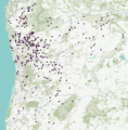
Topónimos germânicos em Portugal.png 2,080 × 2,108; 1.36 MB


