Category:Topographic maps of volcanoes in the Philippines
Jump to navigation
Jump to search
Media in category "Topographic maps of volcanoes in the Philippines"
The following 7 files are in this category, out of 7 total.
-
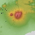
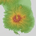
Mount Arayat Relief Map, SRTM-1.jpg 800 × 600; 267 KB
-
Mount Banahaw Relief Map, SRTM-1.jpg 1,000 × 1,000; 723 KB
-
Mount Mariveles Relief Map, SRTM-1.jpg 800 × 800; 377 KB
-
Mount Natib Relief Map, SRTM-1.jpg 800 × 600; 355 KB
-
Mount Pinatubo Relief Map, SRTM-1.jpg 1,200 × 900; 1.03 MB
-
Taal Caldera Relief Map, SRTM-1.jpg 800 × 800; 429 KB


