Category:Topographic maps of the world
Jump to navigation
Jump to search
Subcategories
This category has the following 3 subcategories, out of 3 total.
Media in category "Topographic maps of the world"
The following 171 files are in this category, out of 171 total.
-
158 of 'Eclectic Physical Geography' (11202459383).jpg 1,079 × 2,066; 404 KB
-
159 of 'Eclectic Physical Geography' (11202050315).jpg 1,230 × 2,066; 617 KB
-
20130122214736!Bluemarble banner (cropped).jpg 2,692 × 1,187; 1.09 MB
-
800px-World Nasa.JPG 629 × 400; 46 KB
-
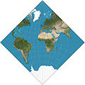
Adams hemisphere in a square.JPG 2,068 × 2,068; 711 KB
-
Albers projection SW.jpg 2,058 × 1,208; 687 KB
-
Alt USGS-Map.jpg 677 × 507; 178 KB
-
Altimetría y batimetría en el mundo.jpg 1,388 × 1,016; 321 KB
-
Approximate Earth Heigh Map.png 2,000 × 2,000; 2.55 MB
-
Argo Float Network.png 1,100 × 636; 168 KB
-
Armadillo projection SW.JPG 2,068 × 1,184; 754 KB
-
Arno Peters-Projektion.JPG 632 × 399; 57 KB
-
Atlas Wereld met namen.png 1,502 × 752; 1.73 MB
-
AYool topography 15min-gl.png 1,617 × 1,133; 976 KB
-
AYool topography 15min.jpg 800 × 561; 76 KB
-
Azimuthal Equidistant Berlin.jpg 1,024 × 1,024; 296 KB
-
Azimuthal Equidistant Canberra.jpg 4,096 × 4,096; 3.23 MB
-
Azimuthal Equidistant N0E0.jpg 4,096 × 4,096; 3.23 MB
-
Azimuthal Equidistant N90.jpg 4,096 × 4,096; 2.9 MB
-
Azimuthal Equidistant S90.jpg 4,096 × 4,096; 3.16 MB
-
Bedrock map Earth2014.jpg 1,477 × 945; 309 KB
-
Behrmann projection SW.jpg 2,058 × 880; 538 KB
-
Blue Marble Next Generation + topography + bathymetry.jpg 3,600 × 1,800; 1.93 MB
-
Blue marble, with the Americas on the right.png 1,506 × 726; 2.17 MB
-
Boggs eumorphic projection SW.JPG 2,070 × 1,042; 583 KB
-
Bonne projection SW.jpg 2,058 × 1,955; 1.02 MB
-
Bottomley projection SW.JPG 2,058 × 1,200; 945 KB
-
Cahill butterfly conformal projection SW.jpg 2,058 × 1,194; 544 KB
-
Cartetourmondestop.jpg 962 × 530; 58 KB
-
Cassini projection squashed SW.JPG 1,040 × 2,068; 749 KB
-
CIA Hand Rendered Terrain Map (30253172314).jpg 2,952 × 1,711; 1.1 MB
-
Collignon projection SW.jpg 2,060 × 530; 295 KB
-
Combined map hillshade + color.png 2,048 × 2,048; 3.78 MB
-
Continents geographycal hires.jpg 4,000 × 4,000; 956 KB
-
Cylindrical equal-area projection SW.jpg 2,058 × 1,122; 636 KB
-
Daylight Map, nonscientific (0900 UTC).jpg 1,000 × 500; 262 KB
-
Dist2con.png 3,600 × 1,800; 398 KB
-
Earth dry elevation 10x.stl 5,120 × 2,880; 22.2 MB
-
Earth dry elevation.png 2,160 × 1,080; 827 KB
-
Earth Impact Database world map.svg 512 × 256; 351 KB
-
Earth map with 180th meridian.jpg 1,024 × 512; 102 KB
-
Earth2014shape SouthAmerica small-fr.jpg 1,500 × 1,362; 413 KB
-
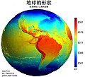
Earth2014shape SouthAmerica small-zh.jpg 1,500 × 1,362; 212 KB
-
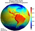
Earth2014shape SouthAmerica small.jpg 1,500 × 1,362; 403 KB
-
Earthmap1000x500.jpg 1,000 × 500; 336 KB
-
Earthmap720x360 grid.jpg 720 × 360; 84 KB
-
Ecker IV projection SW.jpg 2,058 × 1,036; 630 KB
-
Ecker VI projection SW.jpg 2,058 × 1,036; 615 KB
-
Eckert II projection SW.JPG 2,058 × 1,036; 789 KB
-
Elementary physical geography; (1908) (14597790820).jpg 1,556 × 2,498; 472 KB
-
Elementary physical geography; (1908) (14597838099).jpg 1,514 × 1,914; 513 KB
-
Equal Earth projection SW.jpg 2,060 × 1,008; 611 KB
-
Equatorial mount.svg 512 × 410; 110 KB
-
Equirectangular-projection-topographic-world.jpg 4,424 × 2,214; 1.66 MB
-
Equirectangular-projection.jpg 2,048 × 1,025; 937 KB
-
ETOPO minus Earth2014.jpg 1,300 × 776; 328 KB
-
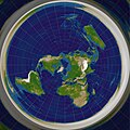
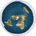
Flat earth.jpg 498 × 498; 31 KB
-
Flat earth.png 543 × 543; 396 KB
-
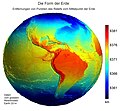
Form der Erde.jpg 1,518 × 1,410; 481 KB
-
Gall isographic projection SW.jpg 2,068 × 1,466; 1.77 MB
-
Gall–Peters projection SW.jpg 2,058 × 1,314; 723 KB
-
Global SRTM Bathymetry map.png 6,600 × 3,000; 4.63 MB
-
Hammer projection SW.jpg 2,058 × 1,036; 622 KB
-
Hillshade tutorial map merc bg.png 2,048 × 2,048; 3.67 MB
-
Hillshade tutorial map merc bump.png 2,048 × 2,048; 2.45 MB
-
Hobo–Dyer projection SW.jpg 2,058 × 1,048; 603 KB
-
Hoelzelbluemarble.png 2,058 × 1,034; 1.56 MB
-
Hufnagel 10 projection SW.JPG 2,070 × 1,042; 604 KB
-
Hufnagel 11 projection SW.JPG 2,070 × 1,042; 598 KB
-
Hufnagel 12 projection SW.JPG 2,070 × 856; 526 KB
-
Hufnagel 2 projection SW.JPG 2,068 × 1,040; 592 KB
-
Hufnagel 3 projection SW.JPG 2,070 × 1,042; 587 KB
-
Hufnagel 4 projection SW.JPG 2,070 × 1,042; 590 KB
-
Hufnagel 7 projection SW.JPG 2,070 × 1,042; 597 KB
-
Hufnagel 9 projection SW.JPG 2,070 × 1,042; 603 KB
-
Kavrayskiy-vii-projection.jpg 2,048 × 1,182; 940 KB
-
La Réunion on world map.jpg 160 × 90; 5 KB
-
LA2-Blitz-0103.jpg 2,832 × 1,832; 1.39 MB
-
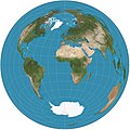
Lambert 1.jpg 1,024 × 1,024; 247 KB
-
Lambert 2.jpg 1,024 × 1,024; 262 KB
-
Lambert Azimutal 3.jpg 1,024 × 1,024; 265 KB
-
Lambert azimuthal equal-area projection SW.jpg 2,058 × 2,058; 1.14 MB
-
Lambert cylindrical equal-area projection SW.jpg 2,058 × 664; 429 KB
-
Lambert-azimuthal-equal-area.jpg 2,048 × 2,047; 1.26 MB
-
Lambert-cylindrical-equal-area-projection.jpg 2,048 × 652; 631 KB
-
Lamberts Projection Transversal.jpg 2,048 × 2,048; 951 KB
-
Land shallow topo 2048 alternate projection.jpg 2,048 × 1,024; 340 KB
-
Land shallow topo 2048.jpg 21,600 × 10,800; 54.96 MB
-
Large World Map bright.jpg 21,600 × 10,800; 75.01 MB
-
Large World Physica Map Bright.png 21,600 × 10,800; 316.43 MB
-
Large World Physical Map.png 21,600 × 10,800; 344.38 MB
-
Large World Topo Map 1.png 21,600 × 10,800; 296.71 MB
-
Large World Topo Map 2.png 21,600 × 10,800; 296.89 MB
-
Loximuthal projection SW.JPG 2,068 × 1,078; 634 KB
-
Map of Ultras.png 1,110 × 679; 299 KB
-
Mapa de wikipedistas.JPG 866 × 385; 39 KB
-
MCD43B4.A2009153.mosaic.png 2,160 × 1,080; 2.27 MB
-
Mecca Direction Equidistant (-90 rotation).jpg 4,096 × 4,096; 2.59 MB
-
Mecca Direction Equidistant.jpg 4,096 × 4,096; 2.48 MB
-
Mercator-projection.jpg 2,048 × 1,588; 1.33 MB
-
Meyers b5 s0742a.jpg 2,048 × 1,647; 615 KB
-
Miller projection SW.jpg 2,058 × 1,512; 831 KB
-
Miller-projection.jpg 2,048 × 1,502; 1.26 MB
-
Mollweide projection SW.jpg 2,058 × 1,036; 596 KB
-
Mollweide.jpg 10,800 × 5,400; 4.52 MB
-
Mollweide10ost.jpg 10,800 × 5,401; 4.52 MB
-
Oceans base map.svg 2,362 × 752; 4.06 MB
-
Ortelius oval projection SW.JPG 2,070 × 1,042; 667 KB
-
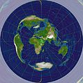
Physical world map in Hellerick triaxial boreal projection - shallow.jpg 4,400 × 4,400; 1.24 MB
-
Physical world map in Hellerick triaxial boreal projection.jpg 4,400 × 4,400; 2.88 MB
-
Qiblih direction.jpg 4,096 × 4,096; 1.93 MB
-
Robinson world.png 7,510 × 3,760; 18.9 MB
-
Robinson-5400.jpg 5,400 × 2,739; 3.49 MB
-
Seven second summits map-fr.svg 1,636 × 831; 4.11 MB
-
Seven summit map-fr.svg 1,636 × 831; 4.11 MB
-
Seven summit map-ku.svg 1,636 × 831; 4.11 MB
-
Sinusoid-projection.jpg 2,048 × 1,024; 668 KB
-
Sinusoidal Projection 0.jpg 4,096 × 2,048; 1.46 MB
-
Sinusoidal Projection 11-5-30.jpg 4,096 × 2,048; 1.46 MB
-
Sinusoidal projection SW.jpg 2,058 × 1,034; 551 KB
-
Srtm ramp2.world.21600x10800.jpg 21,600 × 10,800; 5.89 MB
-
SST Map for May 2, 2012.jpg 11,637 × 6,286; 31.77 MB
-
Stellarium5.jpg 683 × 484; 73 KB
-
Strebe 1995 11E SW.jpg 2,060 × 1,302; 750 KB
-
Strebe 1995 SW.JPG 2,068 × 1,306; 749 KB
-
Strebe asymmetric 2011 SW.JPG 2,068 × 1,246; 727 KB
-
Stylized World Topo 5400x2700.JPG 5,400 × 2,700; 2.59 MB
-
Tahacik.jpg 800 × 400; 112 KB
-
Tectonic plates clean.png 3,168 × 1,584; 6.01 MB
-
Tobler hyperelliptical projection SW.jpg 2,058 × 1,035; 606 KB
-
Topografia Ziemi.svg 800 × 561; 2.58 MB
-
Topografía actual de la Tierra.svg 1,617 × 1,133; 1.48 MB
-
USGS majplatecolor.png 4,368 × 2,205; 9.99 MB
-
Utm-zones.jpg 2,048 × 1,024; 821 KB
-
Valeriepieris circle azimuthal equal area.png 1,024 × 1,024; 1.16 MB
-
Valeriepieris circle azimuthal equidistant.png 1,024 × 1,024; 1.21 MB
-
Van der grinten projection of Earth.jpg 2,048 × 1,024; 582 KB
-
Van der Grinten projection SW.jpg 2,058 × 2,058; 1.05 MB
-
Van-der-Grinten-I-projection.jpg 2,048 × 1,456; 1.14 MB
-
Volcanic eruption map mk.svg 512 × 256; 362 KB
-
Volcanic eruption map.svg 512 × 256; 362 KB
-
Världskarta (ur Svensk världstlas).jpg 3,566 × 2,632; 2.18 MB
-
Wagner VIII Batwing projection SW.JPG 2,070 × 1,392; 756 KB
-
Wagner VIII Eurasian projection SW.JPG 2,070 × 1,558; 822 KB
-
Wagner VIII projection SW.JPG 2,070 × 1,128; 666 KB
-
Wagner VIII–Canters projection SW.JPG 2,070 × 768; 478 KB
-
Wagner VIII–meta-Canters projection SW.JPG 2,070 × 1,214; 703 KB
-
Wagner VIII–meta-TsNIGAiK projection SW.JPG 2,070 × 1,216; 725 KB
-
Wagner-vi-projection.jpg 2,048 × 1,024; 845 KB
-
Welt-etopo2-relief.jpeg 1,024 × 512; 93 KB
-
Weltkarte.jpg 2,804 × 1,521; 715 KB
-
Werner projection SW.jpg 2,058 × 2,065; 1.11 MB
-
Werner-projection.jpg 2,040 × 2,048; 1.23 MB
-
Werner-projection.png 2,040 × 2,048; 3.26 MB
-
Winkel-tripel-projection.jpg 2,048 × 1,252; 940 KB
-
World - Physical (1967).jpg 3,948 × 2,884; 2.08 MB
-
World Blank.jpg 1,074 × 512; 108 KB
-
World Blank100px.jpg 100 × 48; 7 KB
-
World map geographical (drab).png 10,800 × 5,400; 102.26 MB
-
World relief map with isopachs of crustal thickness.jpg 636 × 532; 86 KB
-
World Topography.jpg 21,600 × 9,049; 16.35 MB
-
World, 1963.jpg 1,585 × 1,223; 962 KB
-
World1074-(12-5L-37-5R).jpg 1,074 × 512; 68 KB
-
Worldheight.jpg 1,780 × 1,192; 1.5 MB
-
Worldmap.png 1,024 × 578; 317 KB
-
WSCT C 16Dec04at0230UTC.jpg 1,026 × 405; 96 KB
-
Океани Землі.png 2,058 × 2,058; 4.67 MB
-
Тектонічна карта.jpg 2,481 × 1,418; 1.47 MB
-
Точки 45х90.png 1,121 × 561; 1.24 MB


