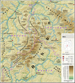
Category:Topographic maps of the Rhön
Jump to navigation
Jump to search
Media in category "Topographic maps of the Rhön"
The following 2 files are in this category, out of 2 total.
-
Handkarte von Thüringen Habenicht (1).jpg 2,683 × 2,995; 5.8 MB
-
Rhön - Deutsche Mittelgebirge, Serie A-de.png 1,800 × 2,000; 4.92 MB

