Category:Topographic maps of Venezuela
Jump to navigation
Jump to search
Subcategories
This category has the following 3 subcategories, out of 3 total.
O
S
Media in category "Topographic maps of Venezuela"
The following 45 files are in this category, out of 45 total.
-
AAltoorinoco2.JPG 308 × 409; 29 KB
-
Barinas elevation map.png 902 × 374; 451 KB
-
BarreradeserCaribe.JPG 832 × 318; 50 KB
-
Calabozo Venezuela.PNG 240 × 180; 10 KB
-
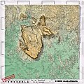
Cerro Marahuaca.jpg 4,320 × 4,320; 10.16 MB
-
CIA map Central America & Caribbean.png 1,390 × 1,044; 1.6 MB
-
Guayana Esequiba - SAGECAN 1994.jpg 1,976 × 2,586; 5.13 MB
-
Karibik 17.png 1,349 × 784; 1.44 MB
-
Karibik 18.png 1,351 × 790; 1.03 MB
-
Karibik 19.png 1,353 × 767; 650 KB
-
Karibik 24.png 1,344 × 810; 440 KB
-
Karibik 35.png 1,351 × 760; 898 KB
-
Karte Golf von Paria.png 995 × 692; 702 KB
-
Map of Venezuela Demis Shaded.png 964 × 861; 625 KB
-
Map of Venezuela Demis.png 1,031 × 970; 324 KB
-
Mapa de regiones naturales (Venezuela).png 4,400 × 3,400; 10.18 MB
-
Mapa físico del término municipal de Málaga..png 1,502 × 1,127; 1.85 MB
-
Mapa Venezuela Topografico.png 3,392 × 2,976; 4.92 MB
-
Mapaproyecto.gif 774 × 524; 101 KB
-
Maracaibo Basin map.jpg 870 × 658; 102 KB
-
Neblina massif.png 840 × 859; 152 KB
-
Paramos.JPG 698 × 918; 861 KB
-
Perfil Trasandina.svg 1,000 × 293; 295 KB
-
Proechimys quadruplicatus distribution (colored).png 1,259 × 944; 1.91 MB
-
Proechimys semispinosus distribution (colored).png 1,259 × 944; 1.77 MB
-
Proechimys semispinosus distribution (gray).png 1,259 × 944; 830 KB
-
Proechimys trinitatus distribution (colored).png 1,259 × 944; 381 KB
-
Proechimys trinitatus distribution (gray).png 1,259 × 944; 126 KB
-
Proechimys urichi distribution (colored).png 1,259 × 944; 418 KB
-
Proechimys urichi distribution (gray).png 1,259 × 944; 214 KB
-
Santamartamys rufodorsalis distribution b.png 1,259 × 944; 839 KB
-
Santamartamys rufodorsalis distribution c.png 1,259 × 944; 1.64 MB
-
Topographic map of Chimantá Massif.png 816 × 780; 1.29 MB
-
Táchira depression map.jpg 424 × 505; 137 KB
-
Vampyrum spectrum distribution (colored).png 1,259 × 944; 2.09 MB
-
Vampyrum spectrum distribution (gray).png 1,259 × 944; 1.03 MB
-
Vargas rain dec 1999.jpg 1,034 × 588; 176 KB
-
VE-Dependencias Federales ubicacion.png 3,934 × 2,048; 1.36 MB
-
Venezuela Physiography.jpg 1,984 × 2,392; 1.48 MB
-
Venezuela Population Density and Low Elevation Coastal Zones (5457914102).jpg 3,300 × 2,478; 833 KB
-
Venezuela rel93.jpg 1,086 × 1,304; 237 KB
-
Venezuela relief location map (+claimed).jpg 1,861 × 1,494; 538 KB
-
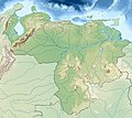
Venezuela relief location map.jpg 1,677 × 1,494; 270 KB
-
Venezuela Topography.png 2,101 × 1,809; 2.89 MB
-
Venezuela.gif 998 × 1,240; 304 KB


