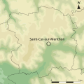
Category:Topographic maps of Saint-Cyr-sur-Menthon
Jump to navigation
Jump to search
Media in category "Topographic maps of Saint-Cyr-sur-Menthon"
The following 5 files are in this category, out of 5 total.
-
Carte Localisation Saint-Cyr-sur-Menthon Relief.svg 640 × 640; 295 KB
-
Carte topographique Brute St Cyr Menthon.svg 640 × 640; 202 KB
-
Carte topographique St Cyr Menthon.svg 640 × 640; 205 KB
-
Profil fossé Bresse St Cyr Menthon.svg 815 × 450; 150 KB
-
Saint-Cyr-sur-Menthon OSM 02.png 796 × 634; 768 KB


