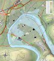
Category:Topographic maps of Besançon
Jump to navigation
Jump to search
Media in category "Topographic maps of Besançon"
The following 5 files are in this category, out of 5 total.
-
Besançon 1910 flood map.svg 877 × 986; 1.67 MB
-
Besançon location map.svg 877 × 986; 2.99 MB
-
Besançon OSM 02.png 724 × 850; 1.57 MB
-
Topographie Besançon.jpg 1,140 × 1,536; 597 KB
-
Topographie Besançon.svg 2,182 × 2,700; 737 KB


