Category:Topographic maps of Australia
Jump to navigation
Jump to search
Media in category "Topographic maps of Australia"
The following 35 files are in this category, out of 35 total.
-
Australia blanc.png 1,500 × 1,479; 1.85 MB
-
Australia high resolution topography and bathymetry.png 15,389 × 11,713; 9.46 MB
-
Australia map (English).svg 1,631 × 1,505; 244 KB
-
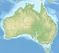
Australia relief map.jpg 1,336 × 1,200; 366 KB
-
Australia topographic location map conic.png 1,520 × 1,440; 2.26 MB
-
Australia Topography Map-sr.svg 1,146 × 840; 1.02 MB
-
Australia Victoria relief location map blank.png 2,456 × 1,733; 1.92 MB
-
Australia Western Australia relief location map.jpg 2,481 × 3,584; 3.35 MB
-
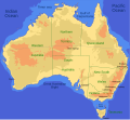
AustraliaMap.jpg 2,668 × 2,450; 1.04 MB
-
Australie -18000.JPG 380 × 293; 15 KB
-
Austràlia - Topografia.png 1,799 × 1,585; 745 KB
-
Chaîne Strzelecki copie.jpg 375 × 255; 130 KB
-
Christmas Island Australia 76-fr.png 1,462 × 1,322; 365 KB
-
Christmas Island Australia 76-fr.svg 1,241 × 1,123; 245 KB
-
Christmas Island Australia 76-mk.svg 1,241 × 1,123; 245 KB
-
Derwent basin topographic map.svg 605 × 638; 6.26 MB
-
Deserts in Australia en.png 1,500 × 1,479; 2.11 MB
-
Deserts of Australia de.png 1,500 × 1,479; 2.11 MB
-
Fraser Island southwest Topo Map 1942.jpg 5,000 × 3,432; 10.89 MB
-
Fraser Island Topo Map 1942.jpg 5,000 × 6,306; 13.73 MB
-
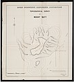
Irrigation Map - (Contour Plan)(GN03328).jpg 3,264 × 2,448; 700 KB
-
Jack hills physical map DE.png 1,772 × 1,253; 3.4 MB
-
Nightcap-range-openstreetmap.jpg 1,300 × 946; 358 KB
-
Passenger rail services in Australia en.png 1,500 × 1,274; 1.66 MB
-
Reliefmap of Australia.png 996 × 914; 1.18 MB
-
Schienenverkehr in Australien de.png 1,500 × 1,274; 1.67 MB
-
Topographic map - Newcastle - 1941.jpg 17,900 × 12,375; 17.07 MB
-
Topography of australia cropped.png 2,420 × 1,935; 3.88 MB
-
Topography of australia great dividing range.jpg 1,040 × 972; 481 KB
-
Topography of australia.jpg 5,200 × 4,858; 3.32 MB
-
Topography of Tasmania Derwent.jpg 395 × 381; 61 KB
-
Topography of Tasmania.jpg 1,237 × 1,500; 322 KB
-
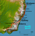
VFTeastcoast topo.jpg 1,619 × 1,664; 1.07 MB
-
VFTeastcoast topo.svg 724 × 744; 4.54 MB


