Category:Topographic maps of Alberta
Jump to navigation
Jump to search
Provinces and territories of Canada: Alberta · British Columbia · New Brunswick · Nova Scotia · Ontario · Quebec · Nunavut · Yukon
Media in category "Topographic maps of Alberta"
The following 13 files are in this category, out of 13 total.
-
Alberta Topo Labeled 90 dpi.png 2,100 × 3,300; 12.08 MB
-
Canadian Rockies 50to54N 114to122W Topo Rainbow Zebra 1326.jpg 9,600 × 4,800; 40.72 MB
-
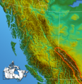
Canadian Rockies ContinentalRanges.png 556 × 574; 709 KB
-
Canadian Rockies.png 1,383 × 1,306; 2.21 MB
-
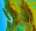
South BC-NW USA-relief Bow Range.png 855 × 724; 1.39 MB
-
South BC-NW USA-relief Clark Range.png 855 × 724; 1.39 MB
-
South BC-NW USA-relief Kananaskis Range.png 855 × 724; 1.39 MB
-
South BC-NW USA-relief Lewis Range.png 855 × 724; 1.39 MB
-
South BC-NW USA-relief Palliser Range.png 855 × 724; 1.39 MB
-
South BC-NW USA-relief Sawback Range.png 855 × 724; 1.39 MB
-
South BC-NW USA-relief Vermilion Range.png 855 × 724; 1.39 MB
-
South BC-NW USA-relief Waputik Mountains.png 855 × 724; 1.39 MB
-
South BC-NW USA-relief Winston Churchill Range.png 855 × 724; 1.39 MB


