Category:Topographic maps of Alaska
Jump to navigation
Jump to search
States of the United States: Alabama · Alaska · Arizona · Arkansas · California · Colorado · Connecticut · Delaware · Florida · Georgia · Hawaii · Idaho · Illinois · Indiana · Iowa · Kansas · Kentucky · Louisiana · Maine · Maryland · Massachusetts · Michigan · Minnesota · Mississippi · Missouri · Montana · Nebraska · Nevada · New Hampshire · New Jersey · New Mexico · New York · North Carolina · North Dakota · Ohio · Oklahoma · Oregon · Pennsylvania · Rhode Island · South Carolina · South Dakota · Tennessee · Texas · Utah · Vermont · Virginia · Washington · West Virginia · Wisconsin · Wyoming – Washington, D.C.
American Samoa · Puerto Rico · United States Virgin Islands
American Samoa · Puerto Rico · United States Virgin Islands
Subcategories
This category has the following 7 subcategories, out of 7 total.
U
Media in category "Topographic maps of Alaska"
The following 47 files are in this category, out of 47 total.
-
 800x598 Carte Alaska R3.jpg 800 × 598; 134 KB
-
 Alaska - DPLA - d9c4e2ea1a135ce7dd13324bc1444e17.jpg 11,980 × 8,818; 8.59 MB
-
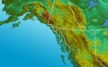
 Alaska Panhandle-relief Chugach Mountains.png 1,176 × 731; 1.49 MB
-
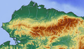
 Alaska Panhandle-relief Fairweather Range.png 1,176 × 731; 1.49 MB
-
 Alaska Panhandle-relief Kenai Mountains.png 1,176 × 731; 1.49 MB
-
 Alaska Panhandle-relief Saint Elias Mountains.png 1,176 × 731; 1.49 MB
-
 Alaska Panhandle-relief Talkeetna Mountains.png 1,176 × 731; 1.49 MB
-
 Alaska Panhandle-relief Tordrillo Mountains.png 1,176 × 731; 1.49 MB
-
 Alaska Panhandle-relief Wrangell Mountains.png 1,176 × 731; 1.49 MB
-
 Alaska Panhandle-relief.png 1,176 × 731; 1.44 MB
-
 Alaska Relief.png 672 × 509; 276 KB
-
 Alaska Yukon British Columbia 58to62N 133to143W Topo Rainbow Zebra 2550.jpg 12,000 × 4,800; 38.18 MB
-
 Aleutian arc physical geography.png 1,457 × 1,277; 1.95 MB
-
 Alexander Archipelago 55to59N 129to137W Topo Rainbow Zebra 1020.jpg 9,600 × 4,800; 29.47 MB
-
 Anchorage and Vicinity O61149A6 geo.pdf 6,602 × 8,343; 24.66 MB
-
 Bering Sea Aleutian Is Alaska map.png 1,457 × 1,277; 2.04 MB
-
 Bristol Bay.png 625 × 472; 389 KB
-
 Brooks Range.png 637 × 369; 410 KB
-
 Cityfalsepassboundaries.jpg 575 × 700; 143 KB
-
 Denali NP map NPS.jpg 1,000 × 922; 479 KB
-
 Glacier Bay National Park official park brochure map.jpg 2,020 × 1,222; 1.51 MB
-
 Juneau geo south.png 920 × 805; 1.92 MB
-
 Map amutka.gif 500 × 414; 104 KB
-
 Map of Alaska Peninsula Volcanoes.gif 398 × 288; 38 KB
-
 Map of Glacier Bay.png 1,033 × 690; 1.55 MB
-
 Map of the Chugach National Forest.png 2,154 × 1,272; 1.94 MB
-
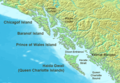
 Map Prince-William-Sound AK.jpg 300 × 226; 40 KB
-
 Matanuska-Susitna Rivers region, Alaska.svg 804 × 989; 6.89 MB
-
 Matanuska-Susitna Valley.jpg 300 × 280; 50 KB
-
 Murder Cove.png 562 × 773; 981 KB
-
 NorthForkKoyukukLargeMap.jpg 1,220 × 1,876; 596 KB
-
 Northwest-relief StikineRiver.jpg 660 × 660; 464 KB
-
 Northwest-relief.2 BoundaryRanges.png 500 × 500; 514 KB
-
 NPS glacier-bay-detail-map.jpg 1,672 × 2,534; 876 KB
-
 NPS katmai-historical-map.jpg 3,391 × 2,186; 5.54 MB
-
 NPS lake-clark-map.jpg 2,527 × 2,198; 1.16 MB
-
 NWCoast1a.png 761 × 529; 172 KB
-
 Okmok Caldera.png 1,073 × 719; 704 KB
-
 Relief map of USA Alaska.png 776 × 580; 693 KB
-
 Southern Alaska 2 60to64N 142to155W Topo Rainbow Zebra 2550.jpg 15,600 × 4,800; 53.81 MB
-
 Southern Alaska 60to64N 143to155W Topo Rainbow Zebra 2550.jpg 14,269 × 4,764; 50.52 MB
-
 Southern Unmak.png 1,000 × 709; 742 KB
-
 Southwest Kuskokwim Mtns Alaska Topo Rainbow Zebra 1122.png 6,119 × 4,499; 28.66 MB
-
 Topograhical View of the Parts of Alaska Tributary to Seward.jpg 4,363 × 3,308; 17.68 MB
-
 Western Brooks Mtns AK 66to69N 147to158W Topo Rainbow Zebra 1020.jpg 6,600 × 3,600; 18.73 MB
-
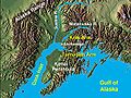 Wpdms shdrlfi020l cook inlet with arms.jpg 300 × 226; 41 KB
-
 Wrangel Saint Elias Mtns Alaska Topo Rainbow Zebra 2550.png 6,929 × 3,869; 37.96 MB


