Category:Tingwall, Shetland Islands
Jump to navigation
Jump to search
village in the Shetland Islands, Scotland, UK | |||||
| Upload media | |||||
| Instance of | |||||
|---|---|---|---|---|---|
| Location |
| ||||
 | |||||
Subcategories
This category has the following 5 subcategories, out of 5 total.
S
T
- Loch of Tingwall (11 F)
- Tingwall Airport (21 F)
- Tingwall Kirk (5 F)
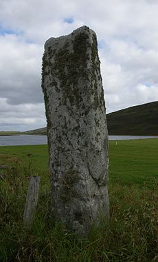
- Tingwall Standing Stone (4 F)
Media in category "Tingwall, Shetland Islands"
The following 39 files are in this category, out of 39 total.
-
A970 at Dales Voe, Lerwick - geograph.org.uk - 1018709.jpg 640 × 506; 57 KB
-
Aerogenerator on Burra Dale - geograph.org.uk - 595009.jpg 426 × 640; 147 KB
-
Boats by the Loch of Tingwall - geograph.org.uk - 102541.jpg 640 × 480; 79 KB
-
Fishing, Loch of Tingwall - geograph.org.uk - 416143.jpg 640 × 426; 70 KB
-
Frakkafield, near Lerwick - geograph.org.uk - 595023.jpg 640 × 426; 139 KB
-
From the Plantiecrub IMG 2292 (18564044761).jpg 4,212 × 2,394; 4.85 MB
-
Grandview, Tingwall - geograph.org.uk - 1064713.jpg 640 × 426; 100 KB
-
Graveyard at Tingwall Kirk - geograph.org.uk - 972780.jpg 640 × 480; 80 KB
-
Holm of Setter, Loch of Tingwall - geograph.org.uk - 319407.jpg 600 × 381; 18 KB
-
Holm of Setter, Loch of Tingwall - geograph.org.uk - 416147.jpg 640 × 426; 37 KB
-
Houses and fields at Gott Farm - geograph.org.uk - 892133.jpg 640 × 501; 70 KB
-
Law Ting Holm in Tingwall Loch - geograph.org.uk - 2734.jpg 640 × 479; 42 KB
-
Loch of Asta - geograph.org.uk - 319411.jpg 399 × 600; 31 KB
-
Lochs of Asta and Tingwall - geograph.org.uk - 594920.jpg 640 × 411; 123 KB
-
North end of Loch of Tingwall - geograph.org.uk - 594942.jpg 640 × 426; 135 KB
-
Plantiecrub at Night IMG 4043 (28305097423).jpg 2,848 × 2,848; 2.08 MB
-
Plantiecrub Sundown IMG 6570 (23806066594).jpg 4,272 × 2,301; 3.61 MB
-
Sheep pens near Gott Farm - geograph.org.uk - 892138.jpg 640 × 347; 49 KB
-
Tingwall Airport - geograph.org.uk - 2495013.jpg 640 × 438; 81 KB
-
Tingwall Airport Terminal - geograph.org.uk - 2130387.jpg 800 × 534; 167 KB
-
Tingwall from Law Ting - geograph.org.uk - 2020982.jpg 2,560 × 1,920; 1.87 MB
-
Tingwall from the North - geograph.org.uk - 2078192.jpg 2,560 × 1,920; 1.79 MB
-
Tingwall Kirk - geograph.org.uk - 3542619.jpg 2,560 × 1,920; 2.37 MB
-
Tingwall Kirk - geograph.org.uk - 972784.jpg 640 × 480; 66 KB
-
Tingwall Kirk MG 0440 (24634232543).jpg 5,184 × 2,923; 4.09 MB
-
Tingwall Kirkyard - geograph.org.uk - 2021007.jpg 2,560 × 1,920; 1.87 MB
-
Tingwall Loch - geograph.org.uk - 634237.jpg 640 × 385; 32 KB
-
Tingwall Manse. - geograph.org.uk - 631333.jpg 640 × 480; 44 KB
-
Tingwall School - geograph.org.uk - 2066598.jpg 2,560 × 1,920; 2.05 MB
-
Tingwall valley - geograph.org.uk - 2705616.jpg 4,928 × 1,963; 557 KB
-
Tingwall Valley MG 0443 (25234878346).jpg 5,184 × 3,009; 5.26 MB
-
Tingwall, a sign for Lichfield^ - geograph.org.uk - 2758988.jpg 640 × 480; 69 KB
-
Utnabrake - geograph.org.uk - 148359.jpg 640 × 426; 57 KB
-
Hill of Dale, Shetland - geograph.org.uk - 142395.jpg 640 × 480; 81 KB
-
Ruined Croft Buildings, Dale, Shetland - geograph.org.uk - 142148.jpg 640 × 480; 135 KB


