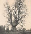
Category:Tilleul du Coftice
Jump to navigation
Jump to search
| Object location | | View all coordinates using: OpenStreetMap |
|---|
tree in Belgium | |||||
| Upload media | |||||
| Instance of | |||||
|---|---|---|---|---|---|
| Location | José, Herve, Arrondissement of Verviers, Province of Liege, Walloon Region, Belgium | ||||
| Street address |
| ||||
 | |||||
Media in category "Tilleul du Coftice"
The following 20 files are in this category, out of 20 total.
-
Colftice.JPG 707 × 1,072; 192 KB
-
Colftice2.JPG 699 × 770; 221 KB
-
José-Tilleul du Coftice (1).jpg 2,988 × 5,312; 5.69 MB
-
José-Tilleul du Coftice (10).jpg 2,988 × 5,312; 6.18 MB
-
José-Tilleul du Coftice (11).jpg 2,988 × 5,312; 4.99 MB
-
José-Tilleul du Coftice (12).jpg 2,988 × 5,312; 6.31 MB
-
José-Tilleul du Coftice (13).jpg 2,988 × 5,312; 6.17 MB
-
José-Tilleul du Coftice (14).jpg 2,988 × 5,312; 5.05 MB
-
José-Tilleul du Coftice (15).jpg 5,312 × 2,988; 4.85 MB
-
José-Tilleul du Coftice (16).jpg 5,312 × 2,988; 4.49 MB
-
José-Tilleul du Coftice (17).jpg 5,312 × 2,988; 4.57 MB
-
José-Tilleul du Coftice (2).jpg 2,988 × 5,312; 6.39 MB
-
José-Tilleul du Coftice (3).jpg 2,988 × 5,312; 6.97 MB
-
José-Tilleul du Coftice (4).jpg 2,988 × 5,312; 5.75 MB
-
José-Tilleul du Coftice (5).jpg 2,988 × 5,312; 5.72 MB
-
José-Tilleul du Coftice (6).jpg 2,988 × 5,312; 5.18 MB
-
José-Tilleul du Coftice (7).jpg 2,988 × 5,312; 5.83 MB
-
José-Tilleul du Coftice (8).jpg 5,312 × 2,988; 6.48 MB
-
José-Tilleul du Coftice (9).jpg 5,312 × 2,988; 7.13 MB
-
Lann um Coftice.jpg 3,168 × 4,752; 7.58 MB


