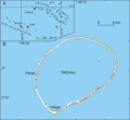
Category:Tikehau
Jump to navigation
Jump to search
island in French Polynesia | |||||
| Upload media | |||||
| Instance of | |||||
|---|---|---|---|---|---|
| Part of | |||||
| Location | Rangiroa, Iles Tuamotu-Gambier, French Polynesia | ||||
| Located in or next to body of water | |||||
| Time of discovery or invention |
| ||||
| Area |
| ||||
 | |||||
Subcategories
This category has the following 2 subcategories, out of 2 total.
B
- Beaches of Tikehau (2 F)
T
- Tikehau Airport (1 F)
Media in category "Tikehau"
The following 21 files are in this category, out of 21 total.
-
039 Sunset at Tikehau (French Polynesia) Photo by Giles Laurent.jpg 6,000 × 4,000; 7.71 MB
-
Atoll research bulletin (1987) (20351461081).jpg 3,280 × 2,262; 1.42 MB
-
Carte Tikehau mk.svg 450 × 414; 86 KB
-
Carte Tikehau.png 2,815 × 2,586; 159 KB
-
Carte Tikehau.svg 450 × 414; 87 KB
-
Choris, Krusenstern Islands.jpg 1,803 × 946; 2.37 MB
-
Fleur de sel.JPG 900 × 1,200; 164 KB
-
Lagon-bleu-vu-du-ciel.jpg 800 × 533; 54 KB
-
Localización de Rangiroa en las Tuamotu.png 711 × 482; 10 KB
-
Tikehau - Locator Map.jpg 800 × 550; 171 KB
-
Tikehau Atoll - EVS Precision Map (1-150,000) Finished.jpg 1,264 × 876; 195 KB
-
Tikehau Atoll - Landsat ETM+ S-06-10 2000 and S-06-15 2000 (1-150,000).jpg 1,264 × 876; 84 KB
-
Tikehau EO.jpg 3,000 × 3,000; 3.93 MB
-
Tikehau EVS districts.jpg 1,264 × 876; 195 KB
-
Tikehau map.png 1,264 × 876; 295 KB
-
Tikehau, archipel des Tuamotus.jpg 800 × 533; 71 KB
-
Tikehau, Tuamotu.jpg 3,072 × 2,304; 2.62 MB
-
Tikehau-SE-2.jpg 1,598 × 1,076; 815 KB
-
Tikehau-SE.jpg 1,598 × 1,076; 234 KB
-
Tikehau.JPG 2,000 × 3,000; 357 KB


