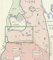
Category:Tigray Amhara border conflict
Jump to navigation
Jump to search
| NO WIKIDATA ID FOUND! Search for Tigray Amhara border conflict on Wikidata | |
| Upload media |
Media in category "Tigray Amhara border conflict"
The following 18 files are in this category, out of 18 total.
-
Administrative map of Tigray.jpg 4,876 × 5,626; 11.51 MB
-
Database historical maps Western Tigray graphical abstract.pdf 1,752 × 1,239; 368 KB
-
Dataset Western Tigray maps - graphical abstract.jpg 1,512 × 801; 263 KB
-
Extract of Thomson’s map (1817) with borders of Tigray.jpg 520 × 563; 128 KB
-
Location of the border between Tigray and Amhara.jpg 1,348 × 535; 85 KB
-
Location of the border between Tigray and Amhara.png 1,027 × 244; 47 KB
-
Nyssen and Demissie JoM supplemental map.pdf 3,508 × 2,475; 5.9 MB
-
Nyssen and Demissie JoM supplemental map.tif 7,019 × 4,950; 99.41 MB
-
Territorial control of Welkait according to historical maps.png 1,027 × 286; 38 KB
-
Timeline of the location of the boundary between Amhara and Tigray.png 1,027 × 148; 32 KB
-
Western Tigray Manesson-Mallet 1683.jpg 602 × 420; 84 KB


