Category:Tiddington, Warwickshire
Jump to navigation
Jump to search
village in Warwickshire, United Kingdom  | |||||
| Upload media | |||||
| Instance of | |||||
|---|---|---|---|---|---|
| Location | Stratford-upon-Avon, Stratford-on-Avon, Warwickshire, West Midlands, England | ||||
 | |||||
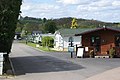
English: Tiddington is a small village located on the B4086 road just over a mile east of Stratford-upon-Avon, Warwickshire, England. The number 15 and 18 buses provide transport between Stratford and Leamington Spa whilst the nearest railway station is at also at Stratford. Until 2006 there was a National Health Service psychiatric hospital for elderly people located in the village until this merged with the main hospital in Stratford. Stratford Town F.C. are based in the village after moving from the town centre and there is an 18-hole golf course just outside it.
Media in category "Tiddington, Warwickshire"
The following 26 files are in this category, out of 26 total.
-
 "Flogging it" in Tiddington - geograph.org.uk - 2071950.jpg 2,424 × 1,771; 1.1 MB
-
 Caravan park - geograph.org.uk - 1277958.jpg 640 × 428; 59 KB
-
 Entrance to Riverside Caravan Park, Tiddington - geograph.org.uk - 1727853.jpg 2,000 × 1,507; 219 KB
-
 Junction of B4086 with Knights Lane, Tiddington - geograph.org.uk - 1727764.jpg 2,000 × 1,498; 228 KB
-
 Junction on A422 Banbury Road - geograph.org.uk - 1716902.jpg 2,000 × 1,501; 248 KB
-
 Loxley Road - geograph.org.uk - 892990.jpg 640 × 525; 57 KB
-
 Loxley Road, Stratford-upon-Avon - geograph.org.uk - 1727862.jpg 2,000 × 1,494; 229 KB
-
 Loxley Road, Stratford-upon-Avon - geograph.org.uk - 1727869.jpg 2,000 × 1,495; 228 KB
-
 Main St Tiddington - geograph.org.uk - 2660983.jpg 640 × 466; 73 KB
-
 Main Street, Tiddington (B4086) - geograph.org.uk - 3396010.jpg 640 × 480; 73 KB
-
 New buildings on Loxley Road - geograph.org.uk - 1691109.jpg 2,000 × 1,491; 341 KB
-
 NFU Mutual Building, Tiddington - geograph.org.uk - 90824.jpg 640 × 467; 103 KB
-
 NFU Mutual Headquarters, Tiddington - geograph.org.uk - 1727835.jpg 2,000 × 1,510; 247 KB
-
 Play area on Knights Lane, Tiddington - geograph.org.uk - 1727754.jpg 2,000 × 1,497; 218 KB
-
 Sculpture under construction - geograph.org.uk - 441142.jpg 640 × 480; 107 KB
-
 Small brook off Loxley Road - geograph.org.uk - 1691097.jpg 1,500 × 1,988; 354 KB
-
 The Old School Tiddington - geograph.org.uk - 206422.jpg 480 × 640; 98 KB
-
 The River Avon - geograph.org.uk - 206428.jpg 640 × 480; 95 KB
-
 Black and white cottages on School Lane, Tiddington - geograph.org.uk - 1727772.jpg 2,000 × 1,494; 226 KB
-
 Tiddington church - geograph.org.uk - 90924.jpg 640 × 480; 76 KB
-
 Tiddington School - geograph.org.uk - 90811.jpg 640 × 480; 105 KB
-
 Tiddington shops and telephone kiosk - geograph.org.uk - 90926.jpg 640 × 480; 72 KB
-
 Tiddington.jpg 2,048 × 1,536; 864 KB
-
 Traffic calming on Loxley Road - geograph.org.uk - 1691065.jpg 2,000 × 1,494; 338 KB
-
 View East from the lane to Tiddington - geograph.org.uk - 1716914.jpg 2,000 × 1,491; 285 KB
-
 View North up the lane to Tiddington - geograph.org.uk - 1716935.jpg 2,000 × 1,500; 269 KB


_-_geograph.org.uk_-_3396010.jpg)


