Category:Thorpe le Street
Jump to navigation
Jump to search
English: Thorpe le Street is a hamlet in the East Riding of Yorkshire, England. It is situated approximately 3.5 miles (5.6 km) south east of the market town of Pocklington and 3 miles (4.8 km) north west of the market town of Market Weighton. It lies to the south of the A1079 road.
village the East Riding of Yorkshire, England, United Kingdom .jpg) | |||||
| Upload media | |||||
| Instance of | |||||
|---|---|---|---|---|---|
| Location | Hayton, East Riding of Yorkshire, Yorkshire and the Humber, England | ||||
 | |||||
Media in category "Thorpe le Street"
The following 12 files are in this category, out of 12 total.
-
 Dual Connection - geograph.org.uk - 1730832.jpg 3,648 × 2,736; 5.79 MB
-
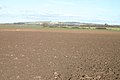 Farmland - geograph.org.uk - 133024.jpg 640 × 425; 67 KB
-
 House Opposite Manor Farm A1079 - geograph.org.uk - 236856.jpg 640 × 426; 134 KB
-
 Lay-by on the A1079 - geograph.org.uk - 133621.jpg 640 × 480; 91 KB
-
 Paddock - geograph.org.uk - 133676.jpg 640 × 480; 135 KB
-
 Remember...... this way^ - geograph.org.uk - 1730927.jpg 3,438 × 2,626; 4.43 MB
-
 Roadside Fungus - geograph.org.uk - 1730869.jpg 3,048 × 2,608; 2.69 MB
-
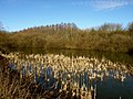 Secret Pond - geograph.org.uk - 1730734.jpg 3,648 × 2,736; 3.4 MB
-
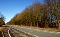 The A1079 - geograph.org.uk - 1730844.jpg 3,642 × 2,262; 3.39 MB
-
 Thorpe le Street, East Yorks (geograph 5188128).jpg 640 × 480; 193 KB
-
 Thorpe Whin - geograph.org.uk - 133630.jpg 640 × 480; 131 KB
-
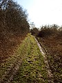 Track of the Past.... and Future^ - geograph.org.uk - 1730641.jpg 2,736 × 3,648; 4.99 MB


