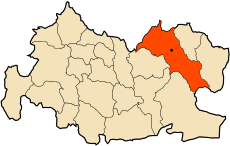
Category:Theniet El Had
Jump to navigation
Jump to search
town / district / commune in Algeria | |||||
| Upload media | |||||
| Instance of | |||||
|---|---|---|---|---|---|
| Location | Théniet El Had District, Tissemsilt Province, Algeria | ||||
| Elevation above sea level |
| ||||
 | |||||
Subcategories
This category has the following 2 subcategories, out of 2 total.
B
- Bakhti Belaïb (1 F)
T
- Théniet El Had National Park (118 F)
Media in category "Theniet El Had"
The following 50 files are in this category, out of 50 total.
-
145 FORET DES CEDRES DE THENIET EL HAD.jpg 4,928 × 3,264; 2.21 MB
-
146 LE CEDRE DU VILLAGE DE THENIET EL HAD.jpg 4,928 × 3,264; 8.75 MB
-
147 LE CEDRE DU VILLAGE DE THENIET EL HAD.jpg 4,928 × 3,264; 8.05 MB
-
149 GRAVURE RUPESTRE LA TORTUE DE BOUHAYRANE THENIET EL HAD.jpg 4,928 × 3,264; 8.68 MB
-
153 LES AMIS DE LA FORETS DES CEDRES.jpg 4,928 × 3,264; 6.16 MB
-
AMAZING LANDSCAPE,THENIET EL HAD,ALGERIA.jpg 5,184 × 3,456; 6.27 MB
-
Bivouac a theiet el had.jpg 4,288 × 2,848; 5.45 MB
-
DZ 38 Theniet El Had.svg 1,819 × 1,154; 61 KB
-
El Meddad.jpg 3,264 × 2,448; 1.32 MB
-
Georges Clairin "Scène orientale dans la clairière" (1908).jpg 1,332 × 1,713; 1.76 MB
-
GREAT MOUTAINS OF THENIET EL HAD ALGERIA.jpg 5,132 × 3,439; 1.97 MB
-
Groupe111.jpg 879 × 399; 213 KB
-
Gul cedar tree.jpg 3,264 × 2,448; 2.49 MB
-
JIJ EL MA.webm 16 s, 1,280 × 720; 5.11 MB
-
La foret des cedres de Theniet El Had Algerie 37.jpg 1,024 × 678; 363 KB
-
La foret des cedres.JPG 4,000 × 3,000; 10.81 MB
-
Le Cèdre (56993816).jpeg 2,048 × 1,096; 346 KB
-
Oued El Ghoul - Theniet El Had واد الغول - ثنية الحد - panoramio.jpg 2,500 × 1,666; 691 KB
-
Parc National de Theniet El Had الحظيرة الوطنية لثنية الحد.jpg 2,500 × 1,667; 1.46 MB
-
Parc national de theniet el had2.jpg 5,760 × 3,840; 667 KB
-
Park thenia.jpg 4,000 × 2,250; 4.58 MB
-
Sky above theniet el had national park.jpg 2,448 × 3,264; 2.16 MB
-
Stade de Theniet El Had (Algérie).jpg 3,648 × 2,736; 1.94 MB
-
Stade de Theniet El Had ملعب ثنية الحد.jpg 2,500 × 1,667; 938 KB
-
Theniet el had , algeria.jpg 640 × 480; 66 KB
-
Theniet el had 2014.jpg 720 × 540; 75 KB
-
Theniet El Had 38200, Algeria - panoramio (1).jpg 5,184 × 3,456; 5.44 MB
-
Theniet El Had 38200, Algeria - panoramio (2).jpg 3,456 × 5,184; 5.39 MB
-
Theniet El Had 38200, Algeria - panoramio (3).jpg 3,456 × 5,184; 6.04 MB
-
Theniet El Had 38200, Algeria - panoramio (4).jpg 3,456 × 5,184; 5.77 MB
-
Theniet El Had 38200, Algeria - panoramio (5).jpg 3,456 × 5,184; 7.03 MB
-
Theniet El Had 38200, Algeria - panoramio (6).jpg 3,456 × 5,184; 6.91 MB
-
Theniet El Had 38200, Algeria - panoramio (7).jpg 3,456 × 5,184; 7.08 MB
-
Theniet El Had 38200, Algeria - panoramio (8).jpg 3,456 × 5,184; 5.98 MB
-
Theniet El Had 38200, Algeria - panoramio.jpg 5,184 × 3,456; 5.72 MB
-
Theniet El Had et ses forêts (Algérie) 1885.jpg 4,211 × 3,508; 6.17 MB
-
Theniet El Had National Park.JPG 3,648 × 2,736; 4.19 MB
-
Theniet El Had ثنية الحد - panoramio (1).jpg 2,500 × 1,667; 554 KB
-
Theniet El Had ثنية الحد - panoramio (2).jpg 2,500 × 1,667; 813 KB
-
Theniet El Had ثنية الحد - panoramio (3).jpg 2,500 × 1,667; 685 KB
-
Theniet El Had ثنية الحد - panoramio (4).jpg 2,500 × 1,667; 546 KB
-
Theniet El Had ثنية الحد - panoramio (5).jpg 2,500 × 1,667; 564 KB
-
Theniet El Had ثنية الحد - panoramio (6).jpg 2,500 × 1,666; 850 KB
-
Theniet El Had ثنية الحد - panoramio.jpg 1,772 × 1,075; 338 KB
-
Theniet El Had.JPG 3,508 × 2,471; 2.34 MB
-
Theniet El Hdjar ثنية الحجر - panoramio.jpg 2,000 × 1,334; 541 KB
-
Village قرية - panoramio.jpg 2,794 × 1,692; 467 KB
-
الحديقة الوطنية ثنية الحد (المداد) - ثنية الحد غزة.jpg 1,080 × 1,918; 125 KB
-
فندق العزيز ثنية الحد.jpg 4,128 × 2,484; 3.43 MB
-
متوسط درجات الحرارة القصوى والدنيا في ثنية الحد.svg 582 × 450; 47 KB


