Category:Thames Path
Jump to navigation
Jump to search
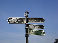
English: The Thames Path is a National Trail that follows the course of the River Thames from its source near Kemble in Gloucestershire through to the Thames Barrier in London. This category contains images that include some aspect of the Thames Path within them.
long-distance trail following the River Thames in England | |||||
| Upload media | |||||
| Instance of |
| ||||
|---|---|---|---|---|---|
| Location | |||||
| Located in or next to body of water | |||||
| Connects with | |||||
| Date of official opening |
| ||||
| Length |
| ||||
| Terminus | |||||
 | |||||
Subcategories
This category has the following 9 subcategories, out of 9 total.
Media in category "Thames Path"
The following 71 files are in this category, out of 71 total.
-
Blackford Lane.jpg 1,280 × 960; 390 KB
-
Canary Wharf seen from the Thames Path - photo by Sandra Dowling in 2010.jpg 2,048 × 1,536; 351 KB
-
Cow Drinking (37140000671).jpg 4,608 × 2,592; 2.16 MB
-
Ham, Surrey County Council Boundary marker 1902.jpg 998 × 1,500; 724 KB
-
Hedges either side - geograph.org.uk - 1566141.jpg 480 × 640; 127 KB
-
Houses on Sunbury Court Island - geograph.org.uk - 2505930.jpg 640 × 480; 85 KB
-
Into the wood - geograph.org.uk - 1566169.jpg 480 × 640; 135 KB
-
Life on the Water - panoramio.jpg 4,672 × 3,104; 1.83 MB
-
Little Wittenham Church - panoramio - ian freeman.jpg 3,872 × 2,592; 4.55 MB
-
Little Wittenham Church - panoramio.jpg 2,592 × 3,872; 4.01 MB
-
No cycles - geograph.org.uk - 1566116.jpg 480 × 640; 127 KB
-
Notices by the path - geograph.org.uk - 1503703.jpg 426 × 640; 126 KB
-
Path back to Gatehampton - geograph.org.uk - 1566172.jpg 480 × 640; 133 KB
-
Path through the woods - geograph.org.uk - 1567248.jpg 480 × 640; 146 KB
-
Path to Goring - geograph.org.uk - 1567415.jpg 640 × 480; 140 KB
-
Path to Hattonhill Shaw - geograph.org.uk - 922332.jpg 427 × 640; 256 KB
-
Power lines in the distance - geograph.org.uk - 1420266.jpg 640 × 426; 76 KB
-
Rainbow Bridge from the north - geograph.org.uk - 530990.jpg 640 × 529; 146 KB
-
Revetment on the bank - geograph.org.uk - 1567434.jpg 480 × 640; 117 KB
-
Riding down the path - geograph.org.uk - 1568260.jpg 480 × 640; 121 KB
-
River Thames and Port Meadow from Godstow Lock.jpg 4,032 × 3,024; 2.16 MB
-
River Thames at Medley, Binsey - geograph.org.uk - 530958.jpg 640 × 602; 134 KB
-
River Thames near Ashton Keynes - geograph.org.uk - 2390654.jpg 1,024 × 680; 328 KB
-
Shifford Church from the Thames Path - geograph.org.uk - 706281.jpg 640 × 480; 91 KB
-
Turn right - geograph.org.uk - 1222301.jpg 640 × 426; 92 KB
-
Signpost - panoramio - Darius Smalskys.jpg 3,303 × 2,969; 759 KB
-
Tamigi River - panoramio.jpg 2,048 × 1,536; 584 KB
-
TempleFootbridge01.JPG 1,970 × 1,463; 1.24 MB
-
Thames Path - geograph.org.uk - 2200842.jpg 640 × 480; 122 KB
-
Thames Path - geograph.org.uk - 2200990.jpg 640 × 480; 80 KB
-
Thames Path above Mapledurham - geograph.org.uk - 924914.jpg 640 × 427; 149 KB
-
Thames Path in Shiplake Lock.JPG 4,288 × 3,216; 3.47 MB
-
Thames Path route sketch.png 884 × 362; 712 KB
-
Thames Path Section 62 Flooded.jpg 1,280 × 960; 455 KB
-
Thames pathway, water still rising - geograph.org.uk - 306751.jpg 640 × 480; 74 KB
-
Thames Trail, Somerford Keynes - geograph.org.uk - 99424.jpg 640 × 480; 118 KB
-
The iron cyclist - geograph.org.uk - 1085925.jpg 640 × 480; 134 KB
-
The River Thames from a footbridge on the Thames Path National Trail (geograph 5884528).jpg 4,608 × 3,456; 5.11 MB
-
The road home - panoramio.jpg 4,672 × 3,104; 1.53 MB
-
The Thames path - geograph.org.uk - 1417651.jpg 640 × 426; 80 KB
-
The Thames path - geograph.org.uk - 1505081.jpg 640 × 427; 62 KB
-
The Thames Path - geograph.org.uk - 964266.jpg 640 × 480; 68 KB
-
The Thames Path - geograph.org.uk - 965641.jpg 640 × 480; 61 KB
-
The Thames Path at Parker's Bridge - geograph.org.uk - 1902291.jpg 1,500 × 1,000; 291 KB
-
The Thames Path by Barton Fields - geograph.org.uk - 1405750.jpg 640 × 427; 109 KB
-
The Thames Path crosses a field - geograph.org.uk - 1775975.jpg 1,500 × 984; 214 KB
-
The Thames Path Ewen - geograph.org.uk - 128624.jpg 640 × 480; 127 KB
-
The Thames Path footbridge from Fiddler's Island - geograph.org.uk - 1760198.jpg 1,500 × 1,000; 157 KB
-
The Thames Path in Cricklade - geograph.org.uk - 1775971.jpg 1,500 × 1,000; 250 KB
-
The Thames Path near Burcot - geograph.org.uk - 946956.jpg 640 × 480; 80 KB
-
The Thames Path near Shillingford - geograph.org.uk - 948388.jpg 480 × 640; 135 KB
-
The Thames Path off North Wall - geograph.org.uk - 1775965.jpg 1,500 × 1,000; 345 KB
-
The Thames Path on Fiddler's Island - geograph.org.uk - 1758537.jpg 1,500 × 983; 261 KB
-
The Thames Path^ - geograph.org.uk - 950956.jpg 640 × 480; 76 KB
-
Towards the Bridge - geograph.org.uk - 1420271.jpg 640 × 426; 89 KB
-
Towpath to Benson - geograph.org.uk - 1060715.jpg 426 × 640; 55 KB
-
Towpath to Wallingford - geograph.org.uk - 1060722.jpg 426 × 640; 94 KB
-
Tripcock Light - geograph.org.uk - 57594.jpg 482 × 640; 88 KB
-
Waiting - panoramio - Darius Smalskys (1).jpg 4,672 × 3,104; 1.82 MB
-
Waiting - panoramio - Darius Smalskys.jpg 4,672 × 3,104; 1.85 MB
-
Waymarker leading to the Thames Path (1466).jpg 2,848 × 4,288; 5.66 MB
-
Let's make this clear - geograph.org.uk - 1386223.jpg 640 × 425; 226 KB
-
Thames Path north of Waterhay - geograph.org.uk - 83429.jpg 640 × 409; 63 KB


