Category:Texas State Highway OSR
Jump to navigation
Jump to search
non-numbered state highway in Texas, United States .jpg)   | |||||
| Upload media | |||||
| Instance of | |||||
|---|---|---|---|---|---|
| Part of | |||||
| Location |
| ||||
| Transport network | |||||
| Connects with |
| ||||
| Owned by |
| ||||
| Maintained by |
| ||||
| Inception |
| ||||
| Length |
| ||||
| Terminus | |||||
| |||||
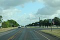
English: Media related to Texas State Highway OSR ('SH OSR), a 61.918-mile (99.647 km) non-numbered state highway in Texas, United States, that is part of the Old San Antonio Road and connects Texas State Highway 21 (SH 21), west of Bryan, with SH 21 in Midway.
Subcategories
This category has only the following subcategory.
Media in category "Texas State Highway OSR"
The following 7 files are in this category, out of 7 total.
-
 OSR East - FM2223 Sign (36290164821).jpg 2,400 × 1,600; 1.49 MB
-
 OSR East - FM2485 Sign (36258577622).jpg 2,400 × 1,600; 1.69 MB
-
 OSR East - Jct FM579 sign (36381591796).jpg 2,400 × 1,600; 1.79 MB
-
 Texas OSR map.svg 1,180 × 688; 200 KB
-
 Texas OSR.svg 384 × 384; 10 KB
-
 TexasStateHighwayOSR-RoadsideSign.jpg 4,272 × 2,848; 5.18 MB
-
 TXOSReRoad-FM1119nSign (31431959824).jpg 2,400 × 1,600; 1.27 MB
.jpg)
.jpg)

.jpg)