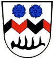
Category:Tettenweis

From Wikimedia Commons, the free media repository
Jump to navigation Jump to search
  Landkreis Passau: Aicha vorm Wald · Aidenbach · Aldersbach · Bad Füssing · Bad Griesbach im Rottal · Beutelsbach · Breitenberg · Büchlberg · Eging am See · Fürstenstein · Fürstenzell · Haarbach · Hauzenberg · Hofkirchen · Hutthurm · Kirchham · Kößlarn · Malching · Neuburg am Inn · Neuhaus am Inn · Neukirchen vorm Wald · Obernzell · Ortenburg · Pocking · Rotthalmünster · Ruderting · Ruhstorf an der Rott · Salzweg · Sonnen · Tettenweis · Thyrnau · Tiefenbach · Tittling · Untergriesbach · Vilshofen an der Donau · Wegscheid · Windorf · Witzmannsberg ·
<nowiki>Tettenweis; Tettenweis; Tettenweis; Tettenweis; Tettenweis; Tettenweis; Tettenweis; Тетенвајс; 特滕魏斯; Tettenweis; Tettenweis; 特滕魏斯; Tettenweis; Теттенвайс; Теттенвайс; 特滕魏斯; Tettenweis; Теттенвайс; Tettenweis; Tettenweis; Tettenweis; Tettenweis; Tettenweis; Tettenweis; Тэтэнвайс; Tettenweis; Tettenweis; Tettenweis; Теттенвайс; تەتتەنۆايس; Tettenweis; Tettenweis; Tettenvaýs; Tettenweis; Тетенвајс; تتنوایس; Tettenweis; Tettenweis; Թեթենվայս; Теттенвайс; Tettenweis; Tettenweis; Tettenweis; Теттенвайс; Tetenvajs; Tettenweis (munisipyo); Теттенвайс; Tettenweis; تيتنفايس; 特滕魏斯; Tettenweis; chemun de la Germania; громада в Німеччині, федеральна земля Баварія; commune allemande; obec v zemském okresu Pasov v Německu; بلدية ألمانية في ولاية بافاريا; municipality of Germany; kommune i Bayern i Tyskland; gemeente in Beieren; comune tedesco; Gemeinde im niederbayerischen Landkreis Passau; gmejna w Bayerskej; település Németországban; komunë në Gjermani; komunumo en Bavario, Germanio; kumun alaman; Şaredariyeke Almanyayê; Теттенwеис; Теттенвайс; Tettenvays; Tettenweis</nowiki>
Tettenweis 
municipality of Germany
Upload media
Instance of
  • non-urban municipality in Germany
Part of
  • Stimmkreis Passau-West (2018)
LocationPassau, Lower Bavaria, Bavaria, Germany
Head of government
  • Robert Stiglmayr
Population
  • 1,836 (2023)
Area
  • 28.72 km² (1987)
  • 28.7 km² (2017)
Elevation above sea level
  • 335 m
official website
Map48° 26′ 00″ N, 13° 16′ 00″ E
Authority file
Wikidata Q506272
VIAF ID: 244589063
GND ID: 4119573-5
OpenStreetMap relation ID: 958098
OpenStreetMap node ID: 240091215
Edit infobox data on Wikidata

Subcategories

This category has the following 4 subcategories, out of 4 total.

Media in category "Tettenweis"

The following 5 files are in this category, out of 5 total.