Category:Telugu-language SVG maps
Jump to navigation
Jump to search
Subcategories
This category has only the following subcategory.
Media in category "Telugu-language SVG maps"
The following 29 files are in this category, out of 29 total.
-
African quadripoint-te.svg 512 × 512; 45 KB
-
Anaximander world map-te.svg 1,063 × 1,063; 12 KB
-
Andhra Pradesh 2019 te.svg 1,030 × 850; 510 KB
-
AP 2019 AC Result-te.pdf 2,481 × 1,754; 166 KB
-
Delhi Municipalities-te.svg 600 × 600; 11 KB
-
India Union Territories TE.svg 1,500 × 1,615; 1.63 MB
-
India-map-te.svg 1,519 × 1,773; 278 KB
-
Karnataka 1956 Reorg-te.svg 693 × 748; 322 KB
-
Kerala Flood Relief States-te.svg 3,189 × 3,543; 319 KB
-
Lincoln Sea map-te.svg 1,000 × 913; 204 KB
-
Maharashtra Divisions-te.svg 3,106 × 2,453; 245 KB
-
MANIPUR district map-te.svg 640 × 715; 233 KB
-
Map Gulf of Finland-te.svg 1,400 × 800; 135 KB
-
Map of Sealand with territorial waters-te.svg 600 × 613; 134 KB
-
Meghalaya 2012.te.svg 807 × 434; 166 KB
-
Nagaland district map-te.svg 768 × 680; 608 KB
-
Naval bases of India-te.svg 1,486 × 1,734; 460 KB
-
Orissa State map-te.svg 2,184 × 1,769; 1.76 MB
-
Puducherry District - Local bodies-te.svg 979 × 1,057; 43 KB
-
Punjab 1951-66-te.svg 1,055 × 427; 54 KB
-
Punjab 2012 administrativ-te.svg 900 × 600; 271 KB
-
SevenSisterStates-te.svg 606 × 615; 1.05 MB
-
Tamil Nadu district map-te.svg 1,640 × 2,032; 80 KB
-
Tripura-district-map-te.svg 545 × 688; 224 KB
-
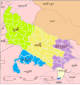
Up-subregions2-te.svg 2,400 × 2,515; 240 KB
-
Uttar Pradesh administrative divisions-te.svg 1,500 × 1,500; 120 KB
-
UttarakhandDistricts numbered-te.svg 1,250 × 1,125; 121 KB
-
WestBengalDistricts numbered-te.svg 450 × 500; 87 KB
-
Zonal Councils.te.svg 1,594 × 1,868; 192 KB


