Category:Tectonics diagrams
Jump to navigation
Jump to search
Subcategories
This category has the following 5 subcategories, out of 5 total.
Media in category "Tectonics diagrams"
The following 93 files are in this category, out of 93 total.
-
Amotoki PlateDrivingForce NewIdea br.jpg 1,851 × 770; 130 KB
-
Amotoki PlateDrivingForce OldIdea br.jpg 1,893 × 769; 141 KB
-
Asthénosphère et courants de convexion.PNG 475 × 329; 11 KB
-
BAB formation.jpg 2,852 × 1,582; 532 KB
-
Bacino di avanfossa.jpg 720 × 540; 35 KB
-
Carboniferous Extension Model.gif 164 × 147; 14 KB
-
Carboniferous model.jpg 4,275 × 1,304; 607 KB
-
Carboniferous-extension model.gif 330 × 304; 31 KB
-
CollisionOnset.jpg 846 × 341; 87 KB
-
Continental-Collision model.png 506 × 312; 23 KB
-
Convection-snapshot.png 689 × 274; 64 KB
-
Core complex.png 800 × 931; 46 KB
-
Cross Section.png 640 × 512; 7 KB
-
Cycle orogénique.png 1,790 × 2,490; 615 KB
-
Cykl superkontynentalny.svg 1,923 × 916; 145 KB
-
Deposition environments.jpg 525 × 535; 93 KB
-
ElasticFlexure.png 572 × 214; 13 KB
-
Erzschlamm rotesmeer hg.jpg 1,641 × 3,140; 567 KB
-
Estrutura de um cráton.jpg 882 × 453; 96 KB
-
Eulerpol.svg 640 × 746; 20 KB
-
Evolution of Earth's radiogenic heat-no total.svg 867 × 976; 41 KB
-
Evolution of Earth's radiogenic heat-with total-ru.svg 704 × 878; 5 KB
-
Evolution of Earth's radiogenic heat-with total.svg 879 × 1,050; 52 KB
-
Evolution of Earth's radiogenic heat.jpg 1,500 × 1,125; 173 KB
-
Evolution of Earth's radiogenic heat.svg 899 × 653; 12 KB
-
Evolutionary Diagram of Cambrian Rift of the Ellsworth Mountains.jpg 1,522 × 2,153; 350 KB
-
Extensional Decollement.pdf 1,275 × 1,650; 252 KB
-
Extensional Setting.pdf 1,500 × 1,125; 57 KB
-
Fault mechanics creating a ridge.jpg 671 × 524; 19 KB
-
Formation d'un Core Complex.png 800 × 930; 35 KB
-
Formation d'un nouvel océan et dérive des continents.PNG 680 × 769; 29 KB
-
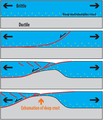
Formation of passive margins (horizontal).png 2,366 × 314; 36 KB
-
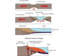
Formation of passive margins cropped.svg 574 × 459; 103 KB
-
Formation of passive margins.png 1,202 × 1,144; 74 KB
-
Interactions and feedback pathways for tectonics and erosional processes.pdf 1,500 × 843; 129 KB
-
Lemezek hármas.jpg 719 × 395; 95 KB
-
Limitesdeplacastectónicas.PNG 775 × 429; 82 KB
-
Modèle fixiste.jpg 1,509 × 742; 71 KB
-
Modèle mobiliste de Wegener.jpg 744 × 745; 35 KB
-
Motoki FalhaTransformante.jpg 979 × 668; 129 KB
-
Oceanic spreading ru.svg 600 × 450; 37 KB
-
Okraje tektonickych platni.png 775 × 429; 75 KB
-
Orogenic collapse models.svg 800 × 600; 19 KB
-
Orogenic collapse.svg 400 × 300; 9 KB
-
Partial melting asthenosphere DE.svg 1,000 × 600; 94 KB
-
Partial melting asthenosphere EN.svg 1,000 × 600; 92 KB
-
Partial melting asthenosphere ES.svg 1,000 × 600; 91 KB
-
Partial melting asthenosphere FR.svg 1,000 × 600; 91 KB
-
Partial melting asthenosphere NL.svg 1,000 × 600; 92 KB
-
Partial melting asthenosphere PL.svg 1,000 × 600; 92 KB
-
Plate Tectonics ru.png 773 × 468; 214 KB
-
Plate-tectonics.png 10,000 × 2,500; 286 KB
-
Plate-tek window.png 1,065 × 740; 111 KB
-
PlatnuTektonika.png 1,000 × 550; 197 KB
-
Plattengrenzen.png 775 × 429; 108 KB
-
Plattentekt.jpg 2,011 × 1,036; 155 KB
-
Plattentektonik-profil hg.png 1,627 × 962; 990 KB
-
Plattentektonik.png 1,146 × 797; 139 KB
-
Plume 2.jpg 640 × 800; 125 KB
-
Ptd.png 474 × 502; 13 KB
-
Schemetic diagram for DZ tectonic settings.jpg 3,449 × 2,245; 1.09 MB
-
Schéma plaques tectoniques.png 773 × 344; 268 KB
-
Shema tektonskih plošč.png 773 × 480; 111 KB
-
Sial ve sima.jpg 350 × 247; 51 KB
-
Some Types of Orogen - Cross-section Diagrams.png 3,483 × 5,232; 2.33 MB
-
Tectonic evolution of Earth.jpg 1,500 × 1,125; 184 KB
-
Tectonic plate boundaries clean.png 775 × 429; 75 KB
-
Tectonic plate boundaries pl.png 775 × 429; 78 KB
-
Tectonic plate boundaries.jpg 775 × 429; 37 KB
-
Tectonic plate boundaries.png 775 × 429; 83 KB
-
Tectonic plate boundaries2.png 735 × 417; 88 KB
-
Tektoniek.gif 775 × 429; 45 KB
-
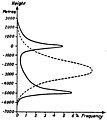
The origin of continents and oceans - Wegener (1924) - figure 03.jpg 2,173 × 632; 508 KB
-
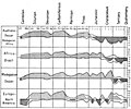
The origin of continents and oceans - Wegener (1924) - figure 04.jpg 1,083 × 789; 353 KB
-
The origin of continents and oceans - Wegener (1924) - figure 05.jpg 1,194 × 1,342; 216 KB
-
The origin of continents and oceans - Wegener (1924) - figure 06.jpg 861 × 628; 214 KB
-
The origin of continents and oceans - Wegener (1924) - figure 07.jpg 1,025 × 787; 194 KB
-
The origin of continents and oceans - Wegener (1924) - figure 15.jpg 1,239 × 1,031; 544 KB
-
The origin of continents and oceans - Wegener (1924) - figure 21.jpg 1,290 × 1,050; 233 KB
-
The origin of continents and oceans - Wegener (1924) - figure 26.jpg 1,839 × 555; 406 KB
-
The origin of continents and oceans - Wegener (1924) - figure 28.jpg 2,429 × 1,449; 362 KB
-
The origin of continents and oceans - Wegener (1924) - figure 29.jpg 606 × 415; 56 KB
-
The origin of continents and oceans - Wegener (1924) - figure 32.jpg 1,255 × 736; 276 KB
-
The origin of continents and oceans - Wegener (1924) - figure 33.jpg 1,662 × 899; 182 KB
-
The origin of continents and oceans - Wegener (1924) - figure 35.jpg 1,929 × 579; 251 KB
-
The origin of continents and oceans - Wegener (1924) - figure 36.jpg 2,082 × 529; 169 KB
-
The origin of continents and oceans - Wegener (1924) - figure 37.jpg 2,508 × 1,530; 627 KB
-
The origin of continents and oceans - Wegener (1924) - figure 38.jpg 437 × 392; 51 KB
-
The origin of continents and oceans - Wegener (1924) - figure 40.jpg 1,185 × 1,143; 261 KB
-
The origin of continents and oceans - Wegener (1924) - figure 42.jpg 690 × 1,428; 98 KB
-
The origin of continents and oceans - Wegener (1924) - figure 44.jpg 1,134 × 745; 94 KB
-
Volcanoes at subduction.JPG 703 × 290; 20 KB
-
Vulkanism ja laamtektoonika.png 767 × 429; 75 KB


