Category:Taxus distribution maps
Jump to navigation
Jump to search
Media in category "Taxus distribution maps"
The following 6 files are in this category, out of 6 total.
-
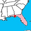
Areal of Taxus floridiana.jpg 200 × 200; 30 KB
-
Counties with yew trees over 900 years old.png 493 × 745; 21 KB
-
Taxus baccata range.png 4,250 × 2,362; 303 KB
-
Taxus baccata range.svg 1,739 × 907; 1.09 MB
-
Taxus canadensis range map.png 1,515 × 1,802; 390 KB
-
Taxus floridana range map.png 487 × 314; 21 KB


