Category:Tarka Line
Jump to navigation
Jump to search
Main Wikipedia article: Tarka Line.
English: The Tarka Line is a community railway between Exeter and Barnstaple in Devon, England.
railway line in the UK | |||||
| Upload media | |||||
| Instance of | |||||
|---|---|---|---|---|---|
| Part of |
| ||||
| Location | Devon, South West England, England | ||||
| Owned by | |||||
| Operator | |||||
| Date of official opening |
| ||||
| Train depot | |||||
 | |||||
Subcategories
This category has the following 19 subcategories, out of 19 total.
B
- Barnstaple railway station (96 F)
C
- Copplestone railway station (15 F)
- Cowley Bridge Junction (45 F)
E
- Eggesford railway station (59 F)
K
L
- Lapford railway station (3 F)
M
N
P
S
U
- Umberleigh railway station (24 F)
Y
- Yeoford railway station (30 F)
Media in category "Tarka Line"
The following 37 files are in this category, out of 37 total.
-
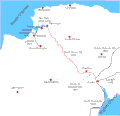
North devon rly.gif 600 × 579; 21 KB
-
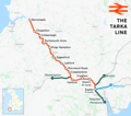
Tarka Line.png 1,789 × 1,580; 1.46 MB
-
Allotments by the railway at Sweetham - geograph.org.uk - 979187.jpg 640 × 480; 90 KB
-
Beware of Trains - geograph.org.uk - 643478.jpg 640 × 480; 115 KB
-
Black Bridge, Umberleigh (2022) down stream side.JPG 1,366 × 910; 680 KB
-
Black Bridge, Umberleigh (2022) underneath.JPG 1,366 × 910; 660 KB
-
Black Bridge, Umberleigh (2022) up stream side.JPG 1,366 × 910; 652 KB
-
Copplestone Road bridge (2021).JPG 1,366 × 910; 768 KB
-
Crediton Hamlets, Tarka Line - geograph.org.uk - 201540.jpg 640 × 427; 218 KB
-
Crediton, Railway at Salmon Pool Crossing - geograph.org.uk - 201524.jpg 640 × 427; 267 KB
-
Higher Doomsford Crossing - River Taw - geograph.org.uk - 5771.jpg 640 × 438; 52 KB
-
Keymelford bridge (2021).JPG 1,366 × 910; 817 KB
-
Lapford railway line - geograph.org.uk - 26103.jpg 640 × 480; 117 KB
-
Level Crossing at Chenson - geograph.org.uk - 79358.jpg 640 × 426; 155 KB
-
Penstone (Coleford Junction) bridge (2021).JPG 1,366 × 910; 587 KB
-
Penstone (Tarka Line) bridge (2021).JPG 1,366 × 910; 645 KB
-
Portsmouth Arms - geograph.org.uk - 7315.jpg 600 × 450; 66 KB
-
Railway at Umberleigh - geograph.org.uk - 609870.jpg 640 × 428; 139 KB
-
Railway Bridge at Umberleigh - August 2011 - panoramio.jpg 2,288 × 1,712; 879 KB
-
Railway bridge, Penstone - geograph.org.uk - 1772544.jpg 640 × 450; 110 KB
-
Railway Bridge, Umberleigh - August 2011 - panoramio.jpg 2,288 × 1,712; 900 KB
-
Railway line, Chapelton - geograph.org.uk - 668442.jpg 556 × 640; 119 KB
-
Salmon Pool Crossing from the north (2021).JPG 1,366 × 820; 547 KB
-
Salmon Pool Crossing from the south (2021).JPG 1,366 × 820; 537 KB
-
Salmonhutch - Railway (geograph 5901824).jpg 6,000 × 4,000; 6.17 MB
-
Tarka Line to Barnstaple - geograph.org.uk - 354997.jpg 426 × 640; 139 KB
-
Taw Valley - geograph.org.uk - 13086.jpg 640 × 480; 70 KB
-
The Tarka Line - geograph.org.uk - 4838506.jpg 640 × 426; 76 KB
-
The Tarka Line - geograph.org.uk - 5298783.jpg 640 × 426; 63 KB
-
The Tarka Line - geograph.org.uk - 6046817.jpg 1,024 × 681; 250 KB
-
The Tarka Line towards Barnstaple - geograph.org.uk - 1042469.jpg 640 × 480; 81 KB
-
Umberleigh Crossing (2022) railway.JPG 1,366 × 820; 501 KB
-
Umberleigh Crossing (2022) road.JPG 1,366 × 820; 522 KB
-
Umberleigh Railway Bridge - August 2011 - panoramio.jpg 2,288 × 1,712; 894 KB


