Category:Sywell
Jump to navigation
Jump to search
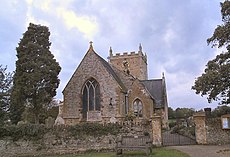
English: Sywell is a small village in North Northamptonshire, England. The name is thought to mean seven wells.
village in Northamptonshire, England | |||||
| Upload media | |||||
| Instance of | |||||
|---|---|---|---|---|---|
| Location | North Northamptonshire, Northamptonshire, East Midlands, England | ||||
| Population |
| ||||
| Said to be the same as | Sywell (Wikimedia duplicated page, civil parish) | ||||
 | |||||
Subcategories
This category has the following 5 subcategories, out of 5 total.
S
- Signs in Sywell (1 F)
- Sywell Reservoir (14 F)
- Sywell Village Hall (5 F)
Media in category "Sywell"
The following 67 files are in this category, out of 67 total.
-
A43 Kettering Road heading south - geograph.org.uk - 7039928.jpg 1,024 × 684; 369 KB
-
Aeroplane formation fountain, The Aviator, Sywell - geograph.org.uk - 4390683.jpg 1,433 × 1,000; 1.08 MB
-
Art-deco aviation - geograph.org.uk - 4038212.jpg 2,048 × 1,536; 1.49 MB
-
Aviator Hotel Restaurant - Entrance - geograph.org.uk - 4390674.jpg 1,155 × 1,000; 865 KB
-
Aviator Hotel Restaurant, Sywell - geograph.org.uk - 4390666.jpg 1,466 × 1,000; 933 KB
-
Aviator Restaurant and Bar, Sywell - Interior - geograph.org.uk - 4390686.jpg 1,333 × 1,000; 1.12 MB
-
Church Lane, Sywell - geograph.org.uk - 6921675.jpg 4,000 × 3,000; 3.2 MB
-
Contrary Mary - geograph.org.uk - 6840501.jpg 1,024 × 768; 107 KB
-
Derelict airfield building - geograph.org.uk - 5601987.jpg 640 × 480; 101 KB
-
Ecton Lane - geograph.org.uk - 5547018.jpg 640 × 480; 423 KB
-
Estate houses at Sywell - geograph.org.uk - 2582450.jpg 2,000 × 1,500; 826 KB
-
Exit to the A43 - geograph.org.uk - 5547001.jpg 640 × 480; 458 KB
-
Footpath to Sywell - geograph.org.uk - 5601986.jpg 480 × 640; 35 KB
-
Former estate cottages in Sywell - geograph.org.uk - 4064342.jpg 640 × 427; 66 KB
-
Gate and Field off Wellingborough Road - geograph.org.uk - 5547025.jpg 640 × 481; 424 KB
-
Hangars at Sywell Aerodrome - geograph.org.uk - 5547032.jpg 640 × 427; 243 KB
-
Hawker Hunter at Sywell - geograph.org.uk - 5601965.jpg 640 × 480; 48 KB
-
Helicopter at Sywell Aerodrome - geograph.org.uk - 6509208.jpg 1,280 × 847; 922 KB
-
Layby (former A43) near Sywell - geograph.org.uk - 5546999.jpg 640 × 480; 401 KB
-
Near Sywell Airport - geograph.org.uk - 5601967.jpg 480 × 640; 50 KB
-
Near Wood Lodge Farm - geograph.org.uk - 5601969.jpg 480 × 640; 118 KB
-
Old school building, Sywell - geograph.org.uk - 3536308.jpg 4,320 × 3,240; 4.75 MB
-
Overstone Manor - geograph.org.uk - 5547014.jpg 640 × 481; 450 KB
-
Overstone, Ecton Lane - geograph.org.uk - 5547019.jpg 640 × 480; 492 KB
-
Park pond - geograph.org.uk - 4038200.jpg 2,048 × 1,536; 1.52 MB
-
Plaque on Sywell village hall - geograph.org.uk - 2582466.jpg 2,000 × 1,544; 793 KB
-
Roundabout on A43 Kettering Road - geograph.org.uk - 7039915.jpg 1,024 × 684; 321 KB
-
Sewage Works in Front of Long Spinney - geograph.org.uk - 133477.jpg 640 × 480; 92 KB
-
Symbolic monoplane - geograph.org.uk - 4038225.jpg 2,048 × 1,536; 1.49 MB
-
Founders stone - geograph.org.uk - 570724.jpg 640 × 427; 62 KB
-
Sywell - Aviator Hotel and Aeroplane sculpture - geograph.org.uk - 4390654.jpg 1,027 × 1,000; 843 KB
-
Sywell - geograph.org.uk - 570730.jpg 427 × 640; 72 KB
-
Sywell Aerodrome - Aeroplane sculpture - geograph.org.uk - 4390660.jpg 1,107 × 1,000; 955 KB
-
Sywell Aerodrome - Aviator Restaurant - north aspect - geograph.org.uk - 4390646.jpg 1,333 × 1,000; 767 KB
-
Sywell Aerodrome, Airfield Gate - geograph.org.uk - 5547030.jpg 640 × 481; 414 KB
-
Sywell Aerodrome, Lancaster Gate - geograph.org.uk - 5547027.jpg 640 × 481; 407 KB
-
Sywell Country Park - geograph.org.uk - 2014656.jpg 480 × 640; 106 KB
-
Sywell Country Park - geograph.org.uk - 2014662.jpg 480 × 640; 65 KB
-
Sywell Country Park - geograph.org.uk - 2014669.jpg 480 × 640; 116 KB
-
Sywell Country Park - geograph.org.uk - 2014674.jpg 480 × 640; 111 KB
-
Sywell Cross - geograph.org.uk - 2582500.jpg 2,000 × 1,500; 940 KB
-
Sywell Cross - geograph.org.uk - 570714.jpg 427 × 640; 71 KB
-
Sywell village, aerial 2014 - geograph.org.uk - 4057218.jpg 640 × 427; 60 KB
-
SywellSign.JPG 1,284 × 1,667; 278 KB
-
The Blades aircraft - geograph.org.uk - 4038248.jpg 2,048 × 1,536; 1.5 MB
-
The Horseshoe at Sywell - geograph.org.uk - 5547005.jpg 640 × 480; 523 KB
-
The Overstone Manor Hotel - geograph.org.uk - 5547017.jpg 640 × 427; 438 KB
-
View along the veranda of the Aviator, Sywell - geograph.org.uk - 4390679.jpg 1,333 × 1,000; 931 KB
-
Village sign, war memorial and cottages, Sywell - geograph.org.uk - 3536312.jpg 4,320 × 3,240; 3.94 MB
-
Bridleway past Wood Lodge Farm - geograph.org.uk - 133471.jpg 640 × 480; 121 KB
-
Caterpillar - geograph.org.uk - 147741.jpg 640 × 480; 144 KB
-
Earls Barton Bridge - geograph.org.uk - 111362.jpg 640 × 480; 133 KB
-
Estate Cottages - geograph.org.uk - 570690.jpg 640 × 427; 73 KB
-
Farm Shop and Herb Centre - geograph.org.uk - 111014.jpg 640 × 480; 131 KB
-
Glebe Barn - geograph.org.uk - 103283.jpg 640 × 480; 137 KB
-
Glebe Road - geograph.org.uk - 111004.jpg 640 × 480; 124 KB
-
Mast at the Transco Depot - geograph.org.uk - 103284.jpg 480 × 640; 74 KB
-
Mortar Pits - geograph.org.uk - 151247.jpg 640 × 480; 159 KB
-
Stile - geograph.org.uk - 111018.jpg 640 × 480; 142 KB
-
View from Wilby Rd - geograph.org.uk - 103289.jpg 640 × 480; 127 KB
-
Wilby Road - geograph.org.uk - 103287.jpg 640 × 480; 134 KB


