Category:System maps of Canadian railways
Jump to navigation
Jump to search
Subcategories
This category has only the following subcategory.
Media in category "System maps of Canadian railways"
The following 13 files are in this category, out of 13 total.
-
 BC Rail map.png 373 × 634; 41 KB
-
 Canadian National System Map.PNG 1,749 × 1,740; 134 KB
-
 Canadian Pacific System Railmap.PNG 1,749 × 1,740; 130 KB
-
 CanadianNationalRailwayNetworkMap.png 462 × 320; 15 KB
-
 CanadianPacificRailwayNetworkMap.png 444 × 309; 33 KB
-
 CorridorVia.svg 1,250 × 750; 161 KB
-
 CP KCS Overview Map.jpg 2,000 × 1,294; 181 KB
-

-
 Map of the North Simcoe Railway, and its connections.jpg 1,920 × 1,599; 910 KB
-
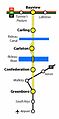
 O-Train Abandoned Expansion Plans Map.svg 600 × 400; 38 KB
-
 ONR System Map.PNG 266 × 244; 6 KB
-
 OttawaO-TrainMap.jpg 211 × 425; 12 KB
-
 Rail Grid of Hastings County and East Northumberland, 1920.png 600 × 1,000; 117 KB


