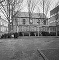
Category:Synagoge (Tilburg)
Jump to navigation
Jump to search
| Object location | | View all coordinates using: OpenStreetMap |
|---|
Nederlands: Afbeeldingen van de Synagoge (Tilburg), Willem II Straat 20, 5038 BG Tilburg. Gelegen in het Dwaalgebied in het stadsdeel Tilburg Centrum in de gemeente Tilburg in de provincie Noord-Brabant in het zuiden van Nederland. Onder meer bereikbaar vanaf de Spoorlaan. Nabij de Helga Deentuin. Het is een rijksmonument
|
This is a category about rijksmonument number 500962
|
Nederlands: Synagoge (Tilburg), Binnenstad (Tilburg), Tilburg, Tilburg (gemeente), Noord-Brabant, Nederland
| Upload media | |||||
| Instance of | |||||
|---|---|---|---|---|---|
| Location | Tilburg, North Brabant, Netherlands | ||||
| Street address |
| ||||
| Located on street | |||||
| Architect |
| ||||
| Heritage designation |
| ||||
 | |||||
Subcategories
This category has only the following subcategory.
I
Media in category "Synagoge (Tilburg)"
The following 17 files are in this category, out of 17 total.
-
500962 Willem ii straat 20.jpg 3,000 × 2,265; 5.73 MB
-
Exterieur VOORGEVEL - Tilburg - 20286151 - RCE.jpg 3,072 × 3,102; 3.38 MB
-
Ingang P1360312.jpg 2,672 × 4,000; 5.56 MB
-
Overzicht - Tilburg - 20209490 - RCE.jpg 2,244 × 3,415; 1.94 MB
-
Rechter zijgevel van de synagoge te Tilburg - Tilburg - 20351218 - RCE.jpg 3,020 × 3,073; 2.74 MB
-
Rijksmonument-500962-20120501065651.jpg 480 × 480; 140 KB
-
RM500962 Tilburg.jpg 2,592 × 1,944; 1.23 MB
-
Synagoge (Tilburg) P1360310.jpg 2,672 × 4,000; 5.82 MB
-
Synagoge (Tilburg) P1360311.jpg 4,000 × 2,672; 5.33 MB
-
Synagoge (Tilburg) P1360313.jpg 4,000 × 2,672; 5.74 MB
-
Synagoge Willem II Straat 20, Tilburg - 2.jpg 3,000 × 4,000; 4.06 MB
-
Synagoge Willem II Straat 20, Tilburg.jpg 4,000 × 3,000; 4.43 MB
-
Synagogetilburg.jpg 2,048 × 1,536; 1.02 MB
-
Voorgevel en rechter zijgevel van de synagoge te Tilburg - Tilburg - 20347356 - RCE.jpg 2,204 × 3,375; 2.18 MB
-
Voorgevel en rechter zijgevel van de synagoge te Tilburg - Tilburg - 20351209 - RCE.jpg 3,020 × 3,061; 2.65 MB
-
Voorgevel van de synagoge te Tilburg - Tilburg - 20209519 - RCE.jpg 2,452 × 3,054; 1.61 MB
-
Voorgevel van de synagoge te Tilburg - Tilburg - 20351211 - RCE.jpg 2,423 × 3,037; 1.64 MB


