Category:Swedish-language SVG maps
Jump to navigation
Jump to search
These maps should have a name ending with -sv.
Subcategories
This category has the following 4 subcategories, out of 4 total.
Media in category "Swedish-language SVG maps"
The following 40 files are in this category, out of 40 total.
-
Abkhazia map-sv.svg 945 × 737; 780 KB
-
Afrika politisk.svg 1,000 × 1,000; 392 KB
-
Caucasus topographic map-sv.svg 1,155 × 898; 4.8 MB
-
Caucasus regions map svenska.svg 2,006 × 1,618; 271 KB
-
Central Asia - political map 2008-sv.svg 996 × 790; 133 KB
-
Central Asia - political map 2022-sv.svg 996 × 790; 133 KB
-
Course Channeltunnel sv.svg 512 × 420; 56 KB
-
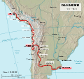
Dakar Rally 2012 map-sv.svg 2,585 × 2,448; 393 KB
-
Finnish railroad network-sv.svg 1,371 × 2,007; 220 KB
-
Georgia, Ossetia, Russia and Abkhazia (sv).svg 676 × 400; 98 KB
-
Great-Lakes sv.svg 786 × 533; 78 KB
-
Heimeya.svg 433 × 403; 39 KB
-
Helsingfors metro och närtåg.svg 840 × 599; 130 KB
-
Helsinki neighborhoods-sv.svg 1,230 × 968; 259 KB
-
Helsinki subdivisions-sv.svg 1,230 × 968; 313 KB
-
Ionian Revolt Campaign Map-sv.svg 1,330 × 1,755; 877 KB
-
Kataja-sv.svg 1,134 × 1,220; 31 KB
-
Kosterhavet Ytre Hvaler National Park topographic map-sv.svg 1,625 × 2,336; 4.36 MB
-
Lake Maracaibo map-sv.svg 722 × 604; 976 KB
-
Laptev Sea map-sv.png 1,500 × 841; 487 KB
-
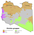
Libya ethnic sv.svg 673 × 685; 42 KB
-
Map of sinitic languages full-sv.svg 2,219 × 1,759; 164 KB
-
Map of sinitic languages-sv.svg 441 × 940; 923 KB
-
Map of Sweden Cities (polar stereographic) Sv.svg 1,000 × 2,387; 1.3 MB
-
Map of Sweden Topography (polar stereographic) Sv.svg 807 × 1,950; 1.52 MB
-
Map of Zanzibar Archipelago-sv.svg 628 × 794; 815 KB
-
Norwegian Sea map sv.png 1,000 × 913; 360 KB
-
Official LanguagesMap-Africa-sv.svg 1,430 × 1,350; 1.43 MB
-
Orientexpressen Rutthistorik (sv).svg 738 × 570; 386 KB
-
Ostrobothnia railway sv.svg 344 × 360; 13 KB
-
Plates tect2 sv.svg 4,217 × 3,169; 455 KB
-
Porvoo-sv.svg 442 × 442; 66 KB
-
Rantarata-sv.svg 728 × 456; 79 KB
-
Regions of Finland labelled SV.svg 1,750 × 2,950; 1.16 MB
-
Seven Hills of Rome sv.svg 654 × 624; 25 KB
-
Subdivisions of Espoo-sv.svg 700 × 1,001; 189 KB
-
Sverigekarta-Landsdelar, namn och landskap.svg 290 × 660; 381 KB
-
Sverigekarta-Landskap Text.svg 500 × 1,091; 171 KB
-
Topographic map of Gabon-sv.svg 815 × 965; 1.69 MB
-
Topographic map of Surtsey-sv.svg 2,453 × 1,911; 853 KB


