Category:Surroundings of the Saint Lawrence church in Warsaw (Wola)
Jump to navigation
Jump to search
| Object location | | View all coordinates using: OpenStreetMap |
|---|
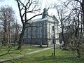
English: Surroundings of the Saint Lawrence church in Warsaw (Wola), at 140a Wolska street
Polski: Warszawa (Wola) ul. Wolska 140a - Parafia pw. św. Wawrzyńca. Parafia przynależy do dekanatu wolskiego.
Subcategories
This category has the following 4 subcategories, out of 4 total.
Media in category "Surroundings of the Saint Lawrence church in Warsaw (Wola)"
The following 8 files are in this category, out of 8 total.
-
 Kościół św Wawrzyńca w Warszawie na Woli - brama.jpg 4,896 × 3,672; 3.78 MB
-
 Kościół św Wawrzyńca w Warszawie na Woli - krzyż nagrobny.jpg 4,839 × 3,630; 4.42 MB
-
 Kościół św Wawrzyńca w Warszawie na Woli - tablica informacyjna.jpg 4,896 × 3,672; 3.74 MB
-
 POL Warsaw Sw wawrzyniec.jpg 1,200 × 900; 332 KB
-
 Saint Lawrence church in Warsaw (Wola) - 08.jpg 4,912 × 1,080; 1.42 MB
-
 Saint Lawrence church in Warsaw (Wola) - 09.jpg 3,672 × 4,896; 6.19 MB
-
 Warszawa Reduta Wolska - teren kościoła p.w. św. Wawrzyńca 03.jpg 2,136 × 3,216; 1.66 MB
-
 Warszawa Reduta Wolska - wały w południowo-zachodnim narożniku.jpg 3,216 × 2,136; 1.65 MB


_-_09.jpg)


_-_08.jpg)